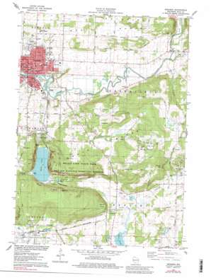
Baraboo Topo Map Wisconsin
To zoom in, hover over the map of Baraboo
USGS Topo Quad 43089d6 - 1:24,000 scale
| Topo Map Name: | Baraboo |
| USGS Topo Quad ID: | 43089d6 |
| Print Size: | ca. 21 1/4" wide x 27" high |
| Southeast Coordinates: | 43.375° N latitude / 89.625° W longitude |
| Map Center Coordinates: | 43.4375° N latitude / 89.6875° W longitude |
| U.S. State: | WI |
| Filename: | o43089d6.jpg |
| Download Map JPG Image: | Baraboo topo map 1:24,000 scale |
| Map Type: | Topographic |
| Topo Series: | 7.5´ |
| Map Scale: | 1:24,000 |
| Source of Map Images: | United States Geological Survey (USGS) |
| Alternate Map Versions: |
Baraboo NW WI 1974, updated 1976 Download PDF Buy paper map Baraboo WI 1975, updated 1978 Download PDF Buy paper map Baraboo WI 1975, updated 1984 Download PDF Buy paper map Baraboo WI 1994, updated 1999 Download PDF Buy paper map Baraboo WI 2010 Download PDF Buy paper map Baraboo WI 2013 Download PDF Buy paper map Baraboo WI 2016 Download PDF Buy paper map |
1:24,000 Topo Quads surrounding Baraboo
> Back to 43089a1 at 1:100,000 scale
> Back to 43088a1 at 1:250,000 scale
> Back to U.S. Topo Maps home
Baraboo topo map: Gazetteer
Baraboo: Airports
Saint Clare Hospital Heliport elevation 294m 964′Baraboo: Basins
East Bluff Basin elevation 325m 1066′Feltz Basin elevation 381m 1250′
Hanson Basin elevation 385m 1263′
Ott Basin elevation 393m 1289′
South Bluff Basin elevation 360m 1181′
Steinke Basin elevation 364m 1194′
Baraboo: Cliffs
Devils Nose elevation 324m 1062′East Bluff elevation 331m 1085′
South Bluff elevation 388m 1272′
West Bluff elevation 351m 1151′
Baraboo: Dams
Linen Mill Dam elevation 248m 813′Oak Street Dam elevation 255m 836′
Waterworks WP226 Dam elevation 250m 820′
Baraboo: Flats
Roznos Meadow elevation 264m 866′Baraboo: Gaps
Lower Narrows elevation 245m 803′Baraboo: Guts
Gallus Slough elevation 236m 774′Baraboo: Lakes
Devils Lake elevation 293m 961′Johnson Ponds elevation 381m 1250′
Baraboo: Parks
Broadway Park elevation 254m 833′Campbell Park elevation 262m 859′
Deppe Park elevation 255m 836′
Devil's Lake Oak Forest State Natural Area elevation 325m 1066′
Devils Lake State Park elevation 405m 1328′
East Bluff State Natural Area elevation 445m 1459′
International Crane Foundation elevation 326m 1069′
Langer Park elevation 267m 875′
Man Mound Park elevation 294m 964′
Parfrey's Glen State Natural Area elevation 365m 1197′
Pierce Park elevation 265m 869′
Sauk County Fairgrounds elevation 264m 866′
South Bluff/Devil's Nose State Natural Area elevation 434m 1423′
Weber Park elevation 275m 902′
Baraboo: Populated Places
Baraboo elevation 271m 889′Crawford Crossing elevation 264m 866′
Maple Bluff Estates elevation 254m 833′
Baraboo: Post Offices
Baraboo Post Office elevation 263m 862′Baraboo: Ranges
North Range elevation 304m 997′Baraboo: Reservoirs
564 Reservoir elevation 255m 836′572 Reservoir elevation 250m 820′
583 Reservoir elevation 248m 813′
Baraboo: Springs
Koshawago Spring elevation 298m 977′Baraboo: Streams
Boulder Creek elevation 245m 803′Manley Creek elevation 237m 777′
Parfreys Glen Creek elevation 243m 797′
Rowley Creek elevation 245m 803′
Baraboo: Summits
Sauk Point elevation 448m 1469′Baraboo: Trails
Bluff Trail elevation 422m 1384′East Bluff Trail elevation 440m 1443′
East Bluff Woods Trail elevation 377m 1236′
Grottos Trail elevation 307m 1007′
West Bluff Trail elevation 442m 1450′
Baraboo: Valleys
Griegol Gulch elevation 362m 1187′Parfreys Glen elevation 318m 1043′
Baraboo digital topo map on disk
Buy this Baraboo topo map showing relief, roads, GPS coordinates and other geographical features, as a high-resolution digital map file on DVD:


