Marquette Topo Map Wisconsin
To zoom in, hover over the map of Marquette
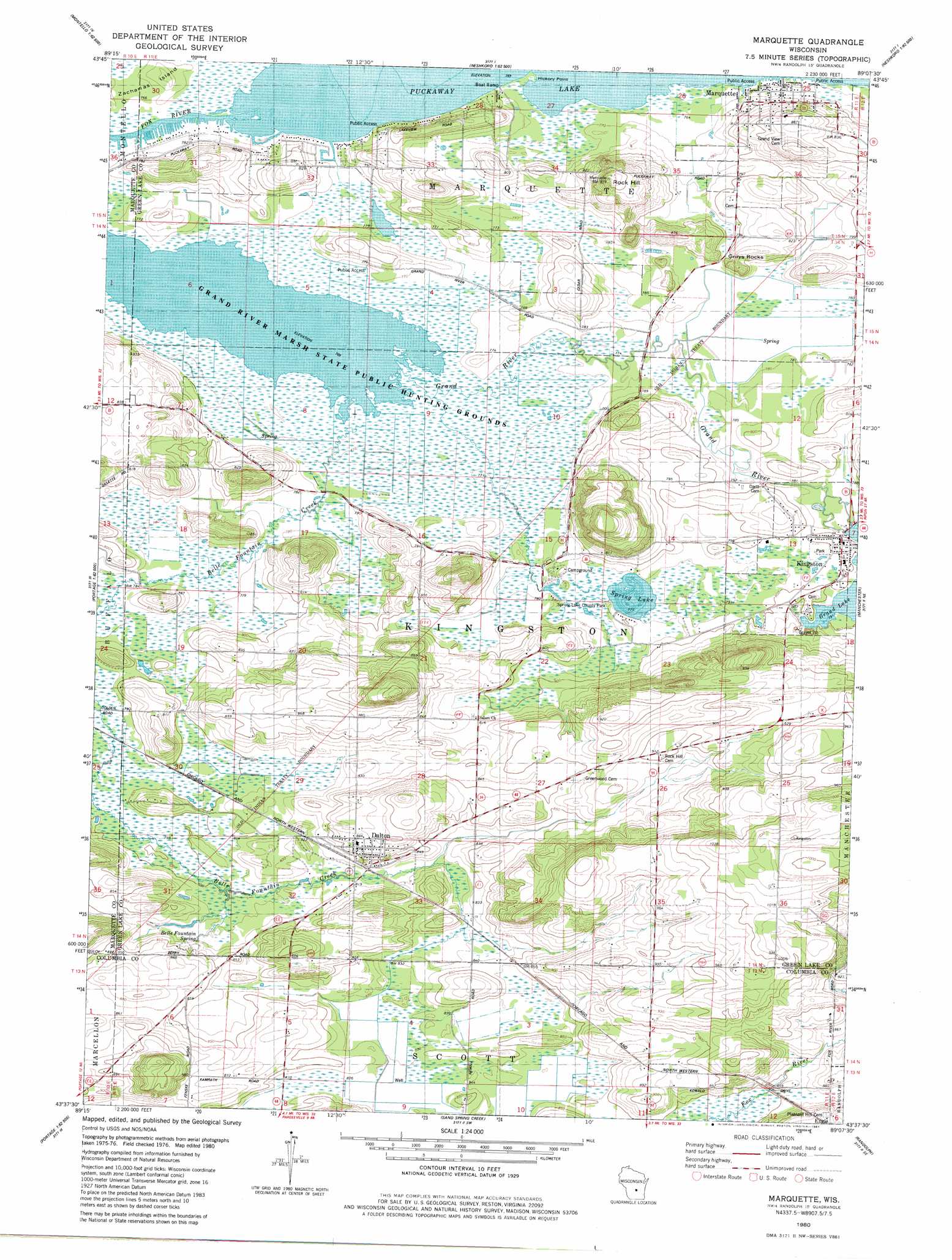
USGS Topo Quad 43089f2 - 1:24,000 scale
| Topo Map Name: | Marquette |
| USGS Topo Quad ID: | 43089f2 |
| Print Size: | ca. 21 1/4" wide x 27" high |
| Southeast Coordinates: | 43.625° N latitude / 89.125° W longitude |
| Map Center Coordinates: | 43.6875° N latitude / 89.1875° W longitude |
| U.S. State: | WI |
| Filename: | o43089f2.jpg |
| Download Map JPG Image: | Marquette topo map 1:24,000 scale |
| Map Type: | Topographic |
| Topo Series: | 7.5´ |
| Map Scale: | 1:24,000 |
| Source of Map Images: | United States Geological Survey (USGS) |
| Alternate Map Versions: |
Marquette WI 1980, updated 1981 Download PDF Buy paper map Marquette WI 2010 Download PDF Buy paper map Marquette WI 2013 Download PDF Buy paper map Marquette WI 2016 Download PDF Buy paper map |
1:24,000 Topo Quads surrounding Marquette
Westfield East |
Germania |
Neshkoro |
Fairburn |
Berlin |
Packwaukee |
Montello |
Princeton West |
Princeton East |
Green Lake |
Endeavor |
Observatory Hill |
Marquette |
Manchester |
Markesan |
Portage |
Pardeeville |
Sand Spring Creek |
Randolph |
Fox Lake |
Poynette |
Wyocena |
Rio |
Fall River |
Lost Lake |
> Back to 43089e1 at 1:100,000 scale
> Back to 43088a1 at 1:250,000 scale
> Back to U.S. Topo Maps home
Marquette topo map: Gazetteer
Marquette: Capes
Hickory Point elevation 233m 764′Marquette: Dams
Kingston 1850c189 Dam elevation 240m 787′Marquette: Islands
Zacharias Island elevation 234m 767′Marquette: Lakes
Spring Lake elevation 236m 774′Marquette: Parks
Fountain Creek Wet Prairie State Natural Area elevation 237m 777′Grand River Marsh State Public Hunting Grounds elevation 234m 767′
Spring Lake County Park elevation 238m 780′
Marquette: Populated Places
Dalton elevation 265m 869′Kingston elevation 243m 797′
Marquette elevation 240m 787′
Marquette: Reservoirs
Grand Lake 102 elevation 240m 787′Marquette: Springs
Belle Fountain Spring elevation 249m 816′Marquette: Summits
Grays Rocks elevation 257m 843′Rock Hill elevation 284m 931′
Marquette digital topo map on disk
Buy this Marquette topo map showing relief, roads, GPS coordinates and other geographical features, as a high-resolution digital map file on DVD: