Observatory Hill Topo Map Wisconsin
To zoom in, hover over the map of Observatory Hill
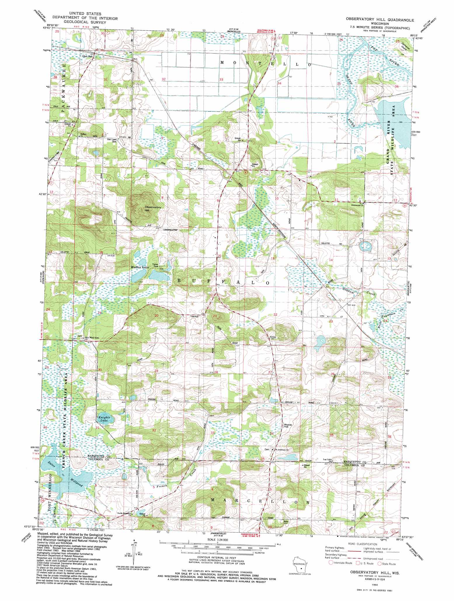
USGS Topo Quad 43089f3 - 1:24,000 scale
| Topo Map Name: | Observatory Hill |
| USGS Topo Quad ID: | 43089f3 |
| Print Size: | ca. 21 1/4" wide x 27" high |
| Southeast Coordinates: | 43.625° N latitude / 89.25° W longitude |
| Map Center Coordinates: | 43.6875° N latitude / 89.3125° W longitude |
| U.S. State: | WI |
| Filename: | o43089f3.jpg |
| Download Map JPG Image: | Observatory Hill topo map 1:24,000 scale |
| Map Type: | Topographic |
| Topo Series: | 7.5´ |
| Map Scale: | 1:24,000 |
| Source of Map Images: | United States Geological Survey (USGS) |
| Alternate Map Versions: |
Observatory Hill WI 1984, updated 1984 Download PDF Buy paper map Observatory Hill WI 2010 Download PDF Buy paper map Observatory Hill WI 2013 Download PDF Buy paper map Observatory Hill WI 2016 Download PDF Buy paper map |
1:24,000 Topo Quads surrounding Observatory Hill
Westfield West |
Westfield East |
Germania |
Neshkoro |
Fairburn |
Oxford |
Packwaukee |
Montello |
Princeton West |
Princeton East |
Briggsville |
Endeavor |
Observatory Hill |
Marquette |
Manchester |
Pine Island |
Portage |
Pardeeville |
Sand Spring Creek |
Randolph |
Durwards Glen |
Poynette |
Wyocena |
Rio |
Fall River |
> Back to 43089e1 at 1:100,000 scale
> Back to 43088a1 at 1:250,000 scale
> Back to U.S. Topo Maps home
Observatory Hill topo map: Gazetteer
Observatory Hill: Dams
Dates Mill Dam elevation 241m 790′Grand River Marsh 3WR220 Dam elevation 233m 764′
Observatory Hill: Lakes
Dates Millpond elevation 241m 790′Knights Lake elevation 246m 807′
Madden Lakes elevation 248m 813′
Observatory Hill: Parks
French Creek State Wildlife Area elevation 244m 800′Grand River State Wildlife Area elevation 234m 767′
Observatory Hill State Natural Area elevation 328m 1076′
Observatory Hill: Populated Places
Glen Oak elevation 241m 790′Observatory Hill: Reservoirs
Dates Millpond 14 elevation 241m 790′Observatory Hill: Streams
Belle Fountain Creek elevation 237m 777′Grand River elevation 233m 764′
Observatory Hill: Summits
Observatory Hill elevation 328m 1076′Observatory Hill digital topo map on disk
Buy this Observatory Hill topo map showing relief, roads, GPS coordinates and other geographical features, as a high-resolution digital map file on DVD: