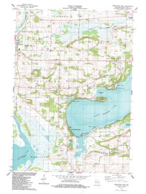
Princeton East Topo Map Wisconsin
To zoom in, hover over the map of Princeton East
USGS Topo Quad 43089g1 - 1:24,000 scale
| Topo Map Name: | Princeton East |
| USGS Topo Quad ID: | 43089g1 |
| Print Size: | ca. 21 1/4" wide x 27" high |
| Southeast Coordinates: | 43.75° N latitude / 89° W longitude |
| Map Center Coordinates: | 43.8125° N latitude / 89.0625° W longitude |
| U.S. State: | WI |
| Filename: | o43089g1.jpg |
| Download Map JPG Image: | Princeton East topo map 1:24,000 scale |
| Map Type: | Topographic |
| Topo Series: | 7.5´ |
| Map Scale: | 1:24,000 |
| Source of Map Images: | United States Geological Survey (USGS) |
| Alternate Map Versions: |
Princeton East WI 1984, updated 1984 Download PDF Buy paper map Princeton East WI 2010 Download PDF Buy paper map Princeton East WI 2013 Download PDF Buy paper map Princeton East WI 2016 Download PDF Buy paper map |
1:24,000 Topo Quads surrounding Princeton East
> Back to 43089e1 at 1:100,000 scale
> Back to 43088a1 at 1:250,000 scale
> Back to U.S. Topo Maps home
Princeton East topo map: Gazetteer
Princeton East: Airports
Bed-Ah-Wick Field elevation 240m 787′Princeton East: Bays
Beyers Cove elevation 243m 797′Dickinsons Bay elevation 243m 797′
Norwegian Bay elevation 243m 797′
Pigeon Cove elevation 243m 797′
Quimby Bay elevation 243m 797′
Princeton East: Capes
Blackbird Point elevation 243m 797′Lone Tree Point elevation 247m 810′
Sugarloaf elevation 246m 807′
Princeton East: Lakes
Spring Lake elevation 251m 823′Princeton East: Parks
Snake Creek Fen State Natural Area elevation 238m 780′Princeton East: Populated Places
Green Lake Terrace elevation 246m 807′Greenwyck elevation 249m 816′
Lakewood Estates elevation 258m 846′
Princeton elevation 238m 780′
Sylvan Shores elevation 257m 843′
Princeton East: Streams
Roy Creek elevation 243m 797′Snake Creek elevation 237m 777′
Spring Creek elevation 243m 797′
Princeton East digital topo map on disk
Buy this Princeton East topo map showing relief, roads, GPS coordinates and other geographical features, as a high-resolution digital map file on DVD:


