Princeton West Topo Map Wisconsin
To zoom in, hover over the map of Princeton West
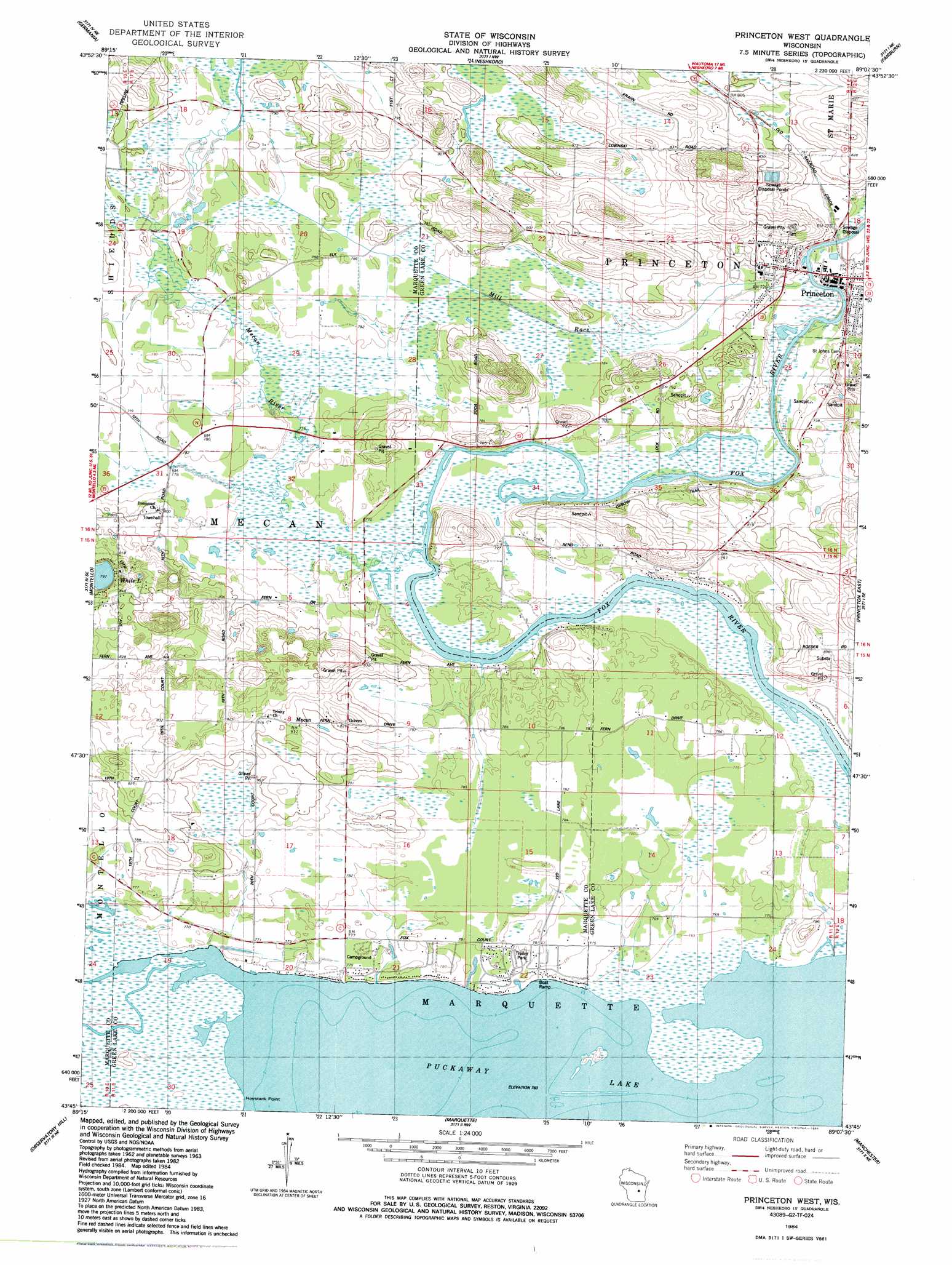
USGS Topo Quad 43089g2 - 1:24,000 scale
| Topo Map Name: | Princeton West |
| USGS Topo Quad ID: | 43089g2 |
| Print Size: | ca. 21 1/4" wide x 27" high |
| Southeast Coordinates: | 43.75° N latitude / 89.125° W longitude |
| Map Center Coordinates: | 43.8125° N latitude / 89.1875° W longitude |
| U.S. State: | WI |
| Filename: | o43089g2.jpg |
| Download Map JPG Image: | Princeton West topo map 1:24,000 scale |
| Map Type: | Topographic |
| Topo Series: | 7.5´ |
| Map Scale: | 1:24,000 |
| Source of Map Images: | United States Geological Survey (USGS) |
| Alternate Map Versions: |
Princeton West WI 1984, updated 1984 Download PDF Buy paper map Princeton West WI 2010 Download PDF Buy paper map Princeton West WI 2013 Download PDF Buy paper map Princeton West WI 2016 Download PDF Buy paper map |
1:24,000 Topo Quads surrounding Princeton West
Richford |
Wautoma |
Spring Lake |
Redgranite |
Auroraville |
Westfield East |
Germania |
Neshkoro |
Fairburn |
Berlin |
Packwaukee |
Montello |
Princeton West |
Princeton East |
Green Lake |
Endeavor |
Observatory Hill |
Marquette |
Manchester |
Markesan |
Portage |
Pardeeville |
Sand Spring Creek |
Randolph |
Fox Lake |
> Back to 43089e1 at 1:100,000 scale
> Back to 43088a1 at 1:250,000 scale
> Back to U.S. Topo Maps home
Princeton West topo map: Gazetteer
Princeton West: Capes
Haystack Point elevation 233m 764′Princeton West: Dams
Princeton Lock (historical) elevation 232m 761′Princeton West: Lakes
Puckaway Lake elevation 233m 764′Princeton West: Populated Places
Mecan elevation 246m 807′Princeton West: Streams
Mecan River elevation 232m 761′Mill Race elevation 233m 764′
Princeton West digital topo map on disk
Buy this Princeton West topo map showing relief, roads, GPS coordinates and other geographical features, as a high-resolution digital map file on DVD: