Long Hollow Topo Map Wisconsin
To zoom in, hover over the map of Long Hollow
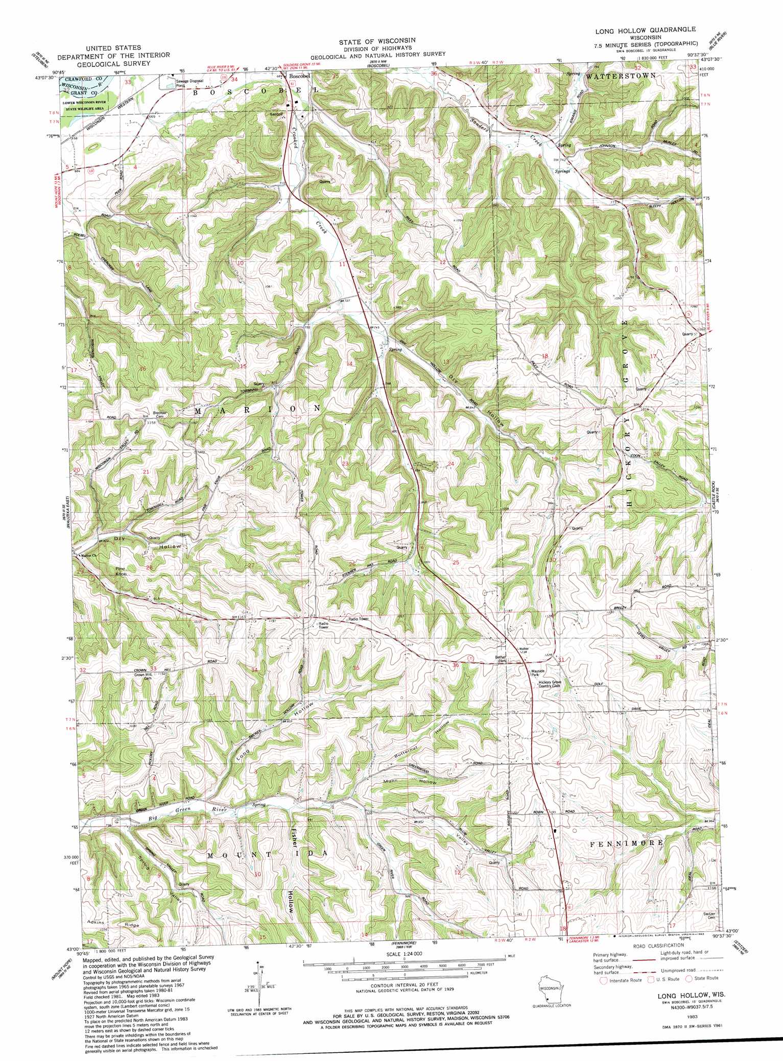
USGS Topo Quad 43090a6 - 1:24,000 scale
| Topo Map Name: | Long Hollow |
| USGS Topo Quad ID: | 43090a6 |
| Print Size: | ca. 21 1/4" wide x 27" high |
| Southeast Coordinates: | 43° N latitude / 90.625° W longitude |
| Map Center Coordinates: | 43.0625° N latitude / 90.6875° W longitude |
| U.S. State: | WI |
| Filename: | o43090a6.jpg |
| Download Map JPG Image: | Long Hollow topo map 1:24,000 scale |
| Map Type: | Topographic |
| Topo Series: | 7.5´ |
| Map Scale: | 1:24,000 |
| Source of Map Images: | United States Geological Survey (USGS) |
| Alternate Map Versions: |
Long Hollow WI 1983, updated 1983 Download PDF Buy paper map Long Hollow WI 2010 Download PDF Buy paper map Long Hollow WI 2013 Download PDF Buy paper map Long Hollow WI 2016 Download PDF Buy paper map |
1:24,000 Topo Quads surrounding Long Hollow
Mount Sterling |
Gays Mills |
Mount Zion |
Boaz |
Richland Center |
Crowley Ridge |
Steuben |
Boscobel |
Blue River |
Muscoda |
Wauzeka West |
Wauzeka East |
Long Hollow |
Castle Rock |
Highland West |
Bloomington |
Mount Hope |
Fennimore |
Stitzer |
Montfort |
Beetown |
Hurricane |
Lancaster |
Ellenboro |
Rewey |
> Back to 43090a1 at 1:100,000 scale
> Back to 43090a1 at 1:250,000 scale
> Back to U.S. Topo Maps home
Long Hollow topo map: Gazetteer
Long Hollow: Ridges
Adkins Ridge elevation 351m 1151′Long Hollow: Summits
Pine Knob elevation 325m 1066′Long Hollow: Valleys
Butternut Hollow elevation 275m 902′Fisher Hollow elevation 283m 928′
Long Hollow elevation 254m 833′
Munn Hollow elevation 280m 918′
Plum Valley elevation 276m 905′
Spring Valley elevation 247m 810′
Long Hollow digital topo map on disk
Buy this Long Hollow topo map showing relief, roads, GPS coordinates and other geographical features, as a high-resolution digital map file on DVD: