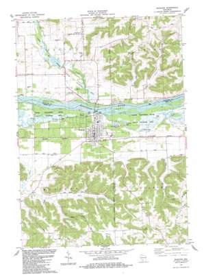
Muscoda Topo Map Wisconsin
To zoom in, hover over the map of Muscoda
USGS Topo Quad 43090b4 - 1:24,000 scale
| Topo Map Name: | Muscoda |
| USGS Topo Quad ID: | 43090b4 |
| Print Size: | ca. 21 1/4" wide x 27" high |
| Southeast Coordinates: | 43.125° N latitude / 90.375° W longitude |
| Map Center Coordinates: | 43.1875° N latitude / 90.4375° W longitude |
| U.S. State: | WI |
| Filename: | o43090b4.jpg |
| Download Map JPG Image: | Muscoda topo map 1:24,000 scale |
| Map Type: | Topographic |
| Topo Series: | 7.5´ |
| Map Scale: | 1:24,000 |
| Source of Map Images: | United States Geological Survey (USGS) |
| Alternate Map Versions: |
Muscoda WI 1983, updated 1983 Download PDF Buy paper map Muscoda WI 2010 Download PDF Buy paper map Muscoda WI 2013 Download PDF Buy paper map Muscoda WI 2016 Download PDF Buy paper map |
1:24,000 Topo Quads surrounding Muscoda
> Back to 43090a1 at 1:100,000 scale
> Back to 43090a1 at 1:250,000 scale
> Back to U.S. Topo Maps home
Muscoda topo map: Gazetteer
Muscoda: Dams
Rodolf Dam elevation 207m 679′Muscoda: Flats
Hickory Flat elevation 360m 1181′Muscoda: Guts
Big Cat Slough elevation 204m 669′Whites Slough elevation 202m 662′
Muscoda: Islands
High Bank Island elevation 204m 669′McClary Island elevation 204m 669′
Muscoda Island elevation 199m 652′
Muscoda: Lakes
Dixon Lake elevation 203m 666′Goodwiler Lake elevation 201m 659′
Kendal Lake elevation 204m 669′
Long Lake elevation 206m 675′
Round Hole elevation 207m 679′
Muscoda: Pillars
Day Rock elevation 318m 1043′Muscoda: Populated Places
Balmoral elevation 215m 705′Muscoda elevation 210m 688′
Orion elevation 218m 715′
Muscoda: Reservoirs
Balmoral Pond 94 elevation 207m 679′Muscoda: Ridges
Bomkamp Ridge elevation 333m 1092′Dry Dog Ridge elevation 338m 1108′
Muscoda: Streams
Indian Creek elevation 196m 643′Mill Creek elevation 196m 643′
Sand Branch elevation 202m 662′
Muscoda: Summits
Pine Hill elevation 326m 1069′Muscoda: Valleys
Hoosier Hollow elevation 206m 675′Miller Hollow elevation 219m 718′
Muscoda digital topo map on disk
Buy this Muscoda topo map showing relief, roads, GPS coordinates and other geographical features, as a high-resolution digital map file on DVD:


