Bear Valley Topo Map Wisconsin
To zoom in, hover over the map of Bear Valley
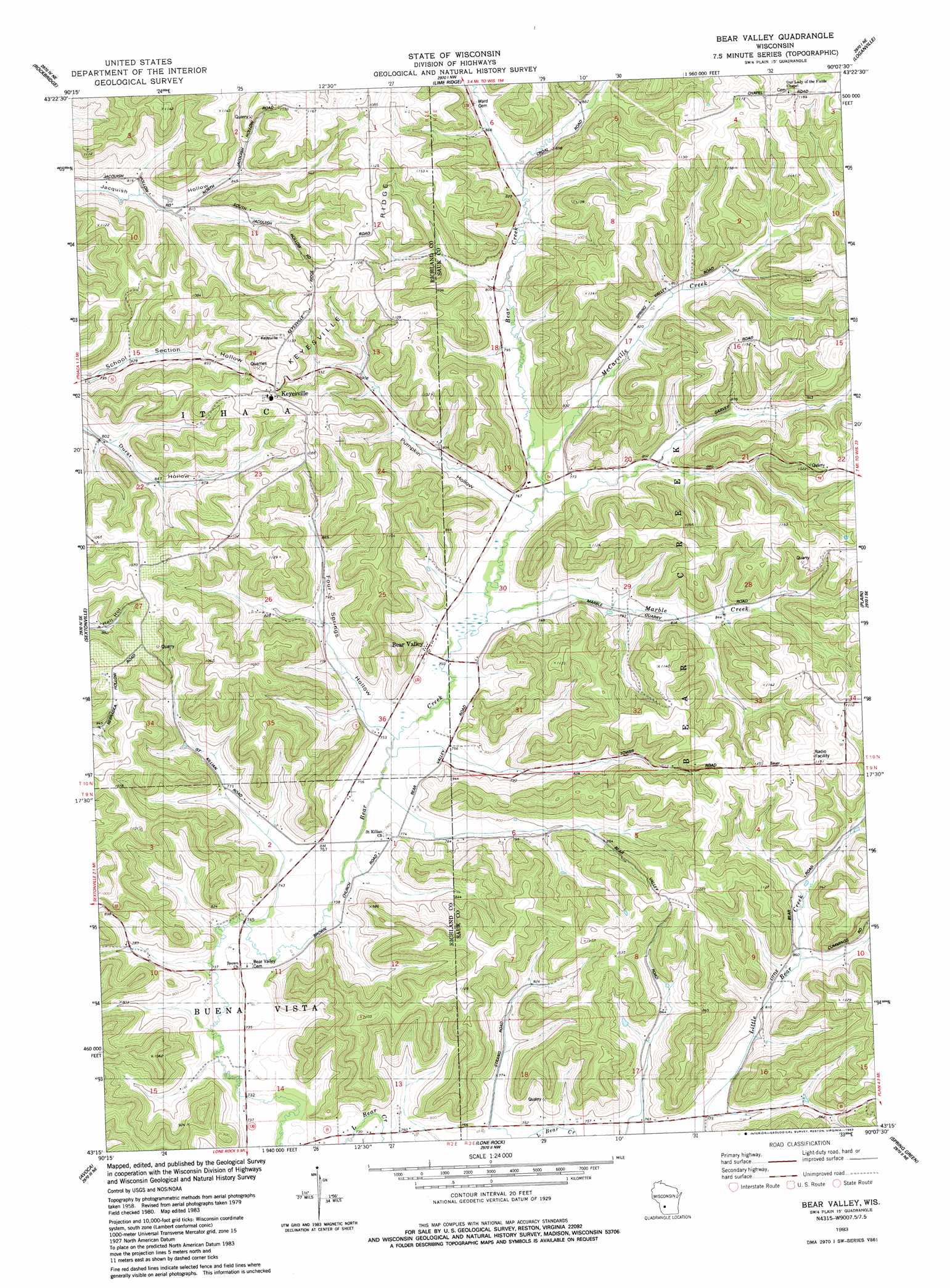
USGS Topo Quad 43090c2 - 1:24,000 scale
| Topo Map Name: | Bear Valley |
| USGS Topo Quad ID: | 43090c2 |
| Print Size: | ca. 21 1/4" wide x 27" high |
| Southeast Coordinates: | 43.25° N latitude / 90.125° W longitude |
| Map Center Coordinates: | 43.3125° N latitude / 90.1875° W longitude |
| U.S. State: | WI |
| Filename: | o43090c2.jpg |
| Download Map JPG Image: | Bear Valley topo map 1:24,000 scale |
| Map Type: | Topographic |
| Topo Series: | 7.5´ |
| Map Scale: | 1:24,000 |
| Source of Map Images: | United States Geological Survey (USGS) |
| Alternate Map Versions: |
Bear Valley WI 1983, updated 1983 Download PDF Buy paper map Bear Valley WI 2010 Download PDF Buy paper map Bear Valley WI 2013 Download PDF Buy paper map Bear Valley WI 2016 Download PDF Buy paper map |
1:24,000 Topo Quads surrounding Bear Valley
Yuba |
Valton |
La Valle |
Reedsburg West |
Reedsburg East |
Gillingham |
Rockeridge |
Lime Ridge |
Loganville |
Rock Springs |
Richland Center |
Sectonville |
Bear Valley |
Plain |
Black Hawk |
Muscoda |
Avoca |
Lone Rock |
Spring Green |
Arena |
Highland West |
Highland East |
Clyde |
Pleasant Ridge |
Barneveld |
> Back to 43090a1 at 1:100,000 scale
> Back to 43090a1 at 1:250,000 scale
> Back to U.S. Topo Maps home
Bear Valley topo map: Gazetteer
Bear Valley: Parks
Bear Creek Sedge Meadow State Natural Area elevation 225m 738′Bear Valley: Populated Places
Bear Valley elevation 232m 761′Keyesville elevation 328m 1076′
Bear Valley: Ridges
Keyesville Ridge elevation 343m 1125′Bear Valley: Streams
Marble Creek elevation 227m 744′McCarville Creek elevation 233m 764′
Bear Valley: Valleys
Four Springs Hollow elevation 227m 744′Pumpkin Hollow elevation 234m 767′
Bear Valley digital topo map on disk
Buy this Bear Valley topo map showing relief, roads, GPS coordinates and other geographical features, as a high-resolution digital map file on DVD: