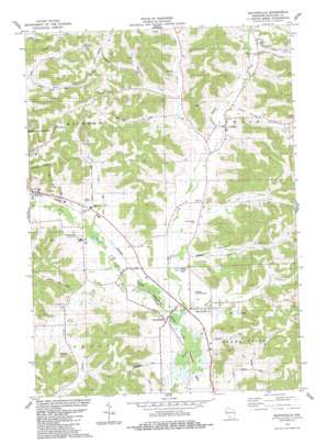
Sectonville Topo Map Wisconsin
To zoom in, hover over the map of Sectonville
USGS Topo Quad 43090c3 - 1:24,000 scale
| Topo Map Name: | Sectonville |
| USGS Topo Quad ID: | 43090c3 |
| Print Size: | ca. 21 1/4" wide x 27" high |
| Southeast Coordinates: | 43.25° N latitude / 90.25° W longitude |
| Map Center Coordinates: | 43.3125° N latitude / 90.3125° W longitude |
| U.S. State: | WI |
| Filename: | o43090c3.jpg |
| Download Map JPG Image: | Sectonville topo map 1:24,000 scale |
| Map Type: | Topographic |
| Topo Series: | 7.5´ |
| Map Scale: | 1:24,000 |
| Source of Map Images: | United States Geological Survey (USGS) |
| Alternate Map Versions: |
Sextonville WI 1983, updated 1983 Download PDF Buy paper map Sextonville WI 2010 Download PDF Buy paper map Sextonville WI 2013 Download PDF Buy paper map Sextonville WI 2016 Download PDF Buy paper map |
1:24,000 Topo Quads surrounding Sectonville
> Back to 43090a1 at 1:100,000 scale
> Back to 43090a1 at 1:250,000 scale
> Back to U.S. Topo Maps home
Sectonville topo map: Gazetteer
Sectonville: Airports
Richland Airport elevation 219m 718′Sectonville: Arches
Elephant Trunk Rock elevation 240m 787′Sectonville: Dams
Calhoun G7989 Dam elevation 272m 892′Sectonville: Pillars
Elephant Trunk Rock elevation 246m 807′Sectonville: Populated Places
Aubrey elevation 230m 754′Ithaca elevation 227m 744′
Neptune elevation 233m 764′
Sextonville elevation 222m 728′
Twin Bluffs elevation 216m 708′
Sectonville: Reservoirs
.37 Reservoir elevation 272m 892′Sectonville: Ridges
Hulster Ridge elevation 341m 1118′Sectonville: Streams
Ash Creek elevation 212m 695′Little Willow Creek elevation 220m 721′
Misslich Creek elevation 228m 748′
Snake Creek elevation 222m 728′
Spring Creek elevation 206m 675′
Willow Creek elevation 209m 685′
Sectonville: Valleys
Dog Hollow elevation 235m 770′Durst Hollow elevation 237m 777′
Hell Hollow elevation 224m 734′
Jacquish Hollow elevation 229m 751′
Morris Valley elevation 228m 748′
Nebraska Hollow elevation 219m 718′
Post Hollow elevation 213m 698′
Pumpkin Hollow elevation 224m 734′
School Section Hollow elevation 225m 738′
Sectonville digital topo map on disk
Buy this Sectonville topo map showing relief, roads, GPS coordinates and other geographical features, as a high-resolution digital map file on DVD:


