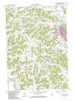
Richland Center Topo Map Wisconsin
To zoom in, hover over the map of Richland Center
USGS Topo Quad 43090c4 - 1:24,000 scale
| Topo Map Name: | Richland Center |
| USGS Topo Quad ID: | 43090c4 |
| Print Size: | ca. 21 1/4" wide x 27" high |
| Southeast Coordinates: | 43.25° N latitude / 90.375° W longitude |
| Map Center Coordinates: | 43.3125° N latitude / 90.4375° W longitude |
| U.S. State: | WI |
| Filename: | o43090c4.jpg |
| Download Map JPG Image: | Richland Center topo map 1:24,000 scale |
| Map Type: | Topographic |
| Topo Series: | 7.5´ |
| Map Scale: | 1:24,000 |
| Source of Map Images: | United States Geological Survey (USGS) |
| Alternate Map Versions: |
Richland Center WI 1983, updated 1983 Download PDF Buy paper map Richland Center WI 2010 Download PDF Buy paper map Richland Center WI 2013 Download PDF Buy paper map Richland Center WI 2016 Download PDF Buy paper map |
1:24,000 Topo Quads surrounding Richland Center
> Back to 43090a1 at 1:100,000 scale
> Back to 43090a1 at 1:250,000 scale
> Back to U.S. Topo Maps home
Richland Center topo map: Gazetteer
Richland Center: Dams
Mill Creek 1b D-31.11 Dam elevation 252m 826′Parfrey Dam elevation 220m 721′
Richland Center: Parks
Story Field elevation 241m 790′Richland Center: Populated Places
Ashford (historical) elevation 315m 1033′Basswood elevation 222m 728′
Richland Center elevation 222m 728′
Richland Center: Post Offices
Richland Center Post Office elevation 225m 738′Richland Center: Reservoirs
1 Reservoir elevation 252m 826′Richland Center Millpond 189 elevation 220m 721′
Richland Center: Ridges
Chicken Ridge elevation 333m 1092′Oak Ridge elevation 335m 1099′
Richland Center: Springs
Pier Spring elevation 272m 892′Richland Center: Streams
Brush Creek elevation 221m 725′Center Creek elevation 220m 721′
Horse Creek elevation 225m 738′
John Hill Creek elevation 213m 698′
Pier Spring Creek elevation 238m 780′
Rocky Branch elevation 218m 715′
Richland Center: Summits
John Hill elevation 355m 1164′Pauls Hill elevation 312m 1023′
Richland Center digital topo map on disk
Buy this Richland Center topo map showing relief, roads, GPS coordinates and other geographical features, as a high-resolution digital map file on DVD:


