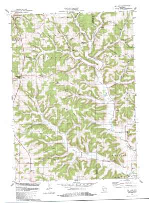
Mount Zion Topo Map Wisconsin
To zoom in, hover over the map of Mount Zion
USGS Topo Quad 43090c6 - 1:24,000 scale
| Topo Map Name: | Mount Zion |
| USGS Topo Quad ID: | 43090c6 |
| Print Size: | ca. 21 1/4" wide x 27" high |
| Southeast Coordinates: | 43.25° N latitude / 90.625° W longitude |
| Map Center Coordinates: | 43.3125° N latitude / 90.6875° W longitude |
| U.S. State: | WI |
| Filename: | o43090c6.jpg |
| Download Map JPG Image: | Mount Zion topo map 1:24,000 scale |
| Map Type: | Topographic |
| Topo Series: | 7.5´ |
| Map Scale: | 1:24,000 |
| Source of Map Images: | United States Geological Survey (USGS) |
| Alternate Map Versions: |
Mt. Zion WI 1983, updated 1983 Download PDF Buy paper map Mount Zion WI 2010 Download PDF Buy paper map Mount Zion WI 2013 Download PDF Buy paper map Mount Zion WI 2016 Download PDF Buy paper map |
1:24,000 Topo Quads surrounding Mount Zion
> Back to 43090a1 at 1:100,000 scale
> Back to 43090a1 at 1:250,000 scale
> Back to U.S. Topo Maps home
Mount Zion topo map: Gazetteer
Mount Zion: Airports
Leeward Farm Airport elevation 324m 1062′Mount Zion: Populated Places
Excelsior elevation 209m 685′Jimtown elevation 251m 823′
Montgomeryville elevation 341m 1118′
Mount Zion elevation 360m 1181′
Rolling Ground elevation 367m 1204′
Tavera elevation 215m 705′
Mount Zion: Ridges
Fresh Ridge elevation 353m 1158′Horrigan Ridge elevation 348m 1141′
Lightfoot Ridge elevation 344m 1128′
McDilley Ridge elevation 317m 1040′
Saint Philips Ridge elevation 348m 1141′
Mount Zion: Streams
English Run elevation 229m 751′Jimtown Branch elevation 225m 738′
O'Connor Branch elevation 213m 698′
O'Connor Branch elevation 213m 698′
Pigeon Run elevation 238m 780′
Plum Run elevation 234m 767′
West Fork Knapp Creek elevation 211m 692′
Wolf Run elevation 248m 813′
Mount Zion: Valleys
Beebe Hollow elevation 217m 711′Dry Hollow elevation 220m 721′
Griffin Hollow elevation 269m 882′
Johnson Hollow elevation 251m 823′
Lightfoot Hollow elevation 223m 731′
Long Hollow elevation 226m 741′
McCumber Hollow elevation 258m 846′
Sleepy Hollow elevation 250m 820′
Welsh Hollow elevation 220m 721′
Whitaker Hollow elevation 238m 780′
Mount Zion digital topo map on disk
Buy this Mount Zion topo map showing relief, roads, GPS coordinates and other geographical features, as a high-resolution digital map file on DVD:


