Gillingham Topo Map Wisconsin
To zoom in, hover over the map of Gillingham
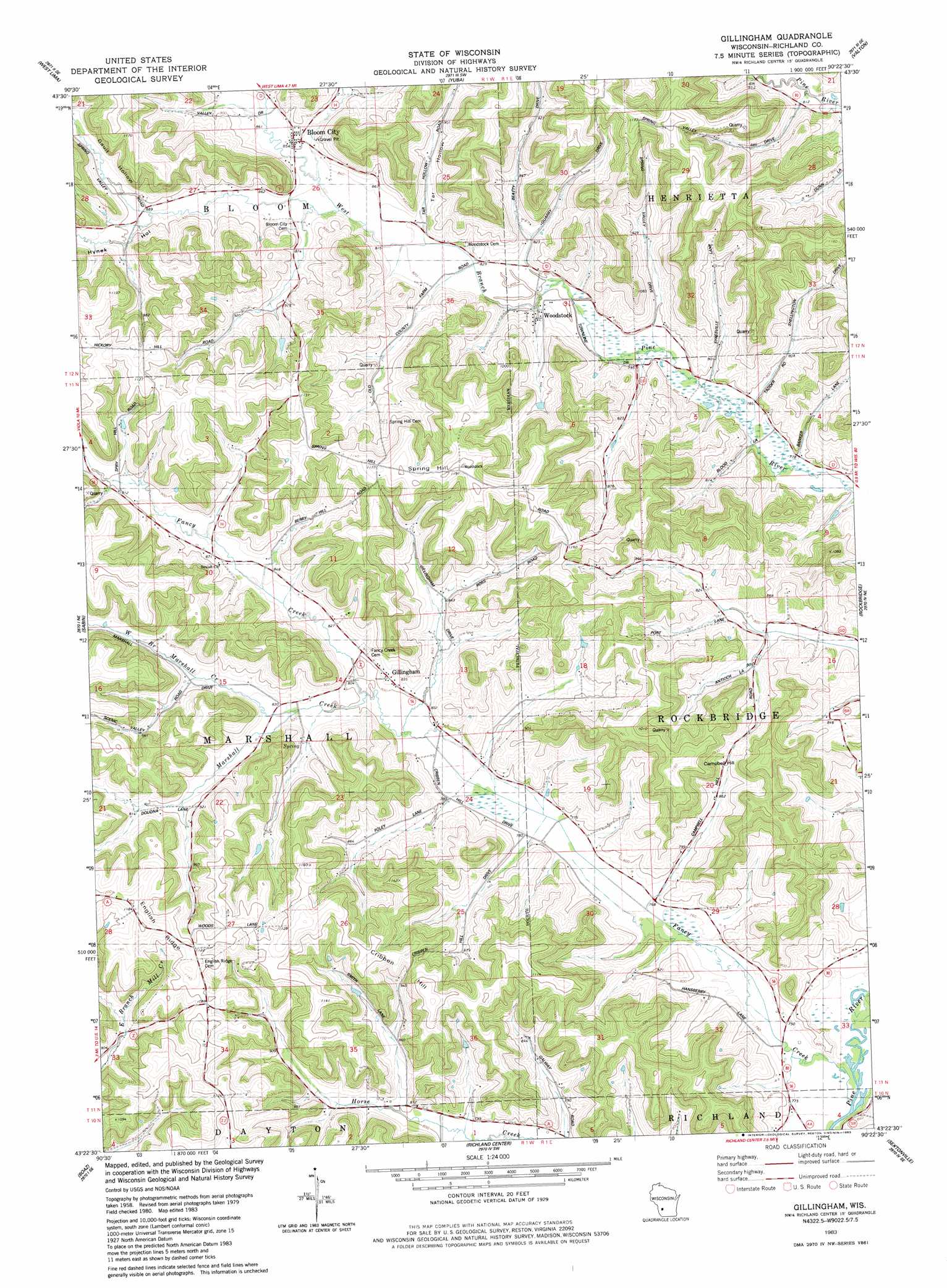
USGS Topo Quad 43090d4 - 1:24,000 scale
| Topo Map Name: | Gillingham |
| USGS Topo Quad ID: | 43090d4 |
| Print Size: | ca. 21 1/4" wide x 27" high |
| Southeast Coordinates: | 43.375° N latitude / 90.375° W longitude |
| Map Center Coordinates: | 43.4375° N latitude / 90.4375° W longitude |
| U.S. State: | WI |
| Filename: | o43090d4.jpg |
| Download Map JPG Image: | Gillingham topo map 1:24,000 scale |
| Map Type: | Topographic |
| Topo Series: | 7.5´ |
| Map Scale: | 1:24,000 |
| Source of Map Images: | United States Geological Survey (USGS) |
| Alternate Map Versions: |
Gillingham WI 1983, updated 1983 Download PDF Buy paper map Gillingham WI 2010 Download PDF Buy paper map Gillingham WI 2013 Download PDF Buy paper map Gillingham WI 2016 Download PDF Buy paper map |
1:24,000 Topo Quads surrounding Gillingham
Dell |
Ontario |
Trippville |
Hillsboro |
Wonewoc |
La Farge |
West Lima |
Yuba |
Valton |
La Valle |
Sugar Grove |
Sabin |
Gillingham |
Rockeridge |
Lime Ridge |
Mount Zion |
Boaz |
Richland Center |
Sectonville |
Bear Valley |
Boscobel |
Blue River |
Muscoda |
Avoca |
Lone Rock |
> Back to 43090a1 at 1:100,000 scale
> Back to 43090a1 at 1:250,000 scale
> Back to U.S. Topo Maps home
Gillingham topo map: Gazetteer
Gillingham: Dams
Bernstein G-8953 Dam elevation 310m 1017′Huffman Brothers Dam G7723 elevation 276m 905′
Mill Creek 13b D-31.11 Dam elevation 283m 928′
Gillingham: Populated Places
Bloom City elevation 261m 856′Gillingham elevation 245m 803′
McGrew (historical) elevation 343m 1125′
Woodstock elevation 253m 830′
Gillingham: Reservoirs
.36 Reservoir elevation 310m 1017′0.3 Reservoir elevation 276m 905′
1 Reservoir elevation 283m 928′
Gillingham: Streams
Fancy Creek elevation 227m 744′Marshall Creek elevation 243m 797′
West Branch Marshall Creek elevation 250m 820′
Gillingham: Summits
Campbell Hill elevation 355m 1164′Cribben Hill elevation 349m 1145′
Spring Hill elevation 366m 1200′
Gillingham: Valleys
Gault Hollow elevation 272m 892′Hynek Hollow elevation 256m 839′
Jarvis Valley elevation 241m 790′
Tar Hollow elevation 253m 830′
Gillingham digital topo map on disk
Buy this Gillingham topo map showing relief, roads, GPS coordinates and other geographical features, as a high-resolution digital map file on DVD: