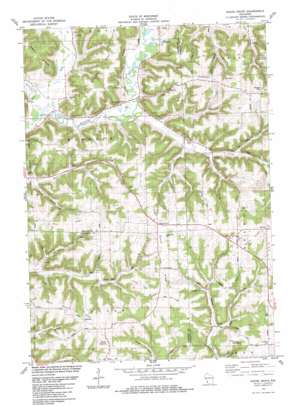
Sugar Grove Topo Map Wisconsin
To zoom in, hover over the map of Sugar Grove
USGS Topo Quad 43090d6 - 1:24,000 scale
| Topo Map Name: | Sugar Grove |
| USGS Topo Quad ID: | 43090d6 |
| Print Size: | ca. 21 1/4" wide x 27" high |
| Southeast Coordinates: | 43.375° N latitude / 90.625° W longitude |
| Map Center Coordinates: | 43.4375° N latitude / 90.6875° W longitude |
| U.S. State: | WI |
| Filename: | o43090d6.jpg |
| Download Map JPG Image: | Sugar Grove topo map 1:24,000 scale |
| Map Type: | Topographic |
| Topo Series: | 7.5´ |
| Map Scale: | 1:24,000 |
| Source of Map Images: | United States Geological Survey (USGS) |
| Alternate Map Versions: |
Sugar Grove WI 1983, updated 1983 Download PDF Buy paper map Sugar Grove WI 2010 Download PDF Buy paper map Sugar Grove WI 2013 Download PDF Buy paper map Sugar Grove WI 2016 Download PDF Buy paper map |
1:24,000 Topo Quads surrounding Sugar Grove
> Back to 43090a1 at 1:100,000 scale
> Back to 43090a1 at 1:250,000 scale
> Back to U.S. Topo Maps home
Sugar Grove topo map: Gazetteer
Sugar Grove: Airports
Big Spring Landing Strip elevation 346m 1135′Sugar Grove: Populated Places
North Clayton elevation 365m 1197′Sugar Grove elevation 374m 1227′
Sylvan elevation 380m 1246′
Sugar Grove: Ridges
Hopewell Ridge elevation 384m 1259′Hustler Ridge elevation 351m 1151′
Maple Ridge elevation 311m 1020′
North Clayton Ridge elevation 355m 1164′
Sugar Grove Ridge elevation 372m 1220′
Ward Ridge elevation 354m 1161′
Sugar Grove: Streams
Elk Creek elevation 229m 751′Harrison Creek elevation 227m 744′
Hoke Creek elevation 252m 826′
Tenny Spring Creek elevation 239m 784′
West Fork Kickapoo River elevation 223m 731′
Sugar Grove: Valleys
Frye Hollow elevation 284m 931′Skunk Hollow elevation 232m 761′
Sugar Grove digital topo map on disk
Buy this Sugar Grove topo map showing relief, roads, GPS coordinates and other geographical features, as a high-resolution digital map file on DVD:


