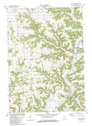
Readstown Topo Map Wisconsin
To zoom in, hover over the map of Readstown
USGS Topo Quad 43090d7 - 1:24,000 scale
| Topo Map Name: | Readstown |
| USGS Topo Quad ID: | 43090d7 |
| Print Size: | ca. 21 1/4" wide x 27" high |
| Southeast Coordinates: | 43.375° N latitude / 90.75° W longitude |
| Map Center Coordinates: | 43.4375° N latitude / 90.8125° W longitude |
| U.S. State: | WI |
| Filename: | o43090d7.jpg |
| Download Map JPG Image: | Readstown topo map 1:24,000 scale |
| Map Type: | Topographic |
| Topo Series: | 7.5´ |
| Map Scale: | 1:24,000 |
| Source of Map Images: | United States Geological Survey (USGS) |
| Alternate Map Versions: |
Readstown WI 1983, updated 1983 Download PDF Buy paper map Readstown WI 2010 Download PDF Buy paper map Readstown WI 2013 Download PDF Buy paper map Readstown WI 2016 Download PDF Buy paper map |
1:24,000 Topo Quads surrounding Readstown
> Back to 43090a1 at 1:100,000 scale
> Back to 43090a1 at 1:250,000 scale
> Back to U.S. Topo Maps home
Readstown topo map: Gazetteer
Readstown: Capes
Briggs Point elevation 320m 1049′Readstown: Pillars
Eagle Rock elevation 337m 1105′Readstown: Populated Places
Folsom elevation 359m 1177′Pine Knob elevation 351m 1151′
Readstown elevation 232m 761′
Soldiers Grove elevation 221m 725′
Readstown: Ridges
Flannagan Ridge elevation 348m 1141′Swigum Ridge elevation 348m 1141′
Readstown: Streams
Baker Creek elevation 218m 715′Day Creek elevation 223m 731′
Reads Creek elevation 223m 731′
Sheridan Creek elevation 228m 748′
Sherry Creek elevation 232m 761′
Trout Creek elevation 218m 715′
Readstown: Valleys
Black Bottom elevation 225m 738′Johnson Valley elevation 228m 748′
Jones Valley elevation 234m 767′
Spring Valley elevation 233m 764′
Readstown digital topo map on disk
Buy this Readstown topo map showing relief, roads, GPS coordinates and other geographical features, as a high-resolution digital map file on DVD:


