Valton Topo Map Wisconsin
To zoom in, hover over the map of Valton
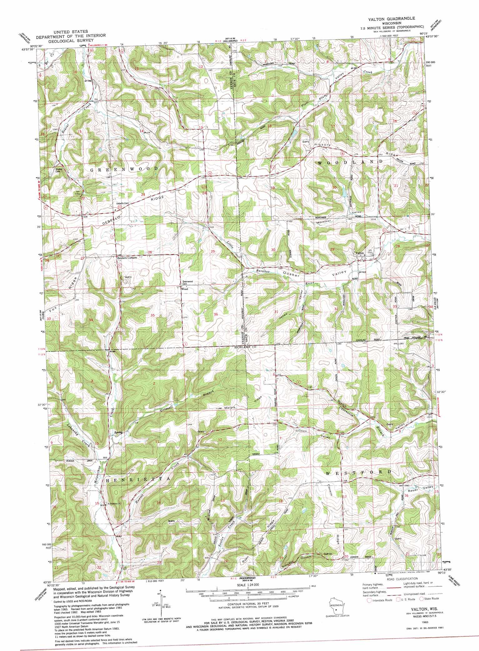
USGS Topo Quad 43090e3 - 1:24,000 scale
| Topo Map Name: | Valton |
| USGS Topo Quad ID: | 43090e3 |
| Print Size: | ca. 21 1/4" wide x 27" high |
| Southeast Coordinates: | 43.5° N latitude / 90.25° W longitude |
| Map Center Coordinates: | 43.5625° N latitude / 90.3125° W longitude |
| U.S. State: | WI |
| Filename: | o43090e3.jpg |
| Download Map JPG Image: | Valton topo map 1:24,000 scale |
| Map Type: | Topographic |
| Topo Series: | 7.5´ |
| Map Scale: | 1:24,000 |
| Source of Map Images: | United States Geological Survey (USGS) |
| Alternate Map Versions: |
Valton WI 1983, updated 1984 Download PDF Buy paper map Valton WI 2010 Download PDF Buy paper map Valton WI 2013 Download PDF Buy paper map Valton WI 2016 Download PDF Buy paper map |
1:24,000 Topo Quads surrounding Valton
Wilton |
Kendall West |
Kendall East |
New Lisbon South |
Mauston |
Ontario |
Trippville |
Hillsboro |
Wonewoc |
Potato Hill |
West Lima |
Yuba |
Valton |
La Valle |
Reedsburg West |
Sabin |
Gillingham |
Rockeridge |
Lime Ridge |
Loganville |
Boaz |
Richland Center |
Sectonville |
Bear Valley |
Plain |
> Back to 43090e1 at 1:100,000 scale
> Back to 43090a1 at 1:250,000 scale
> Back to U.S. Topo Maps home
Valton topo map: Gazetteer
Valton: Dams
Polk 3SD78806 Dam elevation 369m 1210′Satterlee G5136 Dam elevation 324m 1062′
Valton: Populated Places
Corwin (historical) elevation 385m 1263′Valton elevation 324m 1062′
Valton: Reservoirs
0.5 Reservoir elevation 324m 1062′Valton: Ridges
Corwin Ridge elevation 368m 1207′Debello Ridge elevation 393m 1289′
Fox Ridge elevation 383m 1256′
Hickory Ridge elevation 391m 1282′
Marble Ridge elevation 395m 1295′
Ryan Ridge elevation 378m 1240′
Valton: Streams
Grinsell Branch elevation 275m 902′Hanzel Creek elevation 252m 826′
Lebansky Creek elevation 269m 882′
Valton: Valleys
Grimes Valley elevation 323m 1059′Jones Valley elevation 325m 1066′
Mortimer Valley elevation 310m 1017′
Valton digital topo map on disk
Buy this Valton topo map showing relief, roads, GPS coordinates and other geographical features, as a high-resolution digital map file on DVD: