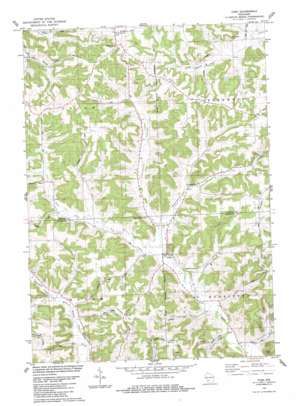
Yuba Topo Map Wisconsin
To zoom in, hover over the map of Yuba
USGS Topo Quad 43090e4 - 1:24,000 scale
| Topo Map Name: | Yuba |
| USGS Topo Quad ID: | 43090e4 |
| Print Size: | ca. 21 1/4" wide x 27" high |
| Southeast Coordinates: | 43.5° N latitude / 90.375° W longitude |
| Map Center Coordinates: | 43.5625° N latitude / 90.4375° W longitude |
| U.S. State: | WI |
| Filename: | o43090e4.jpg |
| Download Map JPG Image: | Yuba topo map 1:24,000 scale |
| Map Type: | Topographic |
| Topo Series: | 7.5´ |
| Map Scale: | 1:24,000 |
| Source of Map Images: | United States Geological Survey (USGS) |
| Alternate Map Versions: |
Yuba WI 1983, updated 1984 Download PDF Buy paper map Yuba WI 2010 Download PDF Buy paper map Yuba WI 2013 Download PDF Buy paper map Yuba WI 2016 Download PDF Buy paper map |
1:24,000 Topo Quads surrounding Yuba
> Back to 43090e1 at 1:100,000 scale
> Back to 43090a1 at 1:250,000 scale
> Back to U.S. Topo Maps home
Yuba topo map: Gazetteer
Yuba: Dams
Herbeck H 208 Dam elevation 312m 1023′Yuba: Populated Places
Greenwood elevation 281m 921′Henrietta (historical) elevation 250m 820′
White City elevation 382m 1253′
Yuba elevation 263m 862′
Yuba: Reservoirs
0.22 Reservoir elevation 312m 1023′Yuba: Ridges
Saint Johns Ridge elevation 383m 1256′Yuba: Streams
Basswood Creek elevation 281m 921′Indian Creek elevation 257m 843′
Yuba: Summits
Eysnogel Hill elevation 354m 1161′Johnson Hill elevation 352m 1154′
Yuba: Valleys
Champion Valley elevation 271m 889′Cherry Valley elevation 280m 918′
Greenwood Valley elevation 268m 879′
Happy Hollow elevation 255m 836′
Norman Valley elevation 250m 820′
Richardson Hollow elevation 247m 810′
Rocky Hollow elevation 276m 905′
Yuba digital topo map on disk
Buy this Yuba topo map showing relief, roads, GPS coordinates and other geographical features, as a high-resolution digital map file on DVD:


