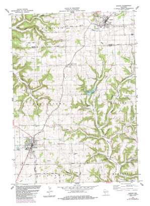
Westby Topo Map Wisconsin
To zoom in, hover over the map of Westby
USGS Topo Quad 43090f7 - 1:24,000 scale
| Topo Map Name: | Westby |
| USGS Topo Quad ID: | 43090f7 |
| Print Size: | ca. 21 1/4" wide x 27" high |
| Southeast Coordinates: | 43.625° N latitude / 90.75° W longitude |
| Map Center Coordinates: | 43.6875° N latitude / 90.8125° W longitude |
| U.S. State: | WI |
| Filename: | o43090f7.jpg |
| Download Map JPG Image: | Westby topo map 1:24,000 scale |
| Map Type: | Topographic |
| Topo Series: | 7.5´ |
| Map Scale: | 1:24,000 |
| Source of Map Images: | United States Geological Survey (USGS) |
| Alternate Map Versions: |
Westby WI 1983, updated 1983 Download PDF Buy paper map Westby WI 1983, updated 1985 Download PDF Buy paper map Westby WI 2010 Download PDF Buy paper map Westby WI 2013 Download PDF Buy paper map Westby WI 2016 Download PDF Buy paper map |
1:24,000 Topo Quads surrounding Westby
> Back to 43090e1 at 1:100,000 scale
> Back to 43090a1 at 1:250,000 scale
> Back to U.S. Topo Maps home
Westby topo map: Gazetteer
Westby: Dams
Coon Creek 14 D 6025 Dam elevation 318m 1043′Coon Creek 15 D 6025 Dam elevation 376m 1233′
Coon Creek 16 D 6025 Dam elevation 334m 1095′
Coon Creek 17 D 6025 Dam elevation 337m 1105′
Coon Creek 21 D6025 Dam elevation 329m 1079′
Coon Creek 23 D-6025 Dam elevation 334m 1095′
Coon Creek 25 D-6025 Dam elevation 310m 1017′
Mlsna D 2592.2 Dam elevation 347m 1138′
Von Ruden G-8509 Dam elevation 402m 1318′
West Fork Kickapoo 1 D 2592.2 Dam elevation 317m 1040′
West Fork Kickapoo 16 D 2592.2 Dam elevation 324m 1062′
West Fork Kickapoo 3 D 2592.2 Dam elevation 325m 1066′
Westby: Parks
Eureka Maple Woods State Natural Area elevation 295m 967′Jersey Valley County Park elevation 327m 1072′
Portland Maples State Natural Area elevation 339m 1112′
Westby: Populated Places
Bloomingdale elevation 294m 964′Cashton elevation 415m 1361′
Newry elevation 408m 1338′
Westby elevation 396m 1299′
Westby: Reservoirs
0.7 Reservoir elevation 402m 1318′1 Reservoir elevation 310m 1017′
1 Reservoir elevation 334m 1095′
1 Reservoir elevation 376m 1233′
1 Reservoir elevation 334m 1095′
1 Reservoir elevation 337m 1105′
1 Reservoir elevation 318m 1043′
1 Reservoir elevation 347m 1138′
2 Reservoir elevation 325m 1066′
2 Reservoir elevation 324m 1062′
Jersey Valley Lake 8 elevation 317m 1040′
Luckasons Pond 3 elevation 329m 1079′
Westby: Ridges
Buckskin Ridge elevation 396m 1299′Clinton Ridge elevation 397m 1302′
Goplin Ridge elevation 381m 1250′
Larson Ridge elevation 380m 1246′
Rongstad Ridge elevation 405m 1328′
Wang Ridge elevation 391m 1282′
Westby: Streams
Dickson Branch elevation 287m 941′Hall Creek elevation 279m 915′
Knapp Creek elevation 293m 961′
Westby: Summits
McElhose Hill elevation 379m 1243′Perkins Hill elevation 379m 1243′
Westby: Valleys
Gronemus Valley elevation 336m 1102′Jersey Valley elevation 291m 954′
Knapp Valley elevation 297m 974′
Westby digital topo map on disk
Buy this Westby topo map showing relief, roads, GPS coordinates and other geographical features, as a high-resolution digital map file on DVD:


