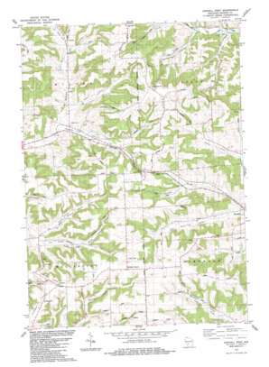
Kendall West Topo Map Wisconsin
To zoom in, hover over the map of Kendall West
USGS Topo Quad 43090g4 - 1:24,000 scale
| Topo Map Name: | Kendall West |
| USGS Topo Quad ID: | 43090g4 |
| Print Size: | ca. 21 1/4" wide x 27" high |
| Southeast Coordinates: | 43.75° N latitude / 90.375° W longitude |
| Map Center Coordinates: | 43.8125° N latitude / 90.4375° W longitude |
| U.S. State: | WI |
| Filename: | o43090g4.jpg |
| Download Map JPG Image: | Kendall West topo map 1:24,000 scale |
| Map Type: | Topographic |
| Topo Series: | 7.5´ |
| Map Scale: | 1:24,000 |
| Source of Map Images: | United States Geological Survey (USGS) |
| Alternate Map Versions: |
Kendall West WI 1983, updated 1984 Download PDF Buy paper map Kendall West WI 2010 Download PDF Buy paper map Kendall West WI 2013 Download PDF Buy paper map Kendall West WI 2016 Download PDF Buy paper map |
1:24,000 Topo Quads surrounding Kendall West
> Back to 43090e1 at 1:100,000 scale
> Back to 43090a1 at 1:250,000 scale
> Back to U.S. Topo Maps home
Kendall West topo map: Gazetteer
Kendall West: Ridges
Dorset Ridge elevation 429m 1407′Kendall West: Streams
Poe Creek elevation 311m 1020′Kendall West: Tunnels
Number One Tunnel elevation 422m 1384′Kendall West: Valleys
Cold Spring Valley elevation 342m 1122′Finucan Valley elevation 304m 997′
Gammerdinger Valley elevation 304m 997′
Grassman Valley elevation 293m 961′
Hoye Valley elevation 322m 1056′
North Branch Black Valley elevation 311m 1020′
South Branch Black Valley elevation 312m 1023′
Spring Valley elevation 329m 1079′
Kendall West digital topo map on disk
Buy this Kendall West topo map showing relief, roads, GPS coordinates and other geographical features, as a high-resolution digital map file on DVD:


