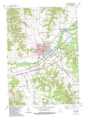
Sparta Topo Map Wisconsin
To zoom in, hover over the map of Sparta
USGS Topo Quad 43090h7 - 1:24,000 scale
| Topo Map Name: | Sparta |
| USGS Topo Quad ID: | 43090h7 |
| Print Size: | ca. 21 1/4" wide x 27" high |
| Southeast Coordinates: | 43.875° N latitude / 90.75° W longitude |
| Map Center Coordinates: | 43.9375° N latitude / 90.8125° W longitude |
| U.S. State: | WI |
| Filename: | o43090h7.jpg |
| Download Map JPG Image: | Sparta topo map 1:24,000 scale |
| Map Type: | Topographic |
| Topo Series: | 7.5´ |
| Map Scale: | 1:24,000 |
| Source of Map Images: | United States Geological Survey (USGS) |
| Alternate Map Versions: |
Sparta NE WI 1976, updated 1978 Download PDF Buy paper map Sparta WI 1983, updated 1984 Download PDF Buy paper map Sparta WI 2010 Download PDF Buy paper map Sparta WI 2013 Download PDF Buy paper map Sparta WI 2016 Download PDF Buy paper map |
1:24,000 Topo Quads surrounding Sparta
> Back to 43090e1 at 1:100,000 scale
> Back to 43090a1 at 1:250,000 scale
> Back to U.S. Topo Maps home
Sparta topo map: Gazetteer
Sparta: Airports
Emergency Medical Heliport elevation 239m 784′Sparta Landing Field elevation 244m 800′
Sparta: Cliffs
Balls Bluff elevation 394m 1292′Sparta: Crossings
Exit 25 elevation 250m 820′Sparta: Dams
Angelo H629.3 Dam elevation 241m 790′Paper Mill Dam elevation 235m 770′
Sparta: Parks
Beaver Creek Park elevation 238m 780′Blyton Park elevation 245m 803′
Evan Evans Park elevation 235m 770′
Fishermans Park elevation 235m 770′
Howard Huff Park elevation 235m 770′
Memorial Park elevation 241m 790′
Westside Park elevation 240m 787′
Sparta: Pillars
Castle Rock elevation 357m 1171′Sparta: Populated Places
Angelo elevation 246m 807′Leon elevation 240m 787′
Sparta elevation 241m 790′
Sparta: Post Offices
Sparta Post Office elevation 241m 790′Sparta: Reservoirs
Angelo 131 Reservoir elevation 241m 790′Angelo Pond elevation 243m 797′
Perch Lake elevation 236m 774′
Perch Lake 143 elevation 235m 770′
Sparta: Ridges
Putnam Ridge elevation 288m 944′Sparta: Streams
Beaver Creek elevation 235m 770′East Beaver Creek elevation 249m 816′
Farmers Valley Creek elevation 235m 770′
Sand Creek elevation 238m 780′
Silver Creek elevation 244m 800′
West Beaver Creek elevation 249m 816′
Sparta: Valleys
Farmers Valley elevation 244m 800′Leon Valley elevation 234m 767′
Sparta digital topo map on disk
Buy this Sparta topo map showing relief, roads, GPS coordinates and other geographical features, as a high-resolution digital map file on DVD:


