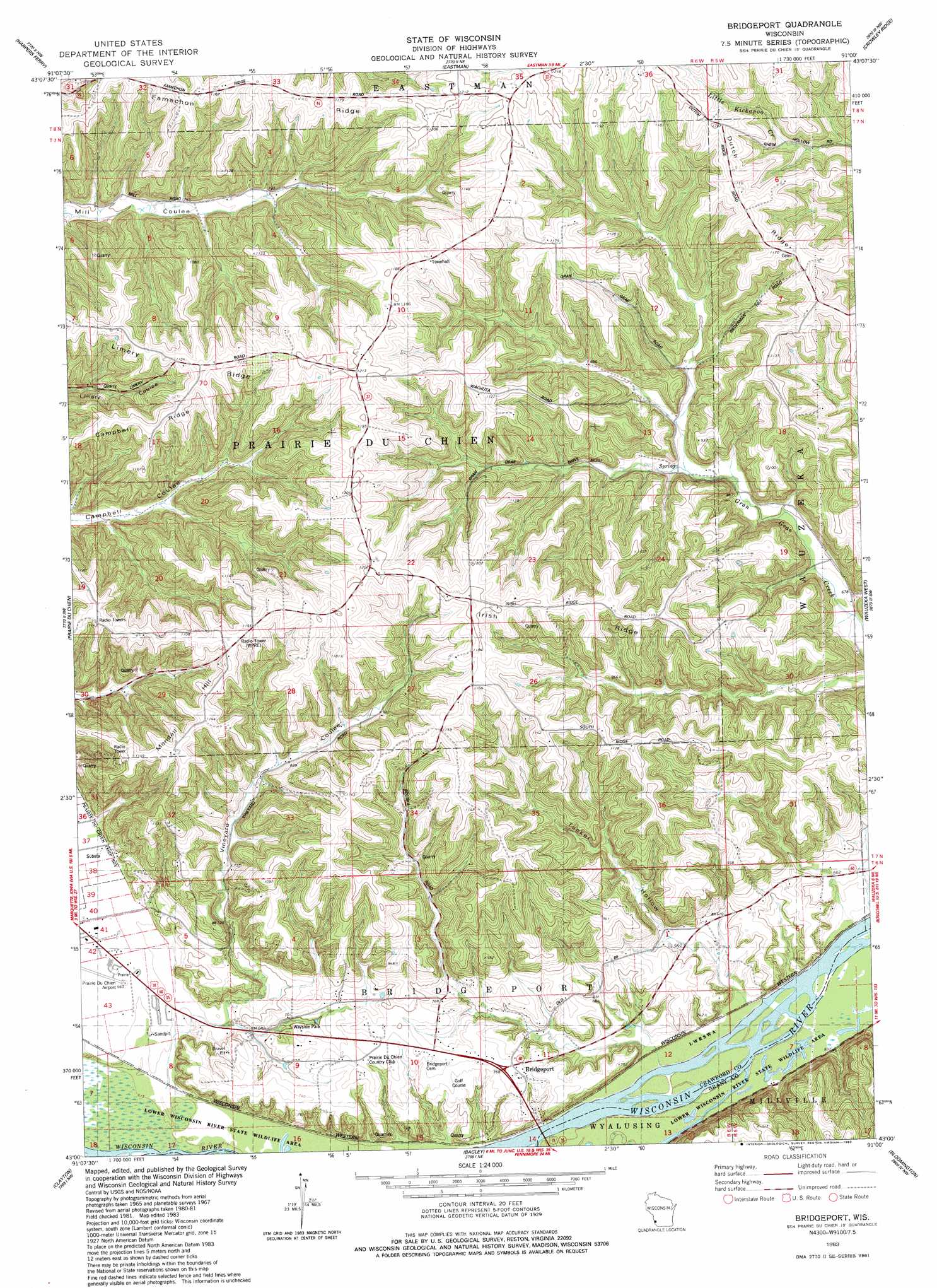
Bridgeport Topo Map Wisconsin
To zoom in, hover over the map of Bridgeport
USGS Topo Quad 43091a1 - 1:24,000 scale
| Topo Map Name: | Bridgeport |
| USGS Topo Quad ID: | 43091a1 |
| Print Size: | ca. 21 1/4" wide x 27" high |
| Southeast Coordinates: | 43° N latitude / 91° W longitude |
| Map Center Coordinates: | 43.0625° N latitude / 91.0625° W longitude |
| U.S. State: | WI |
| Filename: | o43091a1.jpg |
| Download Map JPG Image: | Bridgeport topo map 1:24,000 scale |
| Map Type: | Topographic |
| Topo Series: | 7.5´ |
| Map Scale: | 1:24,000 |
| Source of Map Images: | United States Geological Survey (USGS) |
| Alternate Map Versions: |
Bridgeport WI 1983, updated 1983 Download PDF Buy paper map Bridgeport WI 2010 Download PDF Buy paper map Bridgeport WI 2013 Download PDF Buy paper map Bridgeport WI 2015 Download PDF Buy paper map |
1:24,000 Topo Quads surrounding Bridgeport
Church |
Lansing |
Ferryville |
Mount Sterling |
Gays Mills |
Waterville |
Harpers Ferry |
Eastman |
Crowley Ridge |
Steuben |
Giard |
Prairie Du Chien |
Bridgeport |
Wauzeka West |
Wauzeka East |
Farmersburg |
Clayton |
Bagley |
Bloomington |
Mount Hope |
Littleport |
Garnavillo |
Guttenberg |
Beetown |
Hurricane |
> Back to 43091a1 at 1:100,000 scale
> Back to 43090a1 at 1:250,000 scale
> Back to U.S. Topo Maps home
Bridgeport topo map: Gazetteer
Bridgeport: Airports
Prairie Du Chien Municipal Airport elevation 200m 656′Bridgeport: Populated Places
Bridgeport elevation 235m 770′White Corners elevation 368m 1207′
Bridgeport: Ridges
Campbell Ridge elevation 343m 1125′Famechon Ridge elevation 363m 1190′
Irish Ridge elevation 365m 1197′
Limery Ridge elevation 346m 1135′
Bridgeport: Summits
Mondell Hill elevation 347m 1138′Bridgeport: Valleys
Tucker Hollow elevation 202m 662′Vineyard Coulee elevation 203m 666′
Bridgeport digital topo map on disk
Buy this Bridgeport topo map showing relief, roads, GPS coordinates and other geographical features, as a high-resolution digital map file on DVD: