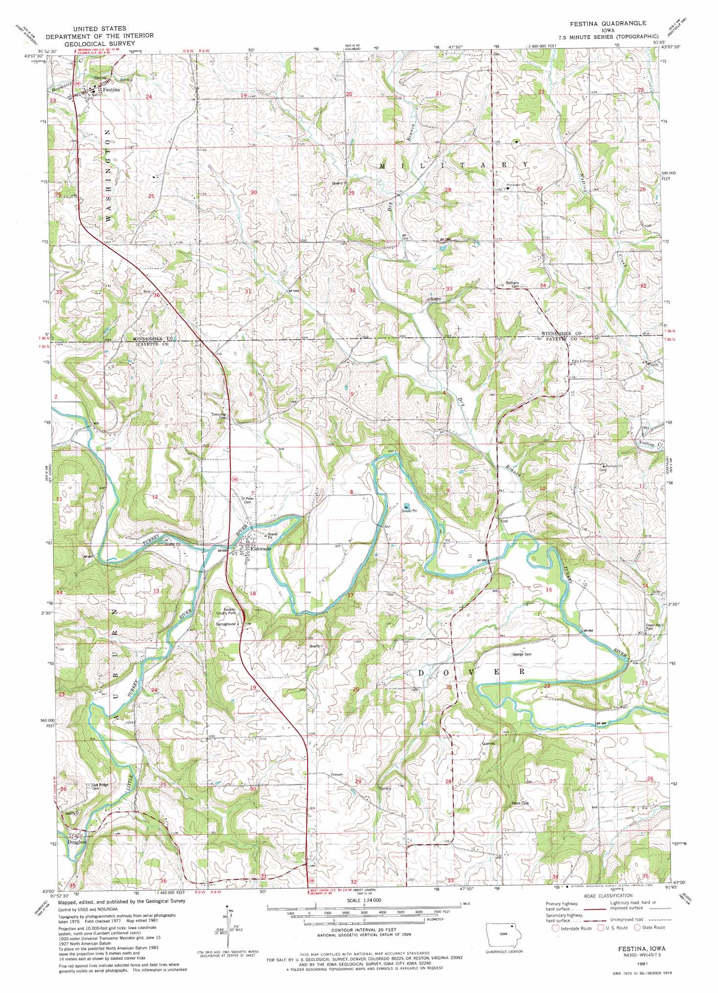
Festina Topo Map Iowa
To zoom in, hover over the map of Festina
USGS Topo Quad 43091a7 - 1:24,000 scale
| Topo Map Name: | Festina |
| USGS Topo Quad ID: | 43091a7 |
| Print Size: | ca. 21 1/4" wide x 27" high |
| Southeast Coordinates: | 43° N latitude / 91.75° W longitude |
| Map Center Coordinates: | 43.0625° N latitude / 91.8125° W longitude |
| U.S. State: | IA |
| Filename: | o43091a7.jpg |
| Download Map JPG Image: | Festina topo map 1:24,000 scale |
| Map Type: | Topographic |
| Topo Series: | 7.5´ |
| Map Scale: | 1:24,000 |
| Source of Map Images: | United States Geological Survey (USGS) |
| Alternate Map Versions: |
Festina IA 1981, updated 1982 Download PDF Buy paper map Festina IA 2010 Download PDF Buy paper map Festina IA 2013 Download PDF Buy paper map Festina IA 2015 Download PDF Buy paper map |
1:24,000 Topo Quads surrounding Festina
Cresco Se |
Ridgeway |
Decorah |
Freeport |
Hanover |
Protivin |
Fort Atkinson |
Calmar |
Postville Nw |
Frankville |
Waucoma |
Saint Lucas |
Festina |
Castalia |
Postville |
Alpha |
Hawkeye |
West Union |
Elgin |
Gunder |
Sumner |
Maynard |
Fayette |
Wadena |
Volga |
> Back to 43091a1 at 1:100,000 scale
> Back to 43090a1 at 1:250,000 scale
> Back to U.S. Topo Maps home
Festina topo map: Gazetteer
Festina: Bridges
Eldorado Bridge elevation 280m 918′W42 Bridge elevation 270m 885′
Festina: Parks
Dover Number Six Park elevation 287m 941′Goeken County Park elevation 362m 1187′
Festina: Populated Places
Douglass elevation 296m 971′Eldorado elevation 285m 935′
Festina elevation 334m 1095′
Festina: Post Offices
Douglass Post Office (historical) elevation 296m 971′Eldorado Post Office (historical) elevation 286m 938′
Festina Post Office elevation 334m 1095′
Gamble Grove Post Office (historical) elevation 303m 994′
Festina: Streams
Dry Branch elevation 270m 885′Little Turkey River elevation 280m 918′
Festina digital topo map on disk
Buy this Festina topo map showing relief, roads, GPS coordinates and other geographical features, as a high-resolution digital map file on DVD: