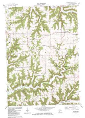
Retreat Topo Map Wisconsin
To zoom in, hover over the map of Retreat
USGS Topo Quad 43091d1 - 1:24,000 scale
| Topo Map Name: | Retreat |
| USGS Topo Quad ID: | 43091d1 |
| Print Size: | ca. 21 1/4" wide x 27" high |
| Southeast Coordinates: | 43.375° N latitude / 91° W longitude |
| Map Center Coordinates: | 43.4375° N latitude / 91.0625° W longitude |
| U.S. State: | WI |
| Filename: | o43091d1.jpg |
| Download Map JPG Image: | Retreat topo map 1:24,000 scale |
| Map Type: | Topographic |
| Topo Series: | 7.5´ |
| Map Scale: | 1:24,000 |
| Source of Map Images: | United States Geological Survey (USGS) |
| Alternate Map Versions: |
Retreat WI 1983, updated 1983 Download PDF Buy paper map Retreat WI 2010 Download PDF Buy paper map Retreat WI 2013 Download PDF Buy paper map Retreat WI 2015 Download PDF Buy paper map |
1:24,000 Topo Quads surrounding Retreat
> Back to 43091a1 at 1:100,000 scale
> Back to 43090a1 at 1:250,000 scale
> Back to U.S. Topo Maps home
Retreat topo map: Gazetteer
Retreat: Dams
Bad Axe 24 D 2592.1 Dam elevation 261m 856′Retreat: Populated Places
Reed elevation 223m 731′Retreat elevation 390m 1279′
West Prairie elevation 367m 1204′
Retreat: Reservoirs
2 Reservoir elevation 261m 856′Retreat: Ridges
Anderson Ridge elevation 349m 1145′Bishop Ridge elevation 336m 1102′
Brown Ridge elevation 351m 1151′
Fortney Ridge elevation 354m 1161′
Nash Ridge elevation 343m 1125′
Tewalt Ridge elevation 335m 1099′
Retreat: Streams
Bull Run elevation 239m 784′Hornby Creek elevation 226m 741′
Retreat: Valleys
Bean Hollow elevation 232m 761′Bohland Hollow elevation 227m 744′
Bristow Hollow elevation 234m 767′
Cooley Valley elevation 201m 659′
Hornby Hollow elevation 228m 748′
Retreat digital topo map on disk
Buy this Retreat topo map showing relief, roads, GPS coordinates and other geographical features, as a high-resolution digital map file on DVD:


