New Albin Topo Map Iowa
To zoom in, hover over the map of New Albin
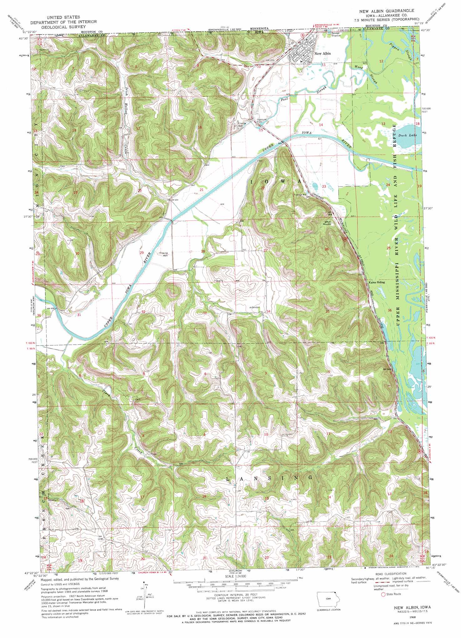
USGS Topo Quad 43091d3 - 1:24,000 scale
| Topo Map Name: | New Albin |
| USGS Topo Quad ID: | 43091d3 |
| Print Size: | ca. 21 1/4" wide x 27" high |
| Southeast Coordinates: | 43.375° N latitude / 91.25° W longitude |
| Map Center Coordinates: | 43.4375° N latitude / 91.3125° W longitude |
| U.S. State: | IA |
| Filename: | o43091d3.jpg |
| Download Map JPG Image: | New Albin topo map 1:24,000 scale |
| Map Type: | Topographic |
| Topo Series: | 7.5´ |
| Map Scale: | 1:24,000 |
| Source of Map Images: | United States Geological Survey (USGS) |
| Alternate Map Versions: |
New Albin IA 1968, updated 1970 Download PDF Buy paper map New Albin IA 1968, updated 1970 Download PDF Buy paper map New Albin IA 2010 Download PDF Buy paper map New Albin IA 2013 Download PDF Buy paper map New Albin IA 2015 Download PDF Buy paper map |
1:24,000 Topo Quads surrounding New Albin
Sheldon |
Caledonia |
Brownsville |
Stoddard |
Coon Valley |
Wilmington |
Eitzen |
Reno |
Genoa |
Newton |
Dorchester |
Waukon Nw |
New Albin |
De Soto |
Retreat |
Hanover |
Waukon |
Church |
Lansing |
Ferryville |
Frankville |
Rossville |
Waterville |
Harpers Ferry |
Eastman |
> Back to 43091a1 at 1:100,000 scale
> Back to 43090a1 at 1:250,000 scale
> Back to U.S. Topo Maps home
New Albin topo map: Gazetteer
New Albin: Areas
New Albin Big Lake Public Hunting Area elevation 190m 623′New Albin: Guts
Pool Slough elevation 194m 636′Wood Slough elevation 192m 629′
New Albin: Lakes
Duck Lake elevation 189m 620′New Albin: Parks
Blackhawk Point Wildlife Management Area elevation 260m 853′Fish Farms Mounds Wildlife Area elevation 307m 1007′
Hayes Lake Roadside Park elevation 195m 639′
Kains Lake Wildlife Management Area elevation 195m 639′
Lansing Wildlife Management Area elevation 269m 882′
New Albin Big Lake Wildlife Management Area elevation 190m 623′
Pool Slough Wildlife Management Area elevation 193m 633′
New Albin: Populated Places
New Albin elevation 198m 649′New Albin: Post Offices
New Albin Post Office elevation 198m 649′New Albin: Streams
Clark Creek elevation 197m 646′Irish Hollow Creek elevation 190m 623′
New Albin digital topo map on disk
Buy this New Albin topo map showing relief, roads, GPS coordinates and other geographical features, as a high-resolution digital map file on DVD: