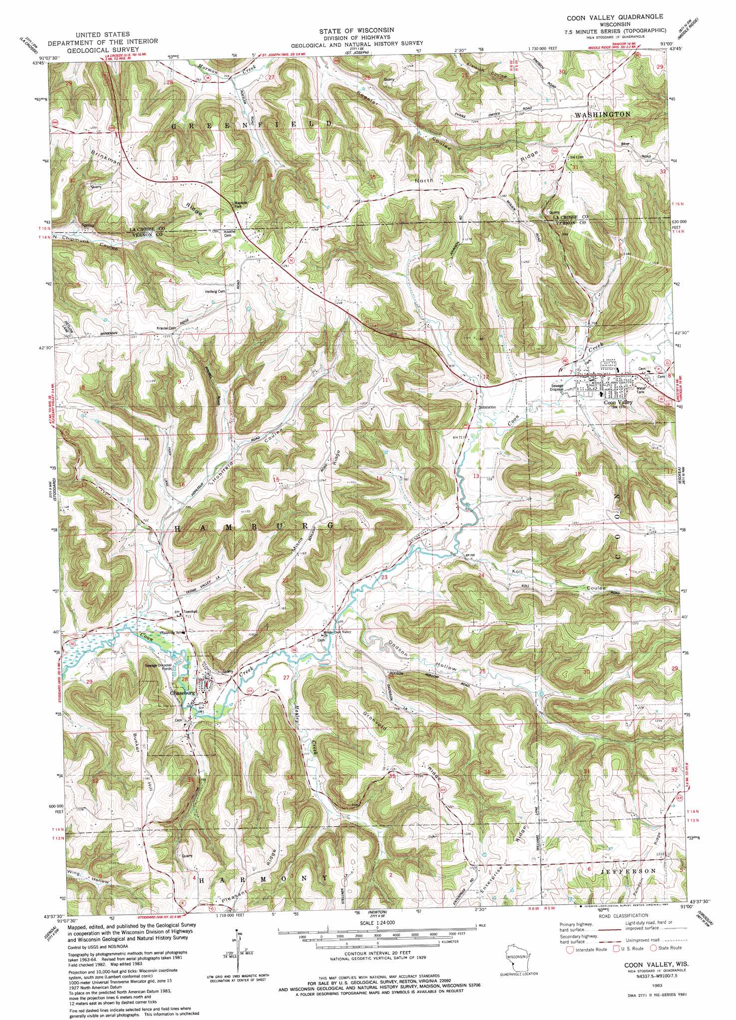
Coon Valley Topo Map Wisconsin
To zoom in, hover over the map of Coon Valley
USGS Topo Quad 43091f1 - 1:24,000 scale
| Topo Map Name: | Coon Valley |
| USGS Topo Quad ID: | 43091f1 |
| Print Size: | ca. 21 1/4" wide x 27" high |
| Southeast Coordinates: | 43.625° N latitude / 91° W longitude |
| Map Center Coordinates: | 43.6875° N latitude / 91.0625° W longitude |
| U.S. State: | WI |
| Filename: | o43091f1.jpg |
| Download Map JPG Image: | Coon Valley topo map 1:24,000 scale |
| Map Type: | Topographic |
| Topo Series: | 7.5´ |
| Map Scale: | 1:24,000 |
| Source of Map Images: | United States Geological Survey (USGS) |
| Alternate Map Versions: |
Coon Valley WI 1983, updated 1983 Download PDF Buy paper map Coon Valley WI 2010 Download PDF Buy paper map Coon Valley WI 2013 Download PDF Buy paper map Coon Valley WI 2015 Download PDF Buy paper map |
1:24,000 Topo Quads surrounding Coon Valley
Holmen |
Onalaska |
West Salem |
Bangor |
Sparta |
La Crescent |
La Crosse |
Saint Joseph |
Middle Ridge |
Melvina |
Brownsville |
Stoddard |
Coon Valley |
Esofea |
Westby |
Reno |
Genoa |
Newton |
Viroqua |
Avalanche |
New Albin |
De Soto |
Retreat |
Rising Sun |
Readstown |
> Back to 43091e1 at 1:100,000 scale
> Back to 43090a1 at 1:250,000 scale
> Back to U.S. Topo Maps home
Coon Valley topo map: Gazetteer
Coon Valley: Populated Places
Chaseburg elevation 216m 708′Coon Valley elevation 225m 738′
Coon Valley: Ridges
Brinkman Ridge elevation 379m 1243′Enterprise Ridge elevation 381m 1250′
Gronvold Ridge elevation 368m 1207′
Misna Ridge elevation 373m 1223′
North Ridge elevation 398m 1305′
Pumpkin Ridge elevation 382m 1253′
Coon Valley: Streams
Hasley Creek elevation 209m 685′Coon Valley: Summits
Bunker Hill elevation 356m 1167′Coon Valley: Valleys
Dodson Hollow elevation 212m 695′Hohlfeld Coulee elevation 203m 666′
Koll Coulee elevation 216m 708′
Roesler Coulee elevation 245m 803′
Coon Valley digital topo map on disk
Buy this Coon Valley topo map showing relief, roads, GPS coordinates and other geographical features, as a high-resolution digital map file on DVD: