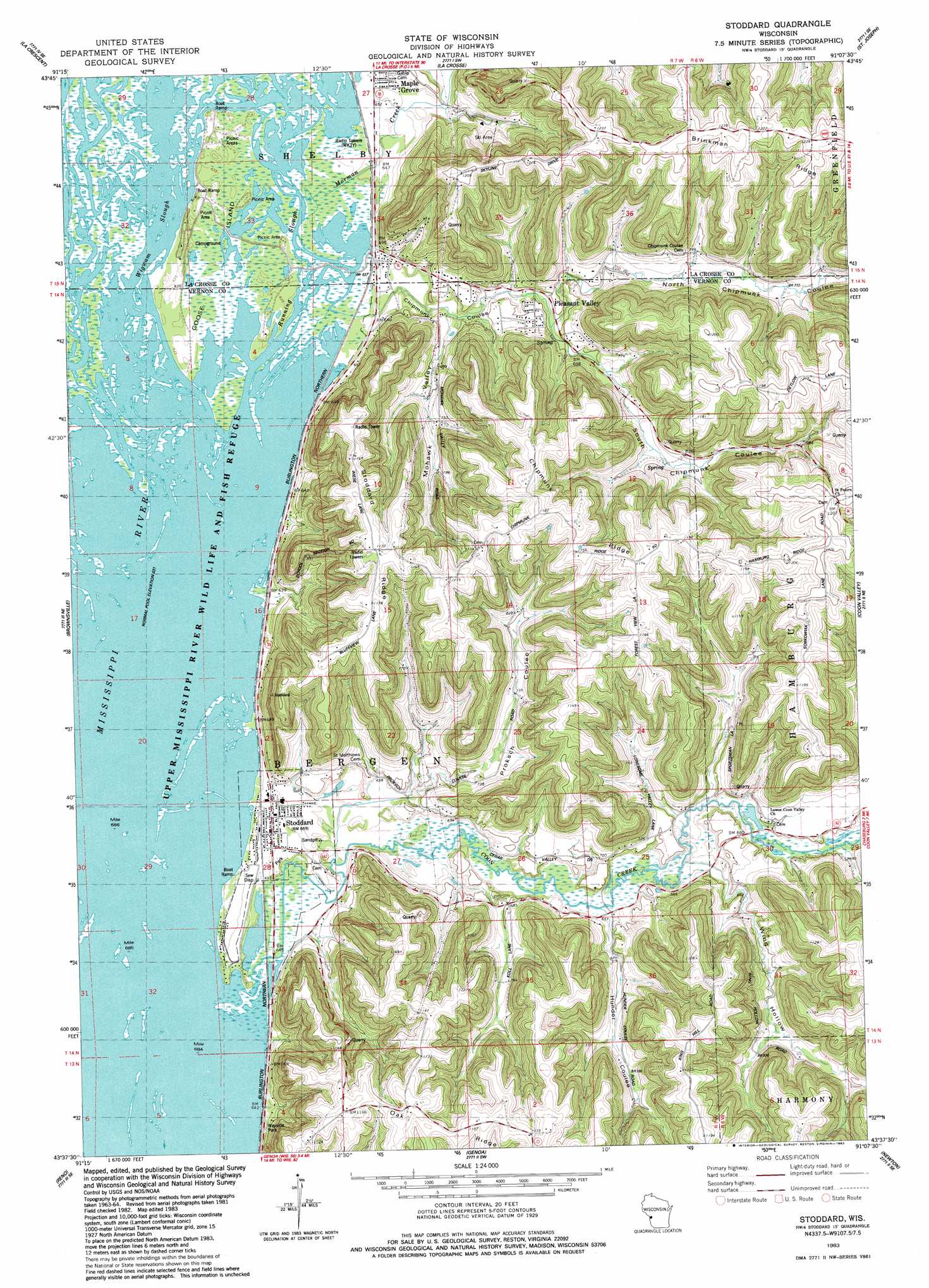
Stoddard Topo Map Wisconsin
To zoom in, hover over the map of Stoddard
USGS Topo Quad 43091f2 - 1:24,000 scale
| Topo Map Name: | Stoddard |
| USGS Topo Quad ID: | 43091f2 |
| Print Size: | ca. 21 1/4" wide x 27" high |
| Southeast Coordinates: | 43.625° N latitude / 91.125° W longitude |
| Map Center Coordinates: | 43.6875° N latitude / 91.1875° W longitude |
| U.S. State: | WI |
| Filename: | o43091f2.jpg |
| Download Map JPG Image: | Stoddard topo map 1:24,000 scale |
| Map Type: | Topographic |
| Topo Series: | 7.5´ |
| Map Scale: | 1:24,000 |
| Source of Map Images: | United States Geological Survey (USGS) |
| Alternate Map Versions: |
Stoddard WI 1983, updated 1983 Download PDF Buy paper map Stoddard WI 2010 Download PDF Buy paper map Stoddard WI 2013 Download PDF Buy paper map Stoddard WI 2015 Download PDF Buy paper map |
1:24,000 Topo Quads surrounding Stoddard
Pickwick |
Holmen |
Onalaska |
West Salem |
Bangor |
Mound Prairie |
La Crescent |
La Crosse |
Saint Joseph |
Middle Ridge |
Caledonia |
Brownsville |
Stoddard |
Coon Valley |
Esofea |
Eitzen |
Reno |
Genoa |
Newton |
Viroqua |
Waukon Nw |
New Albin |
De Soto |
Retreat |
Rising Sun |
> Back to 43091e1 at 1:100,000 scale
> Back to 43090a1 at 1:250,000 scale
> Back to U.S. Topo Maps home
Stoddard topo map: Gazetteer
Stoddard: Guts
Running Slough elevation 193m 633′Wigwam Slough elevation 192m 629′
Stoddard: Islands
Goose Island elevation 193m 633′Stoddard: Parks
Bergen Bluff State Natural Area elevation 253m 830′Stoddard: Populated Places
Maple Grove elevation 201m 659′Pleasant Valley elevation 214m 702′
Stoddard elevation 201m 659′
Stoddard: Ridges
Chipmunk Ridge elevation 362m 1187′Oak Ridge elevation 350m 1148′
Stoddard Ridge elevation 352m 1154′
Stoddard: Streams
Coon Creek elevation 192m 629′Mormon Creek elevation 193m 633′
Stoddard: Valleys
Chipmunk Coulee elevation 195m 639′Hunder Coulee elevation 216m 708′
Mohawk Valley elevation 201m 659′
North Chipmunk Coulee elevation 206m 675′
Proksch Coulee elevation 214m 702′
South Chipmunk Coulee elevation 221m 725′
Wing Hollow elevation 221m 725′
Stoddard digital topo map on disk
Buy this Stoddard topo map showing relief, roads, GPS coordinates and other geographical features, as a high-resolution digital map file on DVD: