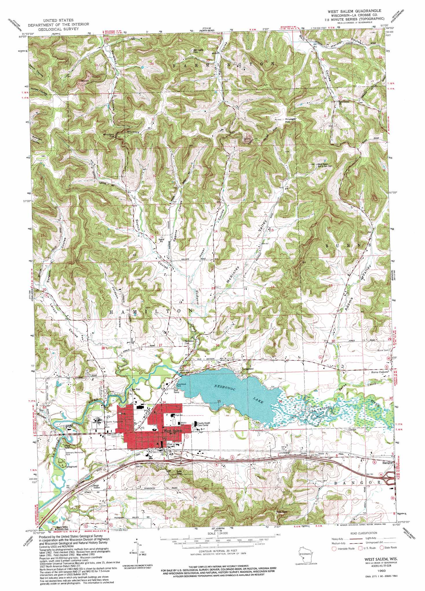
West Salem Topo Map Wisconsin
To zoom in, hover over the map of West Salem
USGS Topo Quad 43091h1 - 1:24,000 scale
| Topo Map Name: | West Salem |
| USGS Topo Quad ID: | 43091h1 |
| Print Size: | ca. 21 1/4" wide x 27" high |
| Southeast Coordinates: | 43.875° N latitude / 91° W longitude |
| Map Center Coordinates: | 43.9375° N latitude / 91.0625° W longitude |
| U.S. State: | WI |
| Filename: | o43091h1.jpg |
| Download Map JPG Image: | West Salem topo map 1:24,000 scale |
| Map Type: | Topographic |
| Topo Series: | 7.5´ |
| Map Scale: | 1:24,000 |
| Source of Map Images: | United States Geological Survey (USGS) |
| Alternate Map Versions: |
West Salem WI 1963, updated 1964 Download PDF Buy paper map West Salem WI 1963, updated 1975 Download PDF Buy paper map West Salem WI 1993, updated 1993 Download PDF Buy paper map West Salem WI 2010 Download PDF Buy paper map West Salem WI 2013 Download PDF Buy paper map West Salem WI 2015 Download PDF Buy paper map |
1:24,000 Topo Quads surrounding West Salem
Ettrick |
Hegg |
North Bend Ne |
Melrose |
Shamrock |
Galesville |
Stevenstown |
North Bend |
Four Corners |
Cataract |
Holmen |
Onalaska |
West Salem |
Bangor |
Sparta |
La Crescent |
La Crosse |
Saint Joseph |
Middle Ridge |
Melvina |
Brownsville |
Stoddard |
Coon Valley |
Esofea |
Westby |
> Back to 43091e1 at 1:100,000 scale
> Back to 43090a1 at 1:250,000 scale
> Back to U.S. Topo Maps home
West Salem topo map: Gazetteer
West Salem: Dams
Neshonoc 2WP44239 Dam elevation 212m 695′West Salem: Gaps
Mindoro Cut elevation 375m 1230′West Salem: Parks
Swarthout Park elevation 220m 721′West Salem: Populated Places
West Salem elevation 226m 741′West Salem: Post Offices
West Salem Post Office elevation 226m 741′West Salem: Reservoirs
Neshonoc Lake elevation 212m 695′Neshonoc Lake 390 elevation 214m 702′
West Salem: Streams
Burns Creek elevation 213m 698′Neshonoc Creek elevation 211m 692′
West Salem: Summits
Krueger Hill elevation 414m 1358′West Salem: Valleys
Adams Valley elevation 222m 728′Bergum Coulee elevation 237m 777′
Eggens Coulee elevation 226m 741′
Gill Coulee elevation 208m 682′
Herman Coulee elevation 260m 853′
Hoyer Coulee elevation 225m 738′
Jordson Coulee elevation 226m 741′
Larson Coulee elevation 210m 688′
McKinley Valley elevation 217m 711′
Scotch Coulee elevation 220m 721′
West Salem digital topo map on disk
Buy this West Salem topo map showing relief, roads, GPS coordinates and other geographical features, as a high-resolution digital map file on DVD: