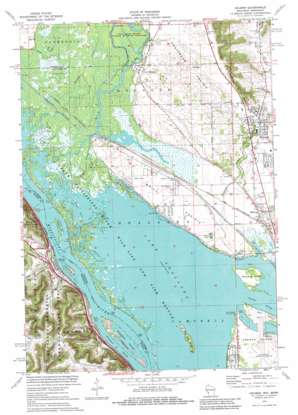
Holmen Topo Map Wisconsin
To zoom in, hover over the map of Holmen
USGS Topo Quad 43091h3 - 1:24,000 scale
| Topo Map Name: | Holmen |
| USGS Topo Quad ID: | 43091h3 |
| Print Size: | ca. 21 1/4" wide x 27" high |
| Southeast Coordinates: | 43.875° N latitude / 91.25° W longitude |
| Map Center Coordinates: | 43.9375° N latitude / 91.3125° W longitude |
| U.S. States: | WI, MN |
| Filename: | o43091h3.jpg |
| Download Map JPG Image: | Holmen topo map 1:24,000 scale |
| Map Type: | Topographic |
| Topo Series: | 7.5´ |
| Map Scale: | 1:24,000 |
| Source of Map Images: | United States Geological Survey (USGS) |
| Alternate Map Versions: |
Holmen WI 1973, updated 1976 Download PDF Buy paper map Holmen WI 2010 Download PDF Buy paper map Holmen WI 2013 Download PDF Buy paper map Holmen WI 2015 Download PDF Buy paper map |
1:24,000 Topo Quads surrounding Holmen
> Back to 43091e1 at 1:100,000 scale
> Back to 43090a1 at 1:250,000 scale
> Back to U.S. Topo Maps home
Holmen topo map: Gazetteer
Holmen: Airports
La Crosse Municipal Airport elevation 199m 652′Holmen: Channels
Dresbach Slough elevation 194m 636′Holmen: Crossings
Interchange 270 elevation 205m 672′Interchange 272 elevation 219m 718′
Holmen: Dams
South Wind Orchard Dam elevation 229m 751′Holmen: Flats
Amsterdam Prairie elevation 219m 718′Brice Prairie elevation 202m 662′
Holmen: Guts
Gibbs Chute elevation 194m 636′Holmen: Islands
Bell Island elevation 200m 656′Dresbach Island elevation 195m 639′
Island Number Ninety-one elevation 195m 639′
Red Oak Ridge elevation 199m 652′
Rosebud Island elevation 197m 646′
Holmen: Parks
Long Coulee Park elevation 233m 764′Louis Nelson County Park elevation 195m 639′
Midway Railroad Prairie State Natural Area elevation 209m 685′
Holmen: Populated Places
Brice Prairie elevation 203m 666′Dakota elevation 208m 682′
Dresbach elevation 208m 682′
Holmen elevation 215m 705′
Lakeview (historical) elevation 197m 646′
Midway elevation 201m 659′
New Amsterdam elevation 209m 685′
Sunset Point (historical) elevation 196m 643′
Holmen: Post Offices
Dakota Post Office elevation 207m 679′Dresbach Post Office (historical) elevation 208m 682′
Holmen: Reservoirs
South Wind Orchard Reservoir elevation 229m 751′Holmen: Streams
Dakota Creek elevation 194m 636′Dodge Chute elevation 195m 639′
Halfway Creek elevation 194m 636′
Hammond Chute elevation 195m 639′
New Channel elevation 197m 646′
Shingle Creek elevation 195m 639′
The Bullet Chute elevation 194m 636′
Holmen: Valleys
Moe Coulee elevation 237m 777′Holmen digital topo map on disk
Buy this Holmen topo map showing relief, roads, GPS coordinates and other geographical features, as a high-resolution digital map file on DVD:


