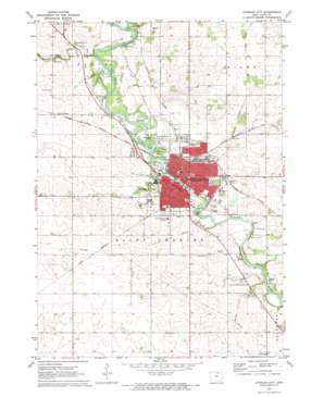
Charles City Topo Map Iowa
To zoom in, hover over the map of Charles City
USGS Topo Quad 43092a6 - 1:24,000 scale
| Topo Map Name: | Charles City |
| USGS Topo Quad ID: | 43092a6 |
| Print Size: | ca. 21 1/4" wide x 27" high |
| Southeast Coordinates: | 43° N latitude / 92.625° W longitude |
| Map Center Coordinates: | 43.0625° N latitude / 92.6875° W longitude |
| U.S. State: | IA |
| Filename: | o43092a6.jpg |
| Download Map JPG Image: | Charles City topo map 1:24,000 scale |
| Map Type: | Topographic |
| Topo Series: | 7.5´ |
| Map Scale: | 1:24,000 |
| Source of Map Images: | United States Geological Survey (USGS) |
| Alternate Map Versions: |
Charles City IA 1971, updated 1973 Download PDF Buy paper map Charles City IA 2010 Download PDF Buy paper map Charles City IA 2013 Download PDF Buy paper map Charles City IA 2015 Download PDF Buy paper map |
1:24,000 Topo Quads surrounding Charles City
> Back to 43092a1 at 1:100,000 scale
> Back to 43092a1 at 1:250,000 scale
> Back to U.S. Topo Maps home
Charles City topo map: Gazetteer
Charles City: Airports
Floyd County Memorial Hospital Heliport elevation 323m 1059′Charles City: Bridges
Brantingham Bridge elevation 299m 980′Suspension Bridge elevation 301m 987′
Charles City: Parks
Andres Memorial Park elevation 308m 1010′Bayou Bend Park elevation 302m 990′
Central Park elevation 306m 1003′
City Improvement Association Park elevation 304m 997′
Dana park elevation 308m 1010′
Flora Ellis Park elevation 308m 1010′
Garden Court Park elevation 306m 1003′
Gibson Park elevation 307m 1007′
Grace Larson Park elevation 303m 994′
Highland Park elevation 319m 1046′
Kate McLeod Park elevation 301m 987′
Lions Field elevation 307m 1007′
Memorial Park elevation 303m 994′
Merten J Klaus Park elevation 303m 994′
Mill Race Park elevation 305m 1000′
River Bend Wildlife Area elevation 302m 990′
Riverside Park elevation 305m 1000′
Rotary Wildlife Area elevation 304m 997′
Saint Marys Park elevation 299m 980′
Sherman Park elevation 303m 994′
Sportsmans Park elevation 307m 1007′
Sunset Park elevation 307m 1007′
Trowbridge Marsh elevation 302m 990′
Waverly Hill Park elevation 309m 1013′
Westwood Park elevation 304m 997′
Wildwood Park elevation 312m 1023′
Charles City: Populated Places
Charles City elevation 307m 1007′Doubleday elevation 331m 1085′
Floyd Crossing elevation 327m 1072′
Greenfield Park Mobile Home Court elevation 307m 1007′
Charles City: Post Offices
Charles City Post Office elevation 306m 1003′Ernie Post Office (historical) elevation 326m 1069′
Charles City: Streams
Bloody Run elevation 295m 967′Stewart Creek elevation 304m 997′
Charles City: Trails
Charles City Trail elevation 299m 980′Parcourse Fitness Trail elevation 299m 980′
Charles City digital topo map on disk
Buy this Charles City topo map showing relief, roads, GPS coordinates and other geographical features, as a high-resolution digital map file on DVD:


