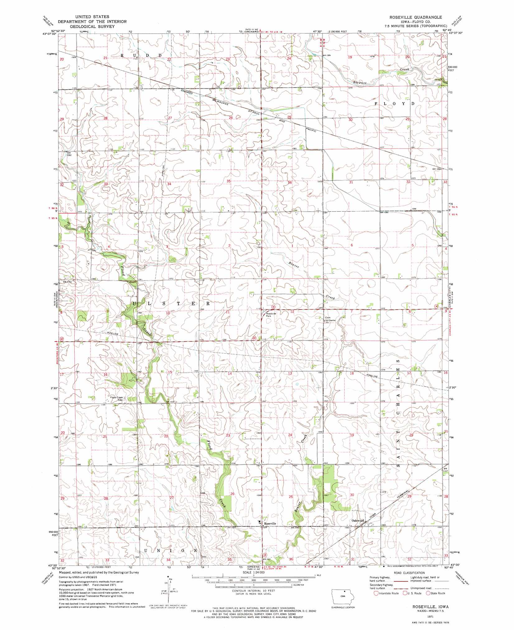
Roseville Topo Map Iowa
To zoom in, hover over the map of Roseville
USGS Topo Quad 43092a7 - 1:24,000 scale
| Topo Map Name: | Roseville |
| USGS Topo Quad ID: | 43092a7 |
| Print Size: | ca. 21 1/4" wide x 27" high |
| Southeast Coordinates: | 43° N latitude / 92.75° W longitude |
| Map Center Coordinates: | 43.0625° N latitude / 92.8125° W longitude |
| U.S. State: | IA |
| Filename: | o43092a7.jpg |
| Download Map JPG Image: | Roseville topo map 1:24,000 scale |
| Map Type: | Topographic |
| Topo Series: | 7.5´ |
| Map Scale: | 1:24,000 |
| Source of Map Images: | United States Geological Survey (USGS) |
| Alternate Map Versions: |
Roseville IA 1971, updated 1973 Download PDF Buy paper map Roseville IA 2010 Download PDF Buy paper map Roseville IA 2013 Download PDF Buy paper map Roseville IA 2015 Download PDF Buy paper map |
1:24,000 Topo Quads surrounding Roseville
Grafton |
Osage Sw |
Osage |
New Haven |
Riceville |
Nora Springs |
Rudd |
Orchard |
Floyd |
Colwell |
Mason City Se |
Rockford |
Roseville |
Charles City |
Bassett |
Dougherty |
Aureola |
Greene |
Nashua Nw |
Nashua |
Hansell |
Dumont North |
Allison |
Clarksville |
Plainfield |
> Back to 43092a1 at 1:100,000 scale
> Back to 43092a1 at 1:250,000 scale
> Back to U.S. Topo Maps home
Roseville topo map: Gazetteer
Roseville: Parks
Happy Acres elevation 312m 1023′Koebrick Wildlife Area elevation 308m 1010′
Roseville: Populated Places
Carney elevation 325m 1066′Oakwood elevation 321m 1053′
Roseville elevation 313m 1026′
Roseville: Post Offices
Carney Post Office (historical) elevation 325m 1066′Roseville Post Office (historical) elevation 313m 1026′
Ulster Post Office (historical) elevation 330m 1082′
Roseville digital topo map on disk
Buy this Roseville topo map showing relief, roads, GPS coordinates and other geographical features, as a high-resolution digital map file on DVD: