Floyd Topo Map Iowa
To zoom in, hover over the map of Floyd
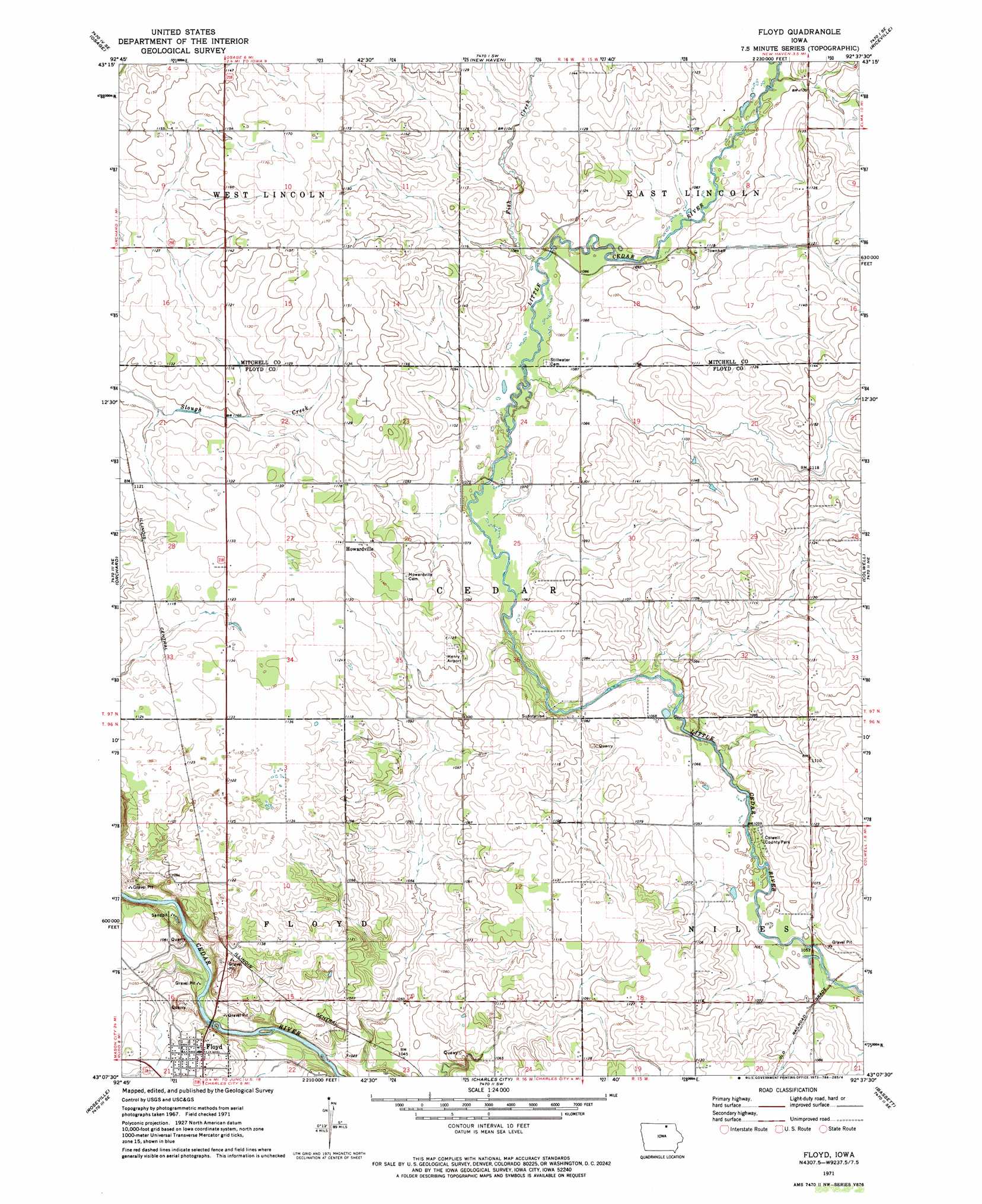
USGS Topo Quad 43092b6 - 1:24,000 scale
| Topo Map Name: | Floyd |
| USGS Topo Quad ID: | 43092b6 |
| Print Size: | ca. 21 1/4" wide x 27" high |
| Southeast Coordinates: | 43.125° N latitude / 92.625° W longitude |
| Map Center Coordinates: | 43.1875° N latitude / 92.6875° W longitude |
| U.S. State: | IA |
| Filename: | o43092b6.jpg |
| Download Map JPG Image: | Floyd topo map 1:24,000 scale |
| Map Type: | Topographic |
| Topo Series: | 7.5´ |
| Map Scale: | 1:24,000 |
| Source of Map Images: | United States Geological Survey (USGS) |
| Alternate Map Versions: |
Floyd IA 1971, updated 1973 Download PDF Buy paper map Floyd IA 2010 Download PDF Buy paper map Floyd IA 2013 Download PDF Buy paper map Floyd IA 2015 Download PDF Buy paper map |
1:24,000 Topo Quads surrounding Floyd
Saint Ansgar |
Stacyville |
Little Cedar |
Mcintire |
Lime Springs Nw |
Osage Sw |
Osage |
New Haven |
Riceville |
Saratoga |
Rudd |
Orchard |
Floyd |
Colwell |
Elma |
Rockford |
Roseville |
Charles City |
Bassett |
Ionia |
Aureola |
Greene |
Nashua Nw |
Nashua |
Tripoli Nw |
> Back to 43092a1 at 1:100,000 scale
> Back to 43092a1 at 1:250,000 scale
> Back to U.S. Topo Maps home
Floyd topo map: Gazetteer
Floyd: Airports
Henry Airport elevation 341m 1118′Floyd: Parks
Colwell County Park elevation 320m 1049′Floyd Park elevation 325m 1066′
Restoration Marsh elevation 347m 1138′
Slough Creek Park elevation 333m 1092′
Wentlands Woods elevation 336m 1102′
Floyd: Populated Places
Floyd elevation 325m 1066′Howardville elevation 347m 1138′
Floyd: Post Offices
Floyd Post Office elevation 325m 1066′Howardville Post Office (historical) elevation 347m 1138′
Nilesville Post Office (historical) elevation 320m 1049′
Stillwater Post Office (historical) elevation 338m 1108′
Floyd: Streams
Fish Creek elevation 329m 1079′Floyd digital topo map on disk
Buy this Floyd topo map showing relief, roads, GPS coordinates and other geographical features, as a high-resolution digital map file on DVD: