Little Cedar Topo Map Iowa
To zoom in, hover over the map of Little Cedar
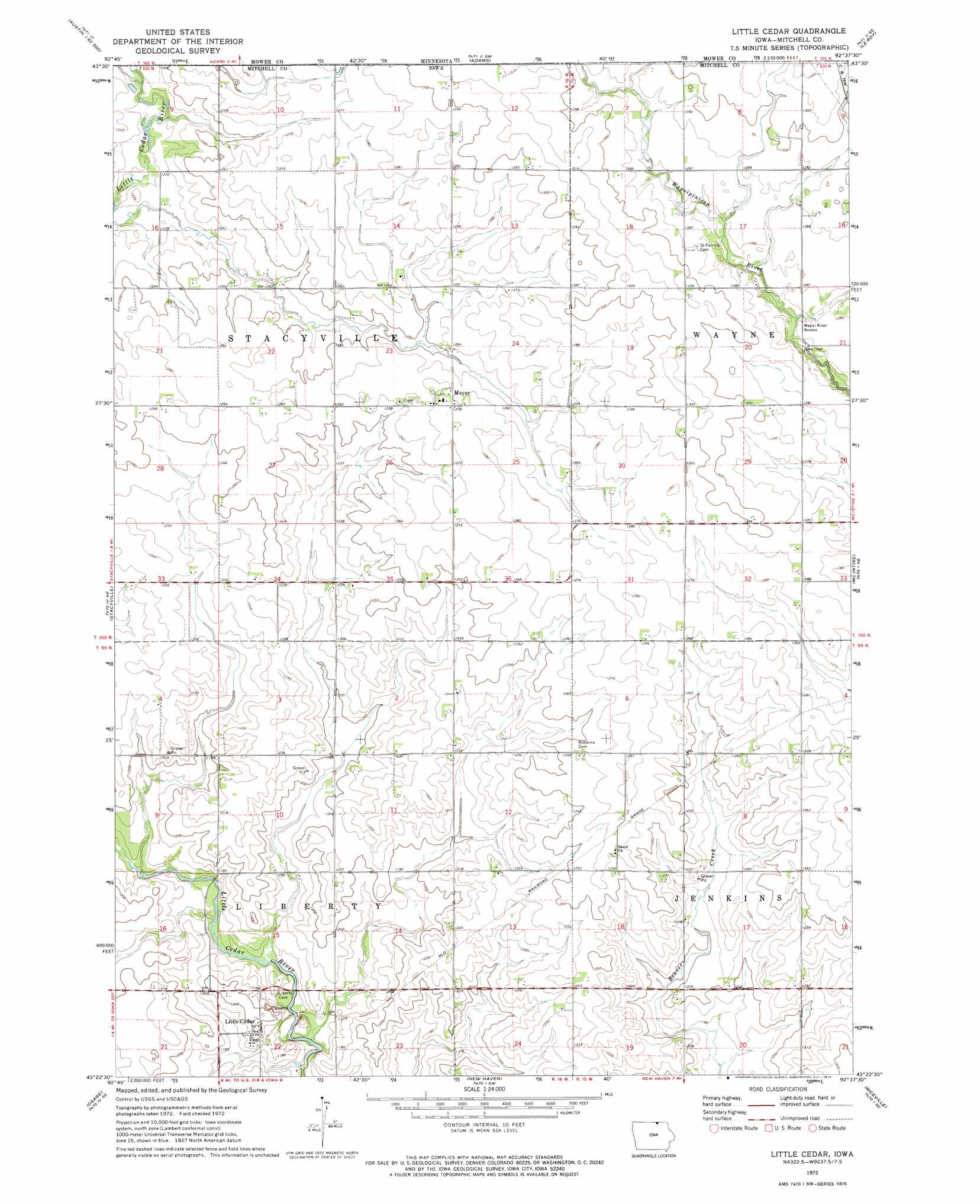
USGS Topo Quad 43092d6 - 1:24,000 scale
| Topo Map Name: | Little Cedar |
| USGS Topo Quad ID: | 43092d6 |
| Print Size: | ca. 21 1/4" wide x 27" high |
| Southeast Coordinates: | 43.375° N latitude / 92.625° W longitude |
| Map Center Coordinates: | 43.4375° N latitude / 92.6875° W longitude |
| U.S. State: | IA |
| Filename: | o43092d6.jpg |
| Download Map JPG Image: | Little Cedar topo map 1:24,000 scale |
| Map Type: | Topographic |
| Topo Series: | 7.5´ |
| Map Scale: | 1:24,000 |
| Source of Map Images: | United States Geological Survey (USGS) |
| Alternate Map Versions: |
Little Cedar IA 1972, updated 1974 Download PDF Buy paper map Little Cedar IA 2010 Download PDF Buy paper map Little Cedar IA 2013 Download PDF Buy paper map Little Cedar IA 2015 Download PDF Buy paper map |
1:24,000 Topo Quads surrounding Little Cedar
Austin East |
Brownsdale |
Dexter |
Grand Meadow |
Spring Valley |
Lyle |
Rose Creek |
Adams |
Le Roy |
Ostrander |
Saint Ansgar |
Stacyville |
Little Cedar |
Mcintire |
Lime Springs Nw |
Osage Sw |
Osage |
New Haven |
Riceville |
Saratoga |
Rudd |
Orchard |
Floyd |
Colwell |
Elma |
> Back to 43092a1 at 1:100,000 scale
> Back to 43092a1 at 1:250,000 scale
> Back to U.S. Topo Maps home
Little Cedar topo map: Gazetteer
Little Cedar: Bridges
Little Cedar River Bridge elevation 353m 1158′Little Cedar: Parks
Wapsi River Access elevation 382m 1253′Little Cedar: Populated Places
Little Cedar elevation 364m 1194′Meyer elevation 388m 1272′
Little Cedar: Post Offices
David Post Office (historical) elevation 386m 1266′Little Cedar Post Office (historical) elevation 359m 1177′
Meyer Post Office (historical) elevation 388m 1272′
Little Cedar digital topo map on disk
Buy this Little Cedar topo map showing relief, roads, GPS coordinates and other geographical features, as a high-resolution digital map file on DVD: