Lyle Topo Map Minnesota
To zoom in, hover over the map of Lyle
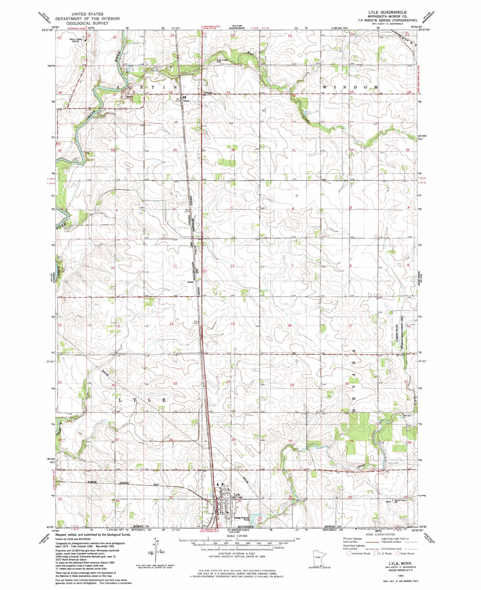
USGS Topo Quad 43092e8 - 1:24,000 scale
| Topo Map Name: | Lyle |
| USGS Topo Quad ID: | 43092e8 |
| Print Size: | ca. 21 1/4" wide x 27" high |
| Southeast Coordinates: | 43.5° N latitude / 92.875° W longitude |
| Map Center Coordinates: | 43.5625° N latitude / 92.9375° W longitude |
| U.S. State: | MN |
| Filename: | o43092e8.jpg |
| Download Map JPG Image: | Lyle topo map 1:24,000 scale |
| Map Type: | Topographic |
| Topo Series: | 7.5´ |
| Map Scale: | 1:24,000 |
| Source of Map Images: | United States Geological Survey (USGS) |
| Alternate Map Versions: |
Lyle MN 1982, updated 1983 Download PDF Buy paper map Lyle MN 2010 Download PDF Buy paper map Lyle MN 2013 Download PDF Buy paper map Lyle MN 2016 Download PDF Buy paper map |
1:24,000 Topo Quads surrounding Lyle
Hollandale |
Blooming Prairie |
Waltham |
Sargeant |
High Forest Sw |
Hayward |
Austin West |
Austin East |
Brownsdale |
Dexter |
Myrtle |
London |
Lyle |
Rose Creek |
Adams |
Northwood |
Carpenter |
Saint Ansgar |
Stacyville |
Little Cedar |
Manly |
Grafton |
Osage Sw |
Osage |
New Haven |
> Back to 43092e1 at 1:100,000 scale
> Back to 43092a1 at 1:250,000 scale
> Back to U.S. Topo Maps home
Lyle topo map: Gazetteer
Lyle: Parks
Larson State Wildlife Management Area elevation 371m 1217′Lyle: Populated Places
Lyle elevation 368m 1207′Ransom Trailer Court elevation 368m 1207′
Varco elevation 366m 1200′
Lyle: Post Offices
Lyle Post Office elevation 367m 1204′Varco Post Office (historical) elevation 366m 1200′
Lyle: Streams
Rose Creek elevation 355m 1164′Lyle digital topo map on disk
Buy this Lyle topo map showing relief, roads, GPS coordinates and other geographical features, as a high-resolution digital map file on DVD: