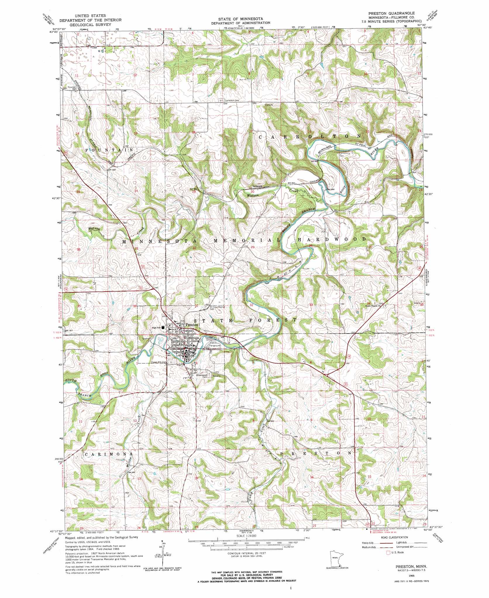
Preston Topo Map Minnesota
To zoom in, hover over the map of Preston
USGS Topo Quad 43092f1 - 1:24,000 scale
| Topo Map Name: | Preston |
| USGS Topo Quad ID: | 43092f1 |
| Print Size: | ca. 21 1/4" wide x 27" high |
| Southeast Coordinates: | 43.625° N latitude / 92° W longitude |
| Map Center Coordinates: | 43.6875° N latitude / 92.0625° W longitude |
| U.S. State: | MN |
| Filename: | o43092f1.jpg |
| Download Map JPG Image: | Preston topo map 1:24,000 scale |
| Map Type: | Topographic |
| Topo Series: | 7.5´ |
| Map Scale: | 1:24,000 |
| Source of Map Images: | United States Geological Survey (USGS) |
| Alternate Map Versions: |
Preston MN 1965, updated 1967 Download PDF Buy paper map Preston MN 2010 Download PDF Buy paper map Preston MN 2013 Download PDF Buy paper map Preston MN 2016 Download PDF Buy paper map |
1:24,000 Topo Quads surrounding Preston
Marion |
Eyota |
Saint Charles |
Utica |
Lewiston |
Washington |
Chatfield |
Pilot Mound |
Arendahl |
Rushford West |
Wykoff |
Fountain |
Preston |
Lanesboro |
Bratsberg |
Cherry Grove |
Greenleafton |
Harmony |
Canton |
Mabel |
Lime Springs |
Cresco Nw |
Cresco Ne |
Bluffton |
Burr Oak |
> Back to 43092e1 at 1:100,000 scale
> Back to 43092a1 at 1:250,000 scale
> Back to U.S. Topo Maps home
Preston topo map: Gazetteer
Preston: Airports
High Grove Airport elevation 364m 1194′Preston: Dams
East Willow Creek Dam elevation 349m 1145′Fillmore County Road 21 Dam elevation 311m 1020′
Ross Graves Dam elevation 337m 1105′
Preston: Parks
Preston Overlook elevation 288m 944′Preston: Populated Places
Isinours elevation 275m 902′New Horizons Mobile Home Park elevation 292m 958′
Preston elevation 292m 958′
Preston Mobile Home Park elevation 292m 958′
Preston: Post Offices
Isinours Post Office (historical) elevation 275m 902′Preston Post Office elevation 292m 958′
Preston: Streams
Camp Creek elevation 281m 921′Watson Creek elevation 269m 882′
Willow Creek elevation 288m 944′
Preston digital topo map on disk
Buy this Preston topo map showing relief, roads, GPS coordinates and other geographical features, as a high-resolution digital map file on DVD: