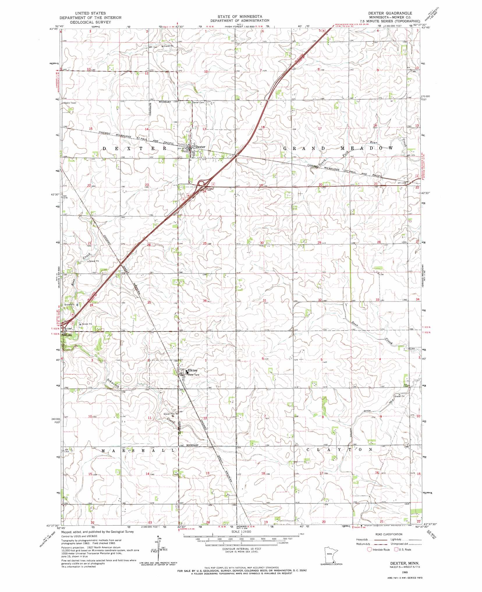
Dexter Topo Map Minnesota
To zoom in, hover over the map of Dexter
USGS Topo Quad 43092f6 - 1:24,000 scale
| Topo Map Name: | Dexter |
| USGS Topo Quad ID: | 43092f6 |
| Print Size: | ca. 21 1/4" wide x 27" high |
| Southeast Coordinates: | 43.625° N latitude / 92.625° W longitude |
| Map Center Coordinates: | 43.6875° N latitude / 92.6875° W longitude |
| U.S. State: | MN |
| Filename: | o43092f6.jpg |
| Download Map JPG Image: | Dexter topo map 1:24,000 scale |
| Map Type: | Topographic |
| Topo Series: | 7.5´ |
| Map Scale: | 1:24,000 |
| Source of Map Images: | United States Geological Survey (USGS) |
| Alternate Map Versions: |
Dexter MN 1965, updated 1966 Download PDF Buy paper map Dexter MN 2010 Download PDF Buy paper map Dexter MN 2013 Download PDF Buy paper map Dexter MN 2016 Download PDF Buy paper map |
1:24,000 Topo Quads surrounding Dexter
Hayfield Nw |
Hayfield |
Rock Dell |
Salem Corners |
Simpson |
Waltham |
Sargeant |
High Forest Sw |
High Forest |
Stewartville |
Austin East |
Brownsdale |
Dexter |
Grand Meadow |
Spring Valley |
Lyle |
Rose Creek |
Adams |
Le Roy |
Ostrander |
Saint Ansgar |
Stacyville |
Little Cedar |
Mcintire |
Lime Springs Nw |
> Back to 43092e1 at 1:100,000 scale
> Back to 43092a1 at 1:250,000 scale
> Back to U.S. Topo Maps home
Dexter topo map: Gazetteer
Dexter: Canals
County Ditch Number Eight elevation 418m 1371′Dexter: Crossings
Interchange 189 elevation 403m 1322′Interchange 193 elevation 433m 1420′
Dexter: Populated Places
Dexter elevation 433m 1420′Elkton elevation 425m 1394′
Pleasant Acres Mobile Home Park elevation 433m 1420′
Dexter: Post Offices
Dexter Post Office elevation 433m 1420′Elkton Post Office elevation 425m 1394′
Dexter digital topo map on disk
Buy this Dexter topo map showing relief, roads, GPS coordinates and other geographical features, as a high-resolution digital map file on DVD: