Waltham Topo Map Minnesota
To zoom in, hover over the map of Waltham
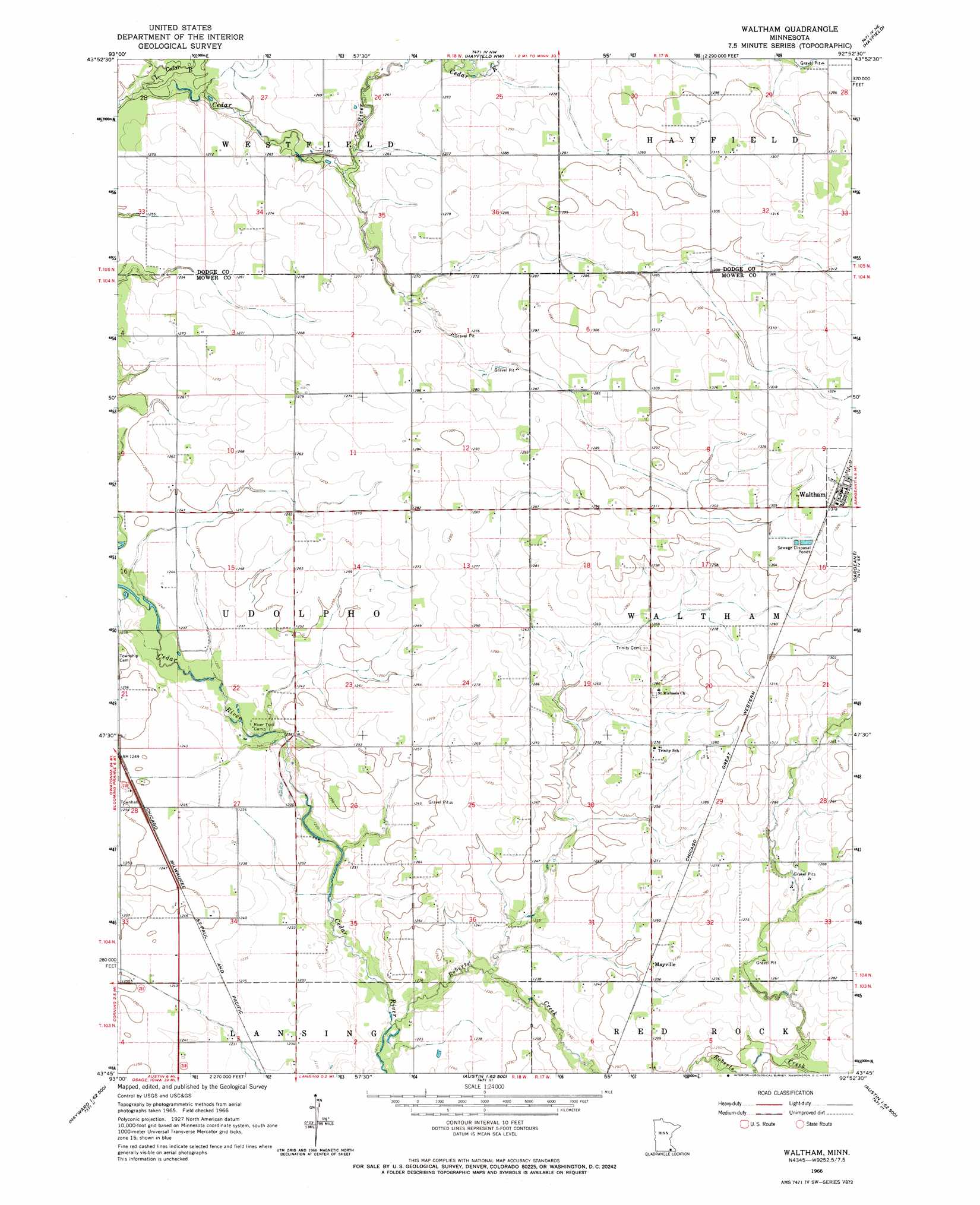
USGS Topo Quad 43092g8 - 1:24,000 scale
| Topo Map Name: | Waltham |
| USGS Topo Quad ID: | 43092g8 |
| Print Size: | ca. 21 1/4" wide x 27" high |
| Southeast Coordinates: | 43.75° N latitude / 92.875° W longitude |
| Map Center Coordinates: | 43.8125° N latitude / 92.9375° W longitude |
| U.S. State: | MN |
| Filename: | o43092g8.jpg |
| Download Map JPG Image: | Waltham topo map 1:24,000 scale |
| Map Type: | Topographic |
| Topo Series: | 7.5´ |
| Map Scale: | 1:24,000 |
| Source of Map Images: | United States Geological Survey (USGS) |
| Alternate Map Versions: |
Waltham MN 1966, updated 1967 Download PDF Buy paper map Waltham MN 2010 Download PDF Buy paper map Waltham MN 2013 Download PDF Buy paper map Waltham MN 2016 Download PDF Buy paper map |
1:24,000 Topo Quads surrounding Waltham
Owatonna |
Owatonna Se |
Claremont |
Dodge Center |
Byron |
Steele Center |
Bixby |
Hayfield Nw |
Hayfield |
Rock Dell |
Hollandale |
Blooming Prairie |
Waltham |
Sargeant |
High Forest Sw |
Hayward |
Austin West |
Austin East |
Brownsdale |
Dexter |
Myrtle |
London |
Lyle |
Rose Creek |
Adams |
> Back to 43092e1 at 1:100,000 scale
> Back to 43092a1 at 1:250,000 scale
> Back to U.S. Topo Maps home
Waltham topo map: Gazetteer
Waltham: Populated Places
Mayville elevation 384m 1259′Waltham elevation 403m 1322′
Waltham: Post Offices
Mayville Post Office (historical) elevation 384m 1259′Waltham Post Office elevation 403m 1322′
Waltham: Streams
Little Cedar River elevation 377m 1236′Roberts Creek elevation 367m 1204′
Waltham digital topo map on disk
Buy this Waltham topo map showing relief, roads, GPS coordinates and other geographical features, as a high-resolution digital map file on DVD: