Saint Charles Topo Map Minnesota
To zoom in, hover over the map of Saint Charles
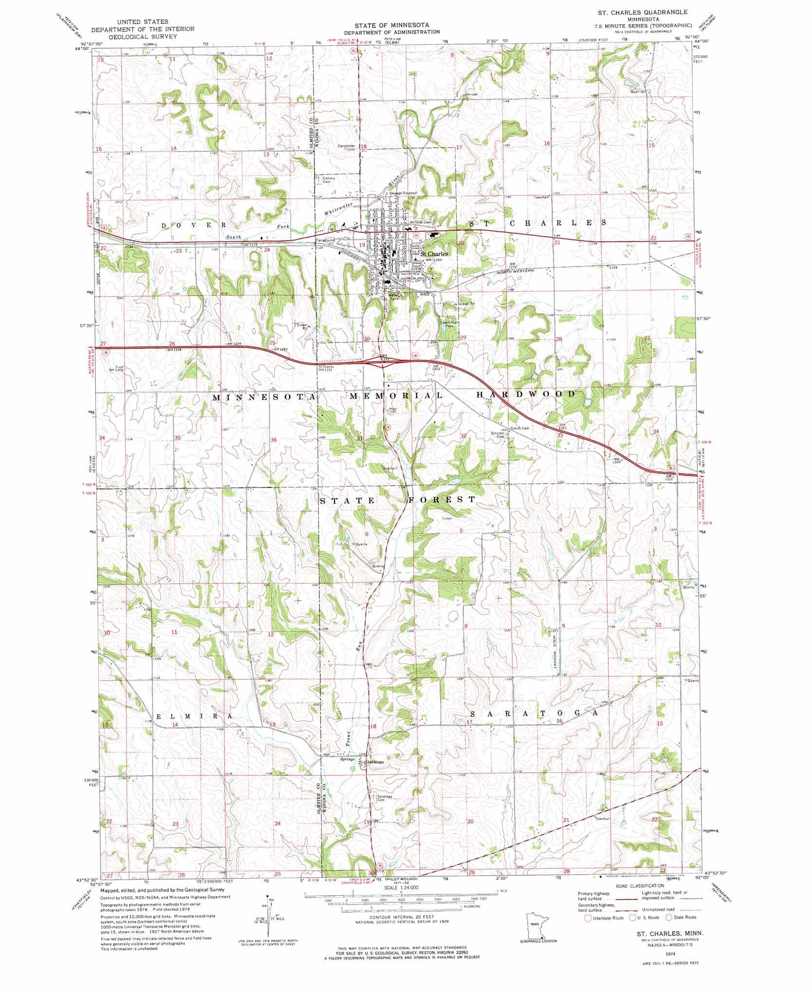
USGS Topo Quad 43092h1 - 1:24,000 scale
| Topo Map Name: | Saint Charles |
| USGS Topo Quad ID: | 43092h1 |
| Print Size: | ca. 21 1/4" wide x 27" high |
| Southeast Coordinates: | 43.875° N latitude / 92° W longitude |
| Map Center Coordinates: | 43.9375° N latitude / 92.0625° W longitude |
| U.S. State: | MN |
| Filename: | o43092h1.jpg |
| Download Map JPG Image: | Saint Charles topo map 1:24,000 scale |
| Map Type: | Topographic |
| Topo Series: | 7.5´ |
| Map Scale: | 1:24,000 |
| Source of Map Images: | United States Geological Survey (USGS) |
| Alternate Map Versions: |
St Charles MN 1974, updated 1976 Download PDF Buy paper map Saint Charles MN 2010 Download PDF Buy paper map Saint Charles MN 2013 Download PDF Buy paper map Saint Charles MN 2016 Download PDF Buy paper map |
1:24,000 Topo Quads surrounding Saint Charles
Millville |
Plainview |
Beaver |
Weaver |
Cochrane |
Chester |
Plainview Sw |
Elba |
Altura |
Rollingstone |
Marion |
Eyota |
Saint Charles |
Utica |
Lewiston |
Washington |
Chatfield |
Pilot Mound |
Arendahl |
Rushford West |
Wykoff |
Fountain |
Preston |
Lanesboro |
Bratsberg |
> Back to 43092e1 at 1:100,000 scale
> Back to 43092a1 at 1:250,000 scale
> Back to U.S. Topo Maps home
Saint Charles topo map: Gazetteer
Saint Charles: Crossings
Interchange 233 elevation 401m 1315′Saint Charles: Dams
Frank Hilke Detention Dam elevation 359m 1177′Jesson Park Dam elevation 374m 1227′
Pagel-Young Detention Number 1 Dam elevation 351m 1151′
Stanley Harcey Stabilizer Dam elevation 370m 1213′
Saint Charles: Parks
Sportsman Park elevation 379m 1243′Saint Charles: Populated Places
Saint Charles elevation 344m 1128′Saratoga elevation 327m 1072′
Saint Charles: Post Offices
Saint Charles Post Office elevation 346m 1135′Saratoga Post Office (historical) elevation 327m 1072′
Saint Charles: Reservoirs
Jessen Park Lake elevation 374m 1227′Saint Charles digital topo map on disk
Buy this Saint Charles topo map showing relief, roads, GPS coordinates and other geographical features, as a high-resolution digital map file on DVD: