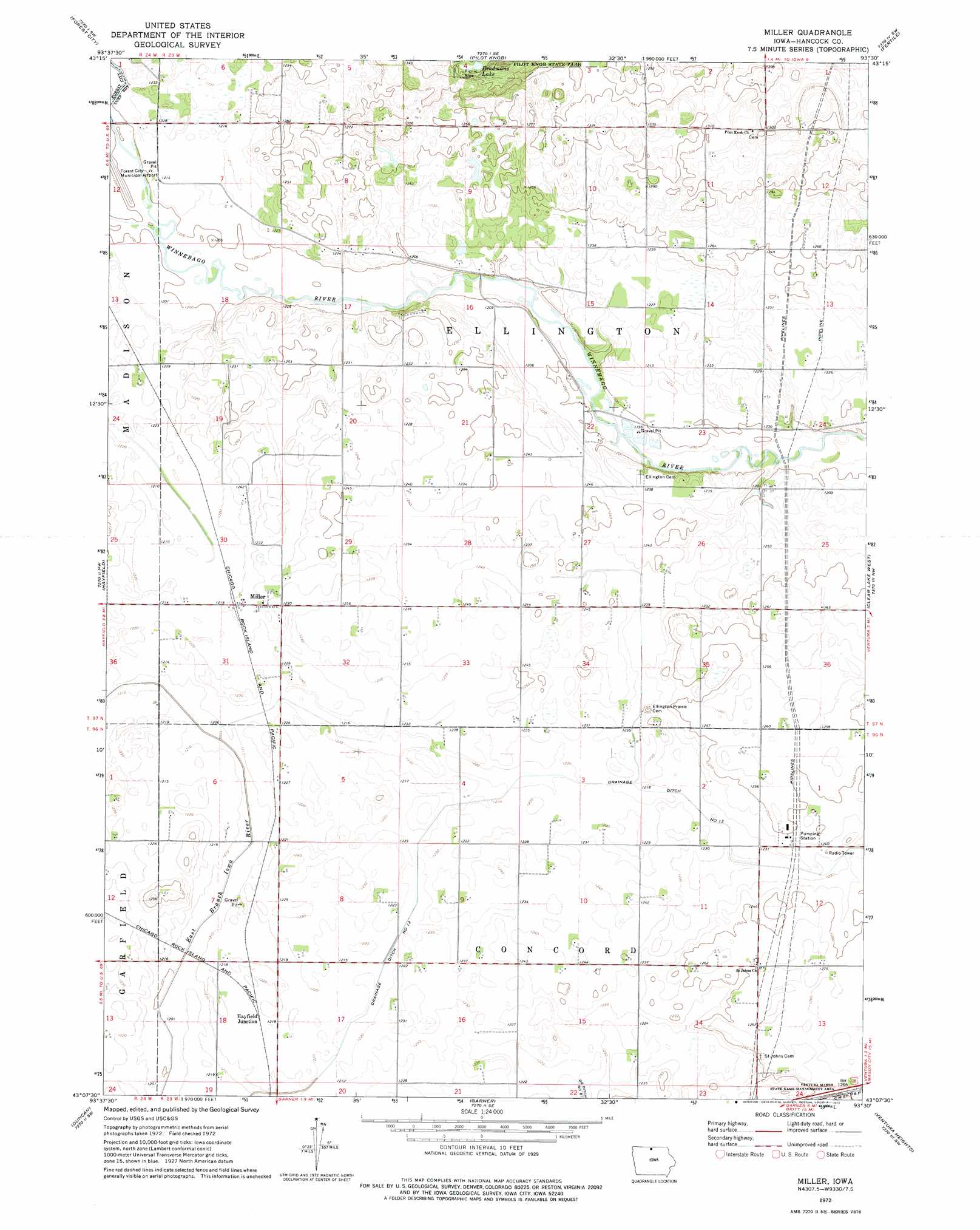
Miller Topo Map Iowa
To zoom in, hover over the map of Miller
USGS Topo Quad 43093b5 - 1:24,000 scale
| Topo Map Name: | Miller |
| USGS Topo Quad ID: | 43093b5 |
| Print Size: | ca. 21 1/4" wide x 27" high |
| Southeast Coordinates: | 43.125° N latitude / 93.5° W longitude |
| Map Center Coordinates: | 43.1875° N latitude / 93.5625° W longitude |
| U.S. State: | IA |
| Filename: | o43093b5.jpg |
| Download Map JPG Image: | Miller topo map 1:24,000 scale |
| Map Type: | Topographic |
| Topo Series: | 7.5´ |
| Map Scale: | 1:24,000 |
| Source of Map Images: | United States Geological Survey (USGS) |
| Alternate Map Versions: |
Miller IA 1972, updated 1975 Download PDF Buy paper map Miller IA 2010 Download PDF Buy paper map Miller IA 2013 Download PDF Buy paper map Miller IA 2015 Download PDF Buy paper map |
1:24,000 Topo Quads surrounding Miller
Buffalo Center Ne |
Vinje |
Lake Mills |
Bristol |
Fertile Ne |
Thompson |
Forest City |
Pilot Knob |
Fertile |
Fertile Se |
Crystal Lake |
Hayfield |
Miller |
Clear Lake West |
Clear Lake East |
Britt |
Duncan |
Garner |
Ventura Heights |
Burchinal |
Kanawha |
Olaf |
Goodell |
Thornton |
Swaledale |
> Back to 43093a1 at 1:100,000 scale
> Back to 43092a1 at 1:250,000 scale
> Back to U.S. Topo Maps home
Miller topo map: Gazetteer
Miller: Airports
Forest City Municipal Airport elevation 366m 1200′Miller: Canals
Drainage Ditch Number 13 elevation 369m 1210′Miller: Lakes
Deadmans Lake elevation 413m 1354′Miller: Parks
Gabrielson Wildlife Management Area elevation 380m 1246′Pilot Knob State Park elevation 417m 1368′
Torkleson Pits Wildlife Area elevation 364m 1194′
Miller: Populated Places
Hayfield Junction elevation 371m 1217′Miller elevation 374m 1227′
Miller: Post Offices
Elk Grove Post Office (historical) elevation 366m 1200′Ellington Post Office (historical) elevation 369m 1210′
Miller Post Office (historical) elevation 374m 1227′
Miller digital topo map on disk
Buy this Miller topo map showing relief, roads, GPS coordinates and other geographical features, as a high-resolution digital map file on DVD: