Grafton Topo Map Iowa
To zoom in, hover over the map of Grafton
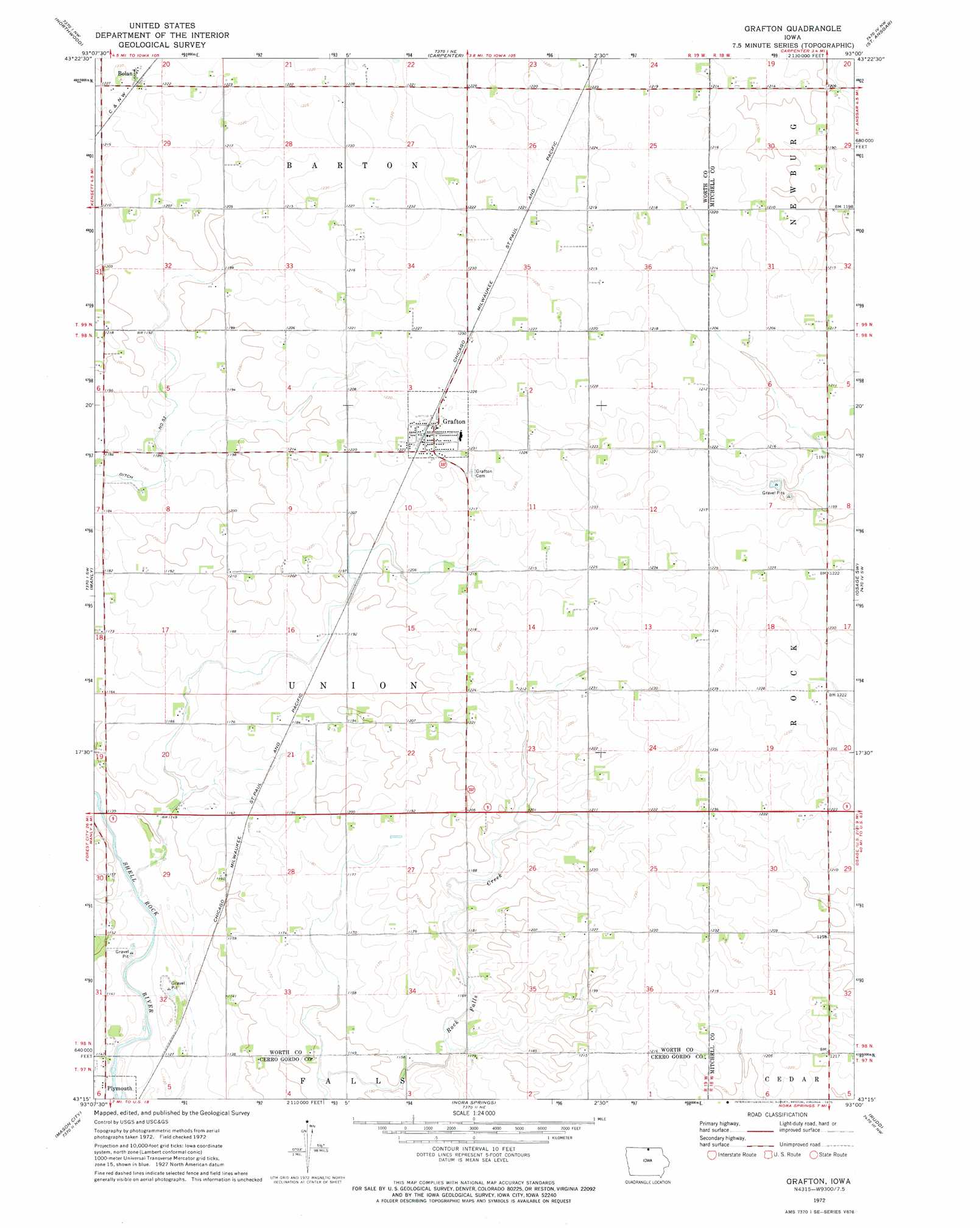
USGS Topo Quad 43093c1 - 1:24,000 scale
| Topo Map Name: | Grafton |
| USGS Topo Quad ID: | 43093c1 |
| Print Size: | ca. 21 1/4" wide x 27" high |
| Southeast Coordinates: | 43.25° N latitude / 93° W longitude |
| Map Center Coordinates: | 43.3125° N latitude / 93.0625° W longitude |
| U.S. State: | IA |
| Filename: | o43093c1.jpg |
| Download Map JPG Image: | Grafton topo map 1:24,000 scale |
| Map Type: | Topographic |
| Topo Series: | 7.5´ |
| Map Scale: | 1:24,000 |
| Source of Map Images: | United States Geological Survey (USGS) |
| Alternate Map Versions: |
Grafton IA 1972, updated 1975 Download PDF Buy paper map Grafton IA 2010 Download PDF Buy paper map Grafton IA 2013 Download PDF Buy paper map Grafton IA 2015 Download PDF Buy paper map |
1:24,000 Topo Quads surrounding Grafton
Glenville |
Myrtle |
London |
Lyle |
Rose Creek |
Fertile Ne |
Northwood |
Carpenter |
Saint Ansgar |
Stacyville |
Fertile Se |
Manly |
Grafton |
Osage Sw |
Osage |
Clear Lake East |
Mason City |
Nora Springs |
Rudd |
Orchard |
Burchinal |
Hanford |
Mason City Se |
Rockford |
Roseville |
> Back to 43093a1 at 1:100,000 scale
> Back to 43092a1 at 1:250,000 scale
> Back to U.S. Topo Maps home
Grafton topo map: Gazetteer
Grafton: Airports
Trettin-Cole Airport elevation 377m 1236′Grafton: Parks
Plymouth Pits Wildlife Area elevation 345m 1131′Shellrock Wildlife Area elevation 345m 1131′
Strand Park elevation 341m 1118′
Grafton: Populated Places
Bolan elevation 374m 1227′Grafton elevation 375m 1230′
Grafton: Post Offices
Bolan Post Office (historical) elevation 374m 1227′Grafton Post Office elevation 375m 1230′
Leni Post Office (historical) elevation 348m 1141′
Wales Post Office (historical) elevation 366m 1200′
Grafton digital topo map on disk
Buy this Grafton topo map showing relief, roads, GPS coordinates and other geographical features, as a high-resolution digital map file on DVD: