Manly Topo Map Iowa
To zoom in, hover over the map of Manly
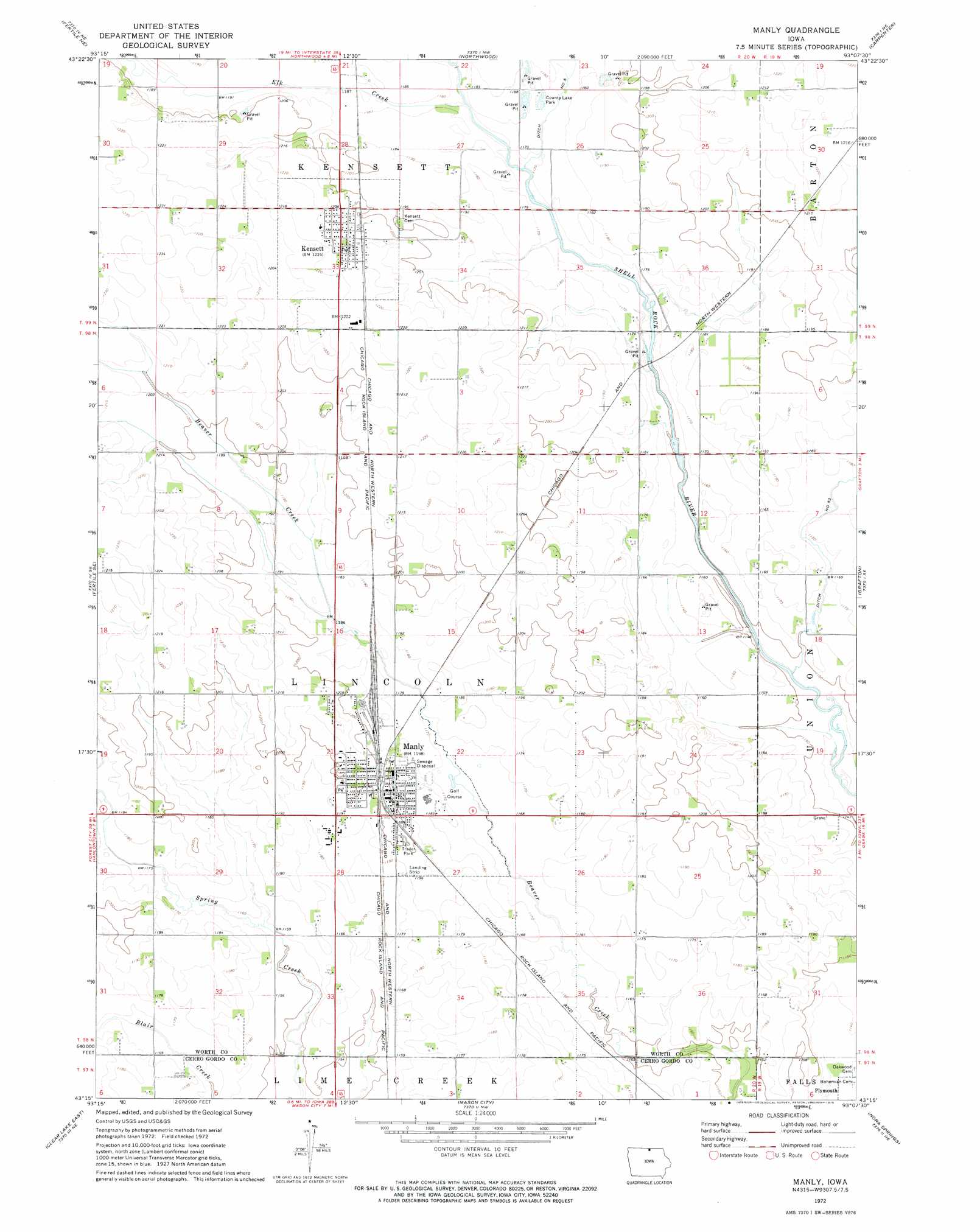
USGS Topo Quad 43093c2 - 1:24,000 scale
| Topo Map Name: | Manly |
| USGS Topo Quad ID: | 43093c2 |
| Print Size: | ca. 21 1/4" wide x 27" high |
| Southeast Coordinates: | 43.25° N latitude / 93.125° W longitude |
| Map Center Coordinates: | 43.3125° N latitude / 93.1875° W longitude |
| U.S. State: | IA |
| Filename: | o43093c2.jpg |
| Download Map JPG Image: | Manly topo map 1:24,000 scale |
| Map Type: | Topographic |
| Topo Series: | 7.5´ |
| Map Scale: | 1:24,000 |
| Source of Map Images: | United States Geological Survey (USGS) |
| Alternate Map Versions: |
Manly IA 1972, updated 1975 Download PDF Buy paper map Manly IA 2010 Download PDF Buy paper map Manly IA 2013 Download PDF Buy paper map Manly IA 2015 Download PDF Buy paper map |
1:24,000 Topo Quads surrounding Manly
Emmons |
Glenville |
Myrtle |
London |
Lyle |
Bristol |
Fertile Ne |
Northwood |
Carpenter |
Saint Ansgar |
Fertile |
Fertile Se |
Manly |
Grafton |
Osage Sw |
Clear Lake West |
Clear Lake East |
Mason City |
Nora Springs |
Rudd |
Ventura Heights |
Burchinal |
Hanford |
Mason City Se |
Rockford |
> Back to 43093a1 at 1:100,000 scale
> Back to 43092a1 at 1:250,000 scale
> Back to U.S. Topo Maps home
Manly topo map: Gazetteer
Manly: Canals
Ditch Number 53 elevation 354m 1161′Manly: Parks
Bliar Creek Area elevation 358m 1174′Land of Two Waters elevation 360m 1181′
Tostenson Wildlife Area elevation 363m 1190′
Worth County Lake Park elevation 359m 1177′
Manly: Populated Places
Glade elevation 354m 1161′Kensett elevation 371m 1217′
Manly elevation 366m 1200′
Manly: Post Offices
Glade Post Office (historical) elevation 357m 1171′Kensett Post Office elevation 371m 1217′
Manly Post Office elevation 363m 1190′
Westfield Post Office (historical) elevation 354m 1161′
Manly: Streams
Elk Creek elevation 356m 1167′Manly digital topo map on disk
Buy this Manly topo map showing relief, roads, GPS coordinates and other geographical features, as a high-resolution digital map file on DVD: