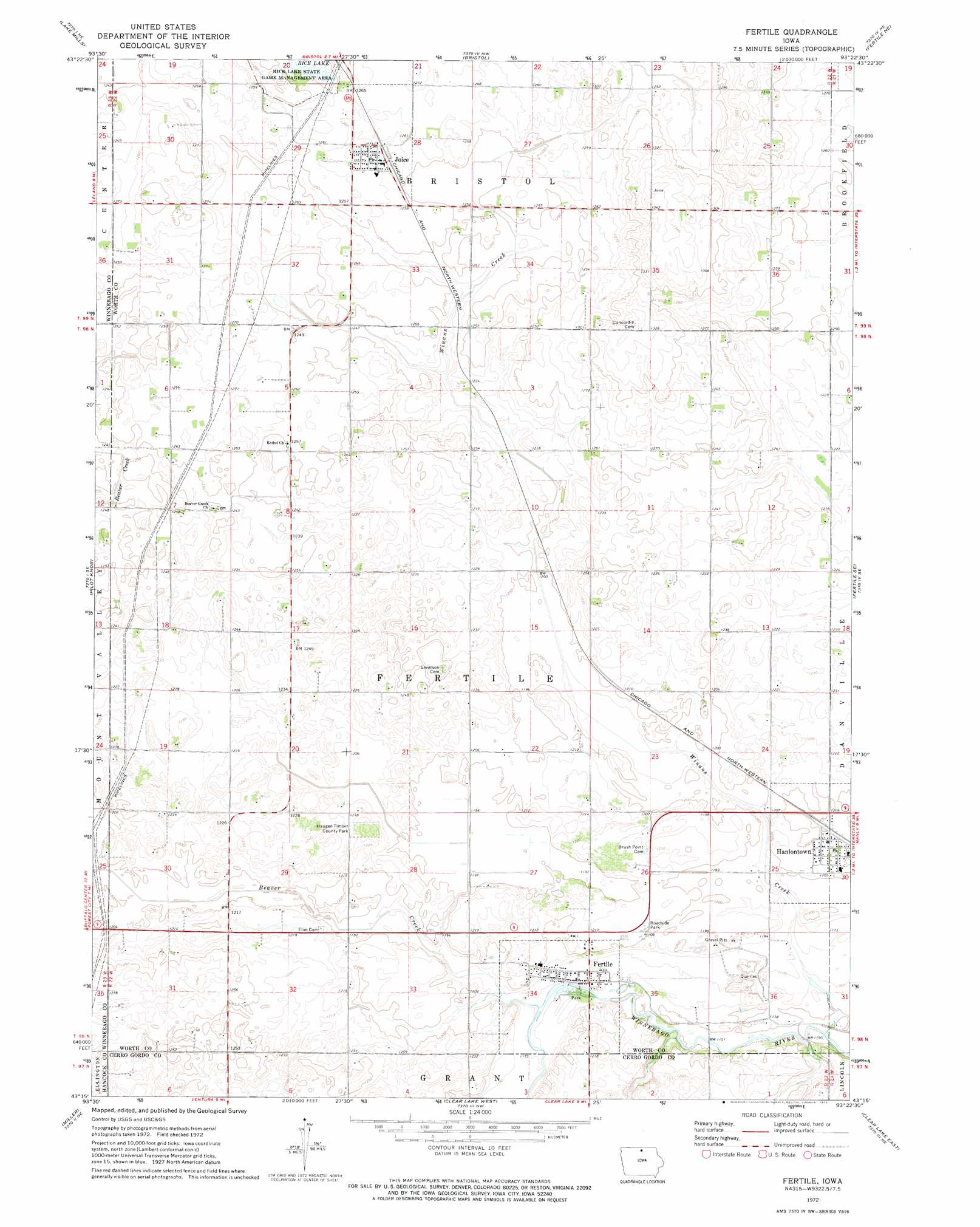
Fertile Topo Map Iowa
To zoom in, hover over the map of Fertile
USGS Topo Quad 43093c4 - 1:24,000 scale
| Topo Map Name: | Fertile |
| USGS Topo Quad ID: | 43093c4 |
| Print Size: | ca. 21 1/4" wide x 27" high |
| Southeast Coordinates: | 43.25° N latitude / 93.375° W longitude |
| Map Center Coordinates: | 43.3125° N latitude / 93.4375° W longitude |
| U.S. State: | IA |
| Filename: | o43093c4.jpg |
| Download Map JPG Image: | Fertile topo map 1:24,000 scale |
| Map Type: | Topographic |
| Topo Series: | 7.5´ |
| Map Scale: | 1:24,000 |
| Source of Map Images: | United States Geological Survey (USGS) |
| Alternate Map Versions: |
Fertile IA 1972, updated 1975 Download PDF Buy paper map Fertile IA 2010 Download PDF Buy paper map Fertile IA 2013 Download PDF Buy paper map Fertile IA 2015 Download PDF Buy paper map |
1:24,000 Topo Quads surrounding Fertile
Kiester |
Conger |
Emmons |
Glenville |
Myrtle |
Vinje |
Lake Mills |
Bristol |
Fertile Ne |
Northwood |
Forest City |
Pilot Knob |
Fertile |
Fertile Se |
Manly |
Hayfield |
Miller |
Clear Lake West |
Clear Lake East |
Mason City |
Duncan |
Garner |
Ventura Heights |
Burchinal |
Hanford |
> Back to 43093a1 at 1:100,000 scale
> Back to 43092a1 at 1:250,000 scale
> Back to U.S. Topo Maps home
Fertile topo map: Gazetteer
Fertile: Parks
Haugen Timber County Park elevation 378m 1240′Storre Wildlife Area elevation 370m 1213′
Wallys Woods elevation 351m 1151′
Fertile: Populated Places
Fertile elevation 357m 1171′Hanlontown elevation 367m 1204′
Joice elevation 385m 1263′
Fertile: Post Offices
Fertile Post Office elevation 357m 1171′Grafton Post Office elevation 367m 1204′
Joice Post Office elevation 385m 1263′
Lark Post Office (historical) elevation 383m 1256′
Nordland Post Office (historical) elevation 395m 1295′
Fertile: Streams
Beaver Creek elevation 356m 1167′Winans Creek elevation 347m 1138′
Fertile digital topo map on disk
Buy this Fertile topo map showing relief, roads, GPS coordinates and other geographical features, as a high-resolution digital map file on DVD: