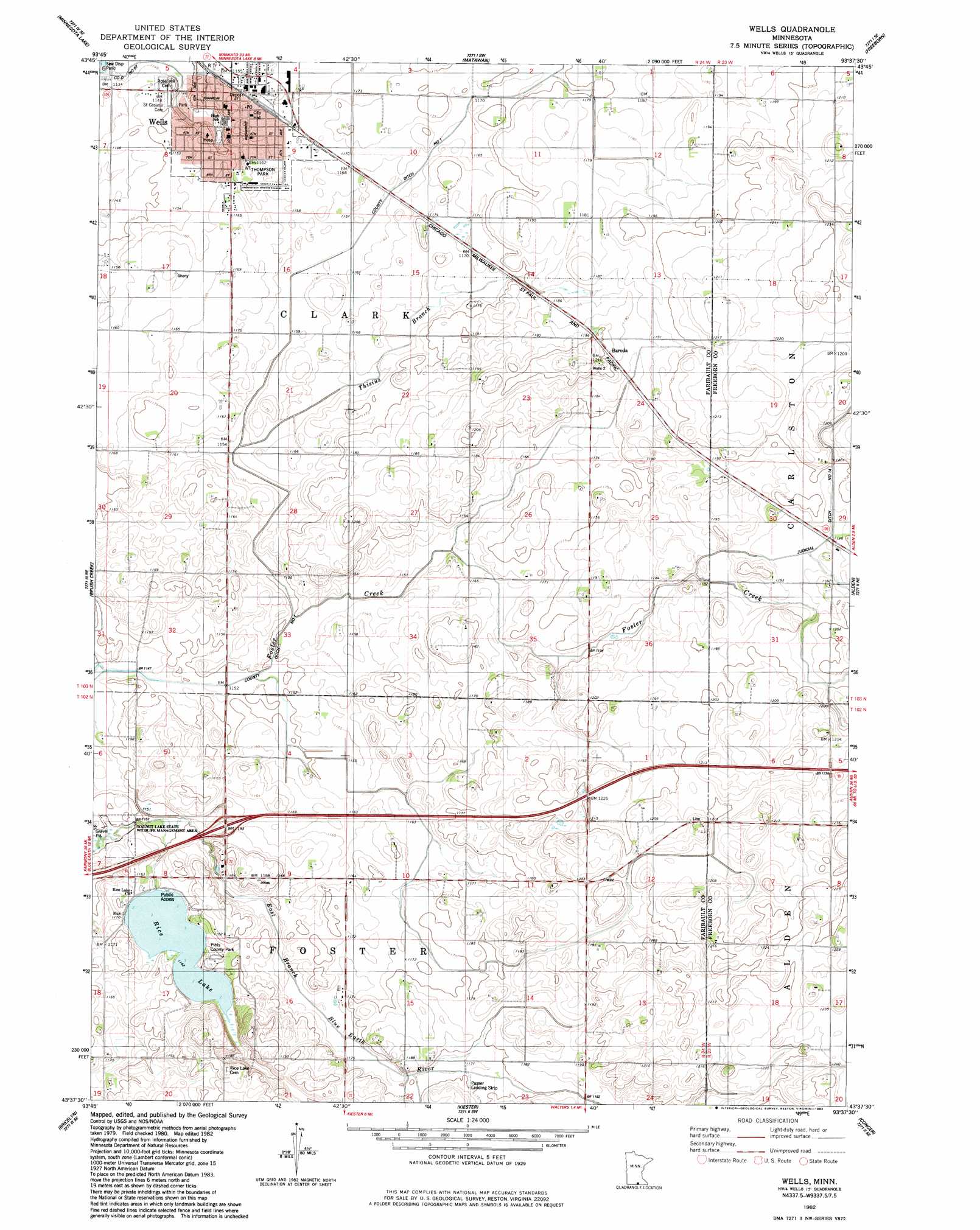
Wells Topo Map Minnesota
To zoom in, hover over the map of Wells
USGS Topo Quad 43093f6 - 1:24,000 scale
| Topo Map Name: | Wells |
| USGS Topo Quad ID: | 43093f6 |
| Print Size: | ca. 21 1/4" wide x 27" high |
| Southeast Coordinates: | 43.625° N latitude / 93.625° W longitude |
| Map Center Coordinates: | 43.6875° N latitude / 93.6875° W longitude |
| U.S. State: | MN |
| Filename: | o43093f6.jpg |
| Download Map JPG Image: | Wells topo map 1:24,000 scale |
| Map Type: | Topographic |
| Topo Series: | 7.5´ |
| Map Scale: | 1:24,000 |
| Source of Map Images: | United States Geological Survey (USGS) |
| Alternate Map Versions: |
Wells MN 1982, updated 1983 Download PDF Buy paper map Wells MN 2010 Download PDF Buy paper map Wells MN 2013 Download PDF Buy paper map Wells MN 2016 Download PDF Buy paper map |
1:24,000 Topo Quads surrounding Wells
Mapleton |
Mapleton Ne |
Waldorf |
Otisco |
New Richland |
Easton |
Minnesota Lake |
Matawan |
Freeborn |
Hartland |
Oza Tanka Lakebed |
Brush Creek |
Wells |
Alden |
Albert Lea West |
Frost |
Bricelyn |
Kiester |
Conger |
Emmons |
Buffalo Center |
Buffalo Center Ne |
Vinje |
Lake Mills |
Bristol |
> Back to 43093e1 at 1:100,000 scale
> Back to 43092a1 at 1:250,000 scale
> Back to U.S. Topo Maps home
Wells topo map: Gazetteer
Wells: Canals
County Ditch Number Eightyseven elevation 347m 1138′County Ditch Number One elevation 354m 1161′
Judicial Ditch Number Fourteen elevation 361m 1184′
Wells: Crossings
Interchange 138 elevation 359m 1177′Wells: Dams
Rice Lake Dam elevation 355m 1164′Wells: Parks
Pihls County Park elevation 359m 1177′Thompson Park elevation 354m 1161′
Wells: Populated Places
Baroda elevation 361m 1184′Wells elevation 353m 1158′
Wells: Post Offices
Wells Post Office elevation 355m 1164′Wells: Reservoirs
Rice Lake elevation 355m 1164′Wells: Streams
Thisius Branch elevation 350m 1148′Wells digital topo map on disk
Buy this Wells topo map showing relief, roads, GPS coordinates and other geographical features, as a high-resolution digital map file on DVD: