Bixby Topo Map Minnesota
To zoom in, hover over the map of Bixby
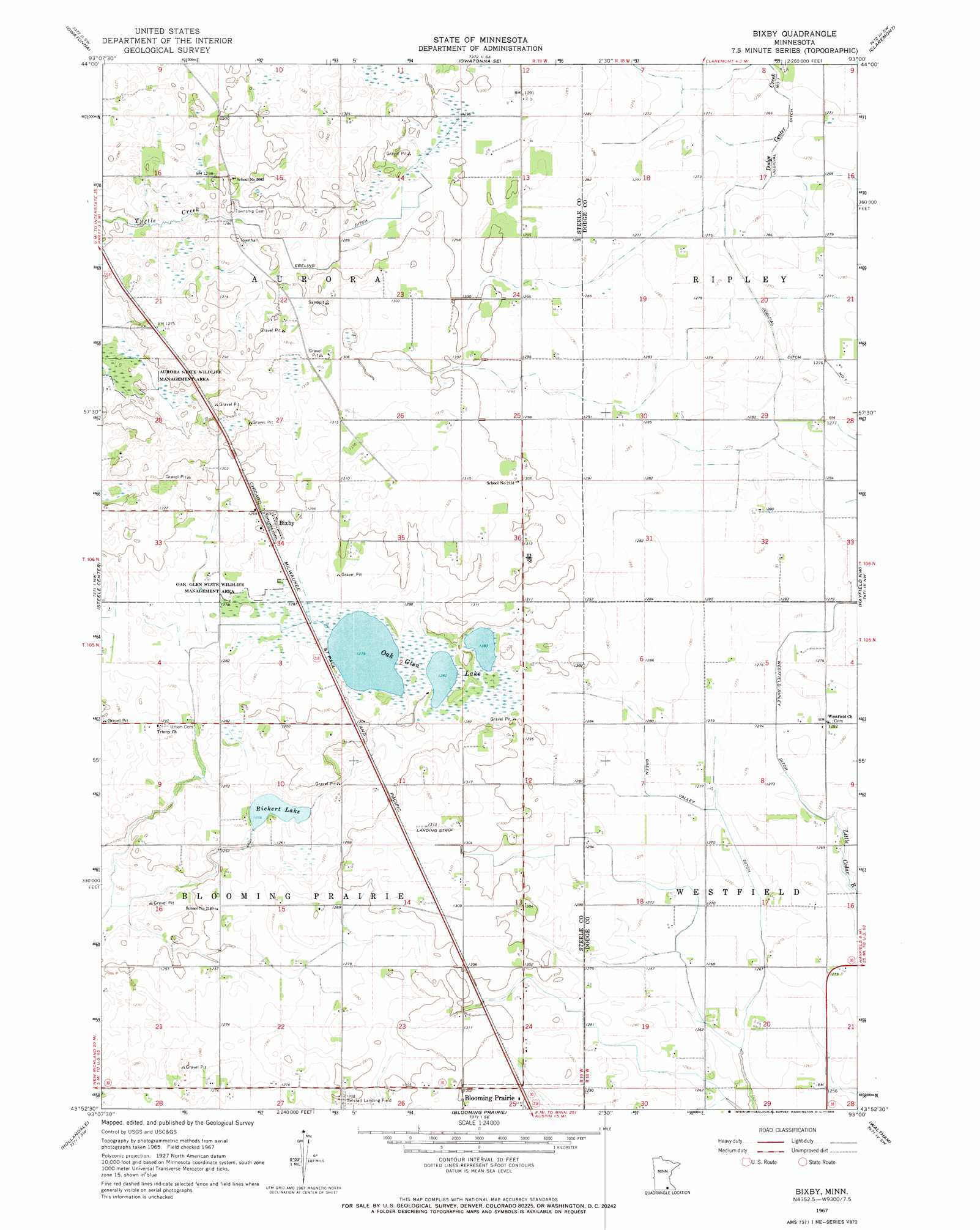
USGS Topo Quad 43093h1 - 1:24,000 scale
| Topo Map Name: | Bixby |
| USGS Topo Quad ID: | 43093h1 |
| Print Size: | ca. 21 1/4" wide x 27" high |
| Southeast Coordinates: | 43.875° N latitude / 93° W longitude |
| Map Center Coordinates: | 43.9375° N latitude / 93.0625° W longitude |
| U.S. State: | MN |
| Filename: | o43093h1.jpg |
| Download Map JPG Image: | Bixby topo map 1:24,000 scale |
| Map Type: | Topographic |
| Topo Series: | 7.5´ |
| Map Scale: | 1:24,000 |
| Source of Map Images: | United States Geological Survey (USGS) |
| Alternate Map Versions: |
Bixby MN 1967, updated 1968 Download PDF Buy paper map Bixby MN 2010 Download PDF Buy paper map Bixby MN 2013 Download PDF Buy paper map Bixby MN 2016 Download PDF Buy paper map |
1:24,000 Topo Quads surrounding Bixby
Medford West |
Medford East |
Moland |
West Concord |
Concord |
Saco |
Owatonna |
Owatonna Se |
Claremont |
Dodge Center |
Hope |
Steele Center |
Bixby |
Hayfield Nw |
Hayfield |
Ellendale |
Hollandale |
Blooming Prairie |
Waltham |
Sargeant |
Albert Lea East |
Hayward |
Austin West |
Austin East |
Brownsdale |
> Back to 43093e1 at 1:100,000 scale
> Back to 43092a1 at 1:250,000 scale
> Back to U.S. Topo Maps home
Bixby topo map: Gazetteer
Bixby: Airports
Selstad Landing Field elevation 394m 1292′Bixby: Canals
Ebeling Ditch elevation 391m 1282′Green Valley Ditch elevation 387m 1269′
Judicial Ditch Number One elevation 387m 1269′
Westfield-Ripley Ditch elevation 387m 1269′
Bixby: Lakes
Oak Glen Lake elevation 390m 1279′Bixby: Parks
Oak Glen State Wildlife Management Area elevation 390m 1279′Bixby: Populated Places
Bixby elevation 396m 1299′Bixby: Post Offices
Bixby Post Office elevation 396m 1299′Bixby: Reservoirs
Rickert Lake elevation 384m 1259′Bixby digital topo map on disk
Buy this Bixby topo map showing relief, roads, GPS coordinates and other geographical features, as a high-resolution digital map file on DVD: