Mapleton Topo Map Minnesota
To zoom in, hover over the map of Mapleton
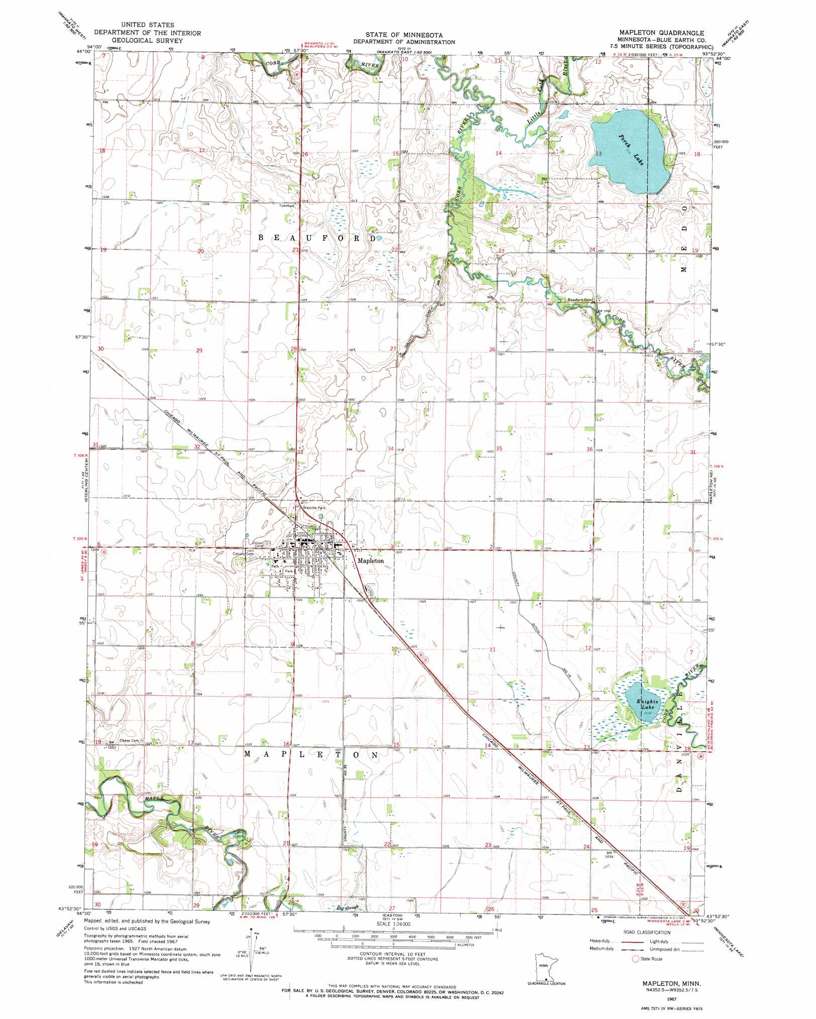
USGS Topo Quad 43093h8 - 1:24,000 scale
| Topo Map Name: | Mapleton |
| USGS Topo Quad ID: | 43093h8 |
| Print Size: | ca. 21 1/4" wide x 27" high |
| Southeast Coordinates: | 43.875° N latitude / 93.875° W longitude |
| Map Center Coordinates: | 43.9375° N latitude / 93.9375° W longitude |
| U.S. State: | MN |
| Filename: | o43093h8.jpg |
| Download Map JPG Image: | Mapleton topo map 1:24,000 scale |
| Map Type: | Topographic |
| Topo Series: | 7.5´ |
| Map Scale: | 1:24,000 |
| Source of Map Images: | United States Geological Survey (USGS) |
| Alternate Map Versions: |
Mapleton MN 1967, updated 1969 Download PDF Buy paper map Mapleton MN 2010 Download PDF Buy paper map Mapleton MN 2013 Download PDF Buy paper map Mapleton MN 2016 Download PDF Buy paper map |
1:24,000 Topo Quads surrounding Mapleton
Judson |
Mankato West |
Mankato East |
Madison Lake |
Elysian |
Lake Crystal |
Good Thunder |
Beauford |
Saint Clair |
Janesville |
Amboy |
Sterling Center |
Mapleton |
Mapleton Ne |
Waldorf |
Winnebago |
Delavan |
Easton |
Minnesota Lake |
Matawan |
Huntley |
Blue Earth |
Oza Tanka Lakebed |
Brush Creek |
Wells |
> Back to 43093e1 at 1:100,000 scale
> Back to 43092a1 at 1:250,000 scale
> Back to U.S. Topo Maps home
Mapleton topo map: Gazetteer
Mapleton: Canals
County Ditch Number Fiftyseven elevation 306m 1003′County Ditch Number Sixteen elevation 311m 1020′
County Ditch Number Thirtyfive elevation 312m 1023′
Mapleton: Dams
Perch Lake Dam elevation 298m 977′Mapleton: Lakes
Knights Lake elevation 308m 1010′Perch Lake elevation 298m 977′
Mapleton: Parks
Cradle of Curling in Minnesota Historical Marker elevation 316m 1036′Mapleton Historical Marker elevation 311m 1020′
Mapleton Wayside Park elevation 311m 1020′
Mapleton: Populated Places
Boening Mobile Home Park elevation 311m 1020′Mapleton elevation 316m 1036′
Mapleton: Post Offices
Mapleton Post Office elevation 315m 1033′Mapleton: Reservoirs
Perch Lake elevation 298m 977′Mapleton: Streams
Little Cobb River elevation 298m 977′Mapleton digital topo map on disk
Buy this Mapleton topo map showing relief, roads, GPS coordinates and other geographical features, as a high-resolution digital map file on DVD: