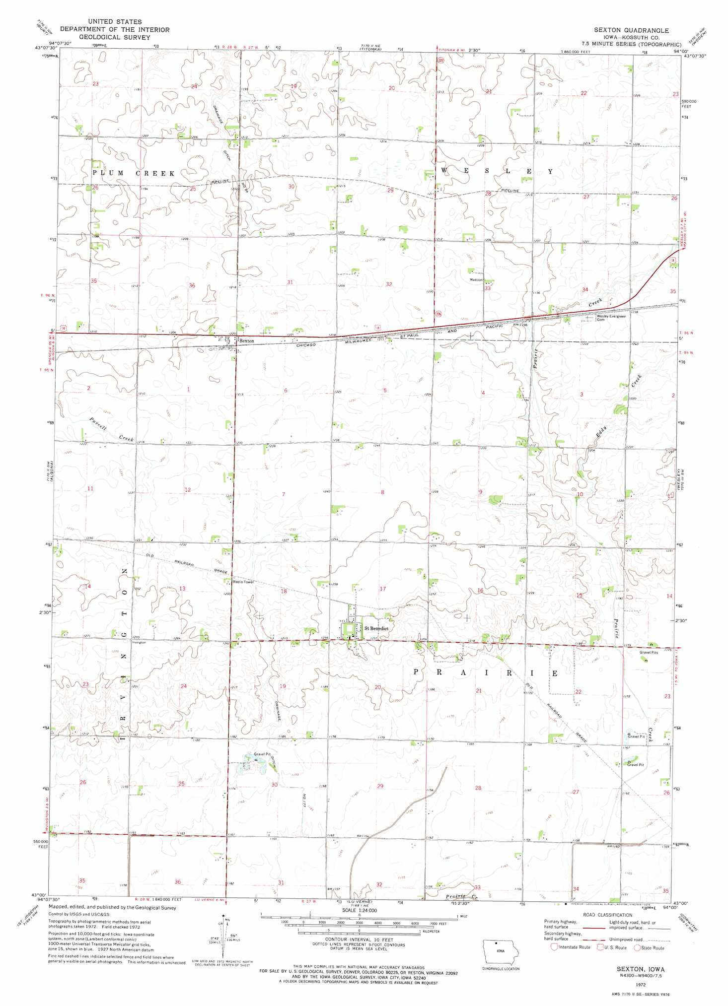
Sexton Topo Map Iowa
To zoom in, hover over the map of Sexton
USGS Topo Quad 43094a1 - 1:24,000 scale
| Topo Map Name: | Sexton |
| USGS Topo Quad ID: | 43094a1 |
| Print Size: | ca. 21 1/4" wide x 27" high |
| Southeast Coordinates: | 43° N latitude / 94° W longitude |
| Map Center Coordinates: | 43.0625° N latitude / 94.0625° W longitude |
| U.S. State: | IA |
| Filename: | o43094a1.jpg |
| Download Map JPG Image: | Sexton topo map 1:24,000 scale |
| Map Type: | Topographic |
| Topo Series: | 7.5´ |
| Map Scale: | 1:24,000 |
| Source of Map Images: | United States Geological Survey (USGS) |
| Alternate Map Versions: |
Sexton IA 1972, updated 1975 Download PDF Buy paper map Sexton IA 2010 Download PDF Buy paper map Sexton IA 2013 Download PDF Buy paper map Sexton IA 2015 Download PDF Buy paper map |
1:24,000 Topo Quads surrounding Sexton
Armstrong Se |
Bancroft |
German Valley |
Buffalo Center Sw |
Thompson |
Lone Rock |
Burt |
Titonka |
Woden |
Crystal Lake |
Hobarton |
Algona |
Sexton |
Wesley |
Britt |
West Bend Ne |
Saint Joseph |
Lu Verne |
Corwith |
Kanawha |
Bode |
Livermore |
Hardy |
Renwick |
Kanawha Se |
> Back to 43094a1 at 1:100,000 scale
> Back to 43094a1 at 1:250,000 scale
> Back to U.S. Topo Maps home
Sexton topo map: Gazetteer
Sexton: Canals
Drainage Ditch Number 177 elevation 354m 1161′Drainage Ditch Number 84 elevation 359m 1177′
Sexton: Parks
Saint Benedict Wildlife Area elevation 360m 1181′Sexton: Populated Places
Saint Benedict elevation 384m 1259′Sexton elevation 372m 1220′
Sexton: Post Offices
Rahm Post Office (historical) elevation 386m 1266′Saint Benedict Post Office (historical) elevation 384m 1259′
Sexton Post Office (historical) elevation 372m 1220′
Sexton: Streams
Eddy Creek elevation 360m 1181′Sexton digital topo map on disk
Buy this Sexton topo map showing relief, roads, GPS coordinates and other geographical features, as a high-resolution digital map file on DVD: