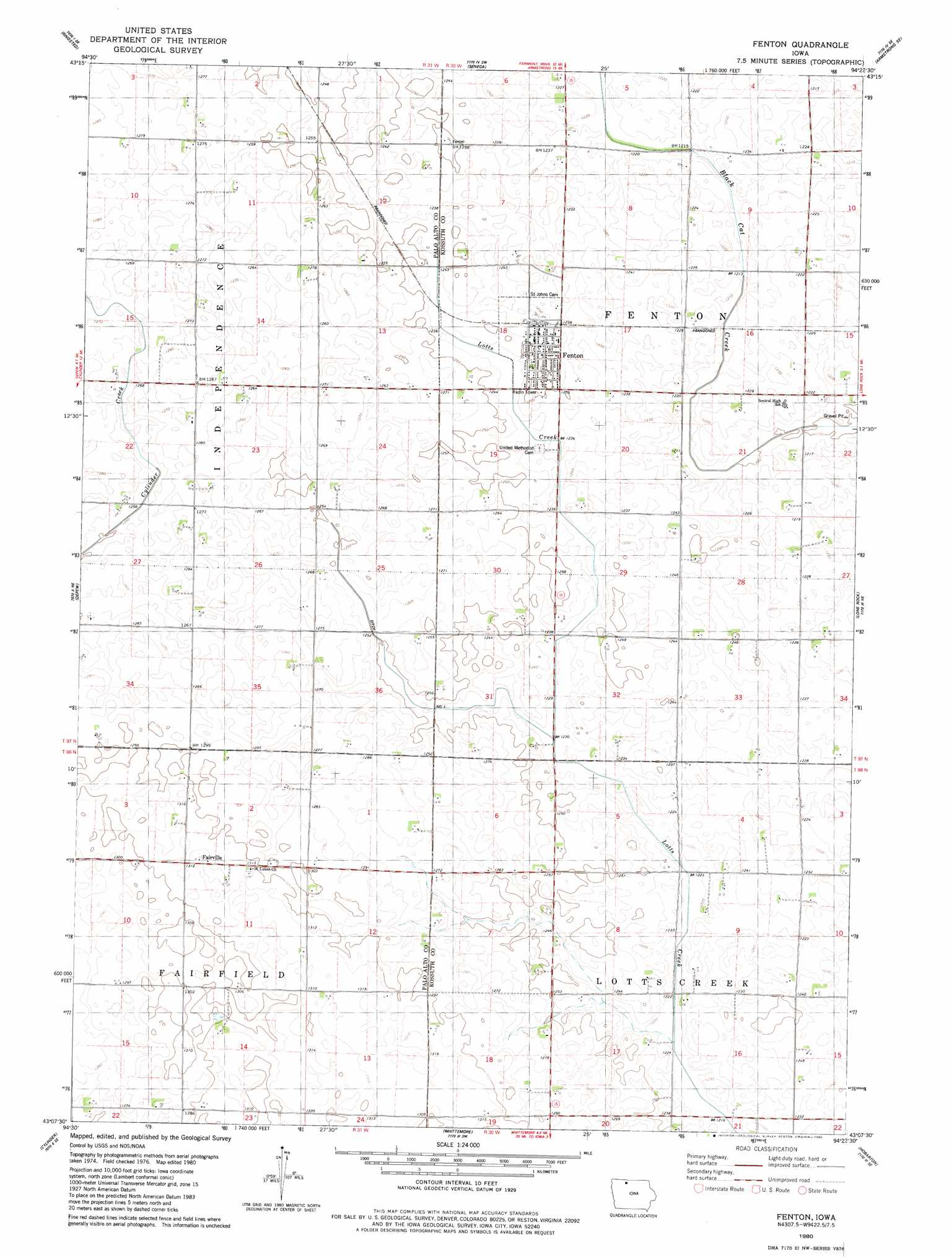
Fenton Topo Map Iowa
To zoom in, hover over the map of Fenton
USGS Topo Quad 43094b4 - 1:24,000 scale
| Topo Map Name: | Fenton |
| USGS Topo Quad ID: | 43094b4 |
| Print Size: | ca. 21 1/4" wide x 27" high |
| Southeast Coordinates: | 43.125° N latitude / 94.375° W longitude |
| Map Center Coordinates: | 43.1875° N latitude / 94.4375° W longitude |
| U.S. State: | IA |
| Filename: | o43094b4.jpg |
| Download Map JPG Image: | Fenton topo map 1:24,000 scale |
| Map Type: | Topographic |
| Topo Series: | 7.5´ |
| Map Scale: | 1:24,000 |
| Source of Map Images: | United States Geological Survey (USGS) |
| Alternate Map Versions: |
Fenton IA 1980, updated 1980 Download PDF Buy paper map Fenton IA 2010 Download PDF Buy paper map Fenton IA 2013 Download PDF Buy paper map Fenton IA 2015 Download PDF Buy paper map |
1:24,000 Topo Quads surrounding Fenton
Gruver |
Dolliver |
Armstrong |
Swea City |
Ledyard |
Ingham Lake |
Ringsted |
Seneca |
Armstrong Se |
Bancroft |
Graettinger East |
Depew |
Fenton |
Lone Rock |
Burt |
Emmetsburg |
Cylinder |
Whittemore |
Hobarton |
Algona |
Mallard |
Plover |
Unique |
West Bend Ne |
Saint Joseph |
> Back to 43094a1 at 1:100,000 scale
> Back to 43094a1 at 1:250,000 scale
> Back to U.S. Topo Maps home
Fenton topo map: Gazetteer
Fenton: Canals
Ditch Number 1 elevation 375m 1230′Fenton: Populated Places
Fairville elevation 396m 1299′Fenton elevation 378m 1240′
Fenton: Post Offices
Fairville Post Office (historical) elevation 396m 1299′Fenton Post Office elevation 379m 1243′
Fenton digital topo map on disk
Buy this Fenton topo map showing relief, roads, GPS coordinates and other geographical features, as a high-resolution digital map file on DVD: