Terril Topo Map Iowa
To zoom in, hover over the map of Terril
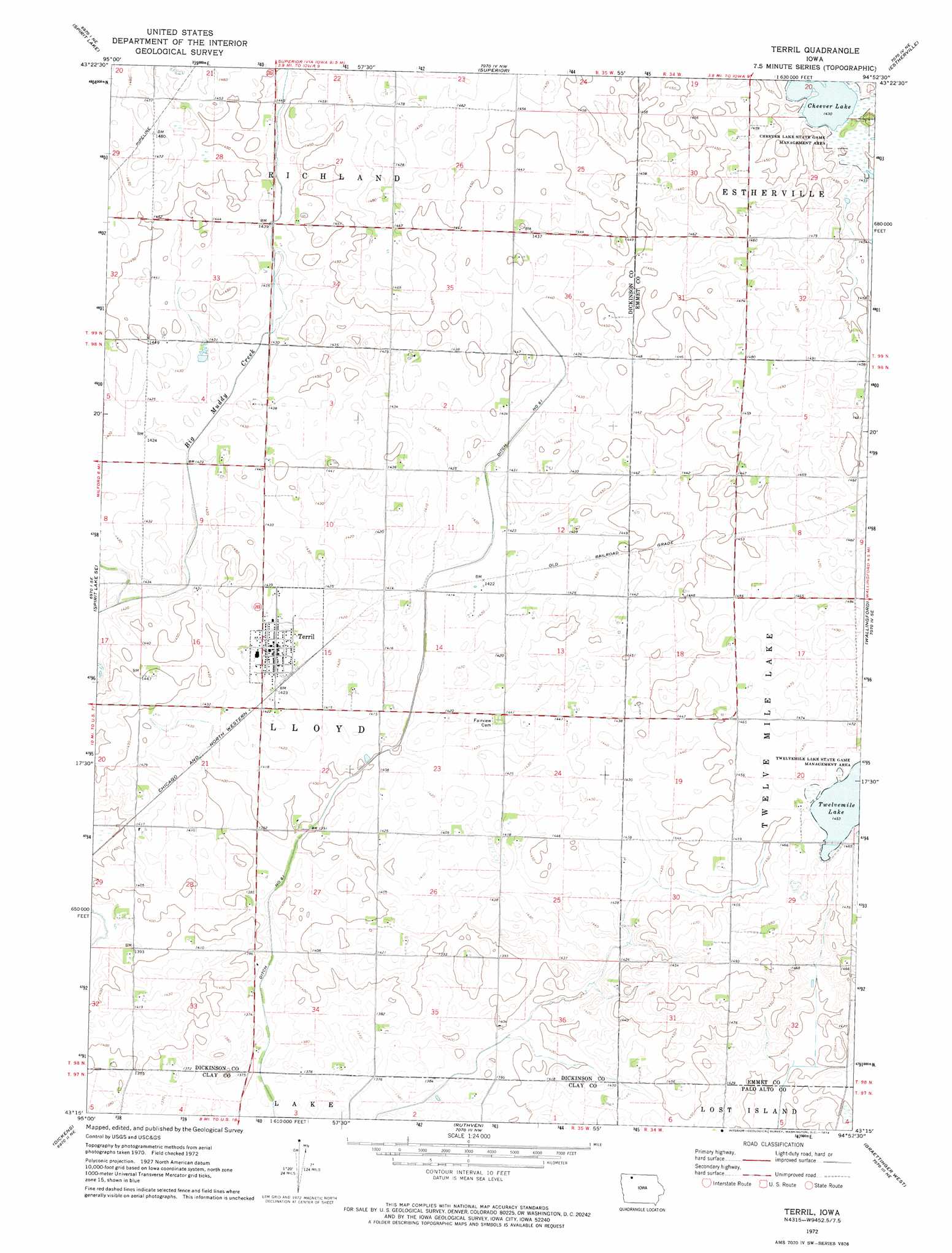
USGS Topo Quad 43094c8 - 1:24,000 scale
| Topo Map Name: | Terril |
| USGS Topo Quad ID: | 43094c8 |
| Print Size: | ca. 21 1/4" wide x 27" high |
| Southeast Coordinates: | 43.25° N latitude / 94.875° W longitude |
| Map Center Coordinates: | 43.3125° N latitude / 94.9375° W longitude |
| U.S. State: | IA |
| Filename: | o43094c8.jpg |
| Download Map JPG Image: | Terril topo map 1:24,000 scale |
| Map Type: | Topographic |
| Topo Series: | 7.5´ |
| Map Scale: | 1:24,000 |
| Source of Map Images: | United States Geological Survey (USGS) |
| Alternate Map Versions: |
Terril IA 1972, updated 1974 Download PDF Buy paper map Terril IA 2010 Download PDF Buy paper map Terril IA 2013 Download PDF Buy paper map Terril IA 2015 Download PDF Buy paper map |
1:24,000 Topo Quads surrounding Terril
Lakefield Sw |
Lakefield Se |
Jackson |
Dunnell |
Ceylon |
Okoboji |
Spirit Lake |
Superior |
Estherville |
Gruver |
Milford |
Spirit Lake Se |
Terril |
Wallingford |
Ingham Lake |
Spencer |
Dickens |
Ruthven |
Graettinger West |
Graettinger East |
Creenville |
Gillett Grove |
Silver Lake |
Ayrshire |
Emmetsburg |
> Back to 43094a1 at 1:100,000 scale
> Back to 43094a1 at 1:250,000 scale
> Back to U.S. Topo Maps home
Terril topo map: Gazetteer
Terril: Canals
Ditch Number 61 elevation 427m 1400′Terril: Lakes
Cheever Lake elevation 437m 1433′Twelvemile Lake elevation 443m 1453′
Terril: Parks
Cheever Lake State Game Mgt Area elevation 437m 1433′Terril: Populated Places
Terril elevation 437m 1433′Terril: Post Offices
Terril Post Office elevation 437m 1433′Terril digital topo map on disk
Buy this Terril topo map showing relief, roads, GPS coordinates and other geographical features, as a high-resolution digital map file on DVD: