Lakota Topo Map Iowa
To zoom in, hover over the map of Lakota
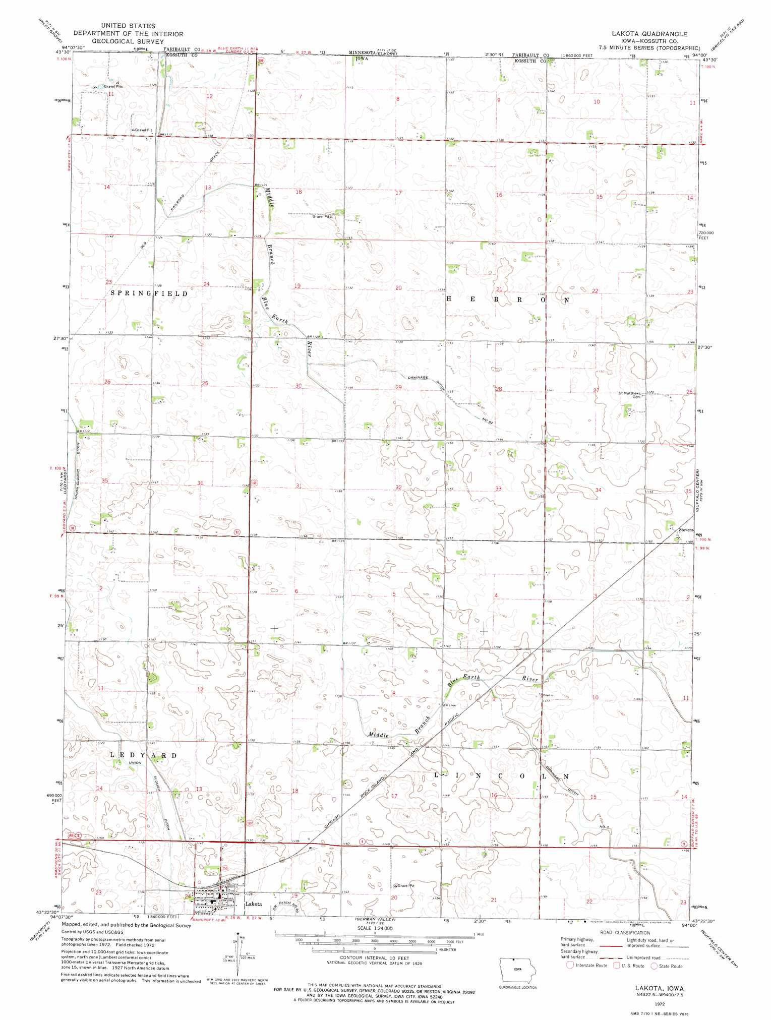
USGS Topo Quad 43094d1 - 1:24,000 scale
| Topo Map Name: | Lakota |
| USGS Topo Quad ID: | 43094d1 |
| Print Size: | ca. 21 1/4" wide x 27" high |
| Southeast Coordinates: | 43.375° N latitude / 94° W longitude |
| Map Center Coordinates: | 43.4375° N latitude / 94.0625° W longitude |
| U.S. States: | IA, MN |
| Filename: | o43094d1.jpg |
| Download Map JPG Image: | Lakota topo map 1:24,000 scale |
| Map Type: | Topographic |
| Topo Series: | 7.5´ |
| Map Scale: | 1:24,000 |
| Source of Map Images: | United States Geological Survey (USGS) |
| Alternate Map Versions: |
Lakota IA 1972, updated 1975 Download PDF Buy paper map Lakota IA 2010 Download PDF Buy paper map Lakota IA 2013 Download PDF Buy paper map Lakota IA 2015 Download PDF Buy paper map |
1:24,000 Topo Quads surrounding Lakota
Granada |
Huntley |
Blue Earth |
Oza Tanka Lakebed |
Brush Creek |
East Chain |
Pilot Grove |
Elmore |
Frost |
Bricelyn |
Swea City |
Ledyard |
Lakota |
Buffalo Center |
Buffalo Center Ne |
Armstrong Se |
Bancroft |
German Valley |
Buffalo Center Sw |
Thompson |
Lone Rock |
Burt |
Titonka |
Woden |
Crystal Lake |
> Back to 43094a1 at 1:100,000 scale
> Back to 43094a1 at 1:250,000 scale
> Back to U.S. Topo Maps home
Lakota topo map: Gazetteer
Lakota: Canals
Drainage Ditch Number 82 elevation 345m 1131′Union Slough Ditch elevation 340m 1115′
Lakota: Populated Places
Lakota elevation 348m 1141′Stevens elevation 354m 1161′
Lakota: Post Offices
Lakota Post Office elevation 348m 1141′Lakota digital topo map on disk
Buy this Lakota topo map showing relief, roads, GPS coordinates and other geographical features, as a high-resolution digital map file on DVD: