Dolliver Topo Map Iowa
To zoom in, hover over the map of Dolliver
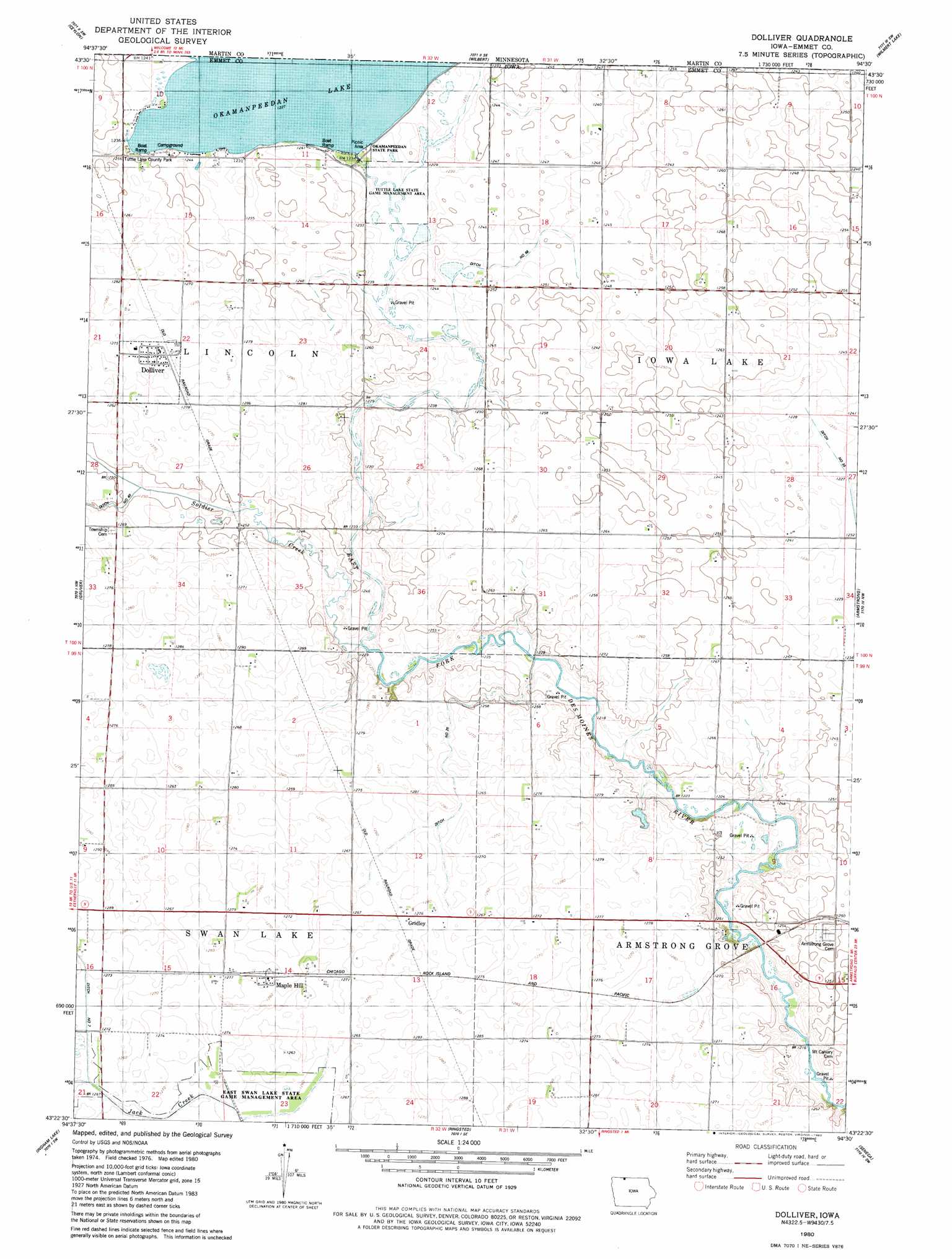
USGS Topo Quad 43094d5 - 1:24,000 scale
| Topo Map Name: | Dolliver |
| USGS Topo Quad ID: | 43094d5 |
| Print Size: | ca. 21 1/4" wide x 27" high |
| Southeast Coordinates: | 43.375° N latitude / 94.5° W longitude |
| Map Center Coordinates: | 43.4375° N latitude / 94.5625° W longitude |
| U.S. State: | IA |
| Filename: | o43094d5.jpg |
| Download Map JPG Image: | Dolliver topo map 1:24,000 scale |
| Map Type: | Topographic |
| Topo Series: | 7.5´ |
| Map Scale: | 1:24,000 |
| Source of Map Images: | United States Geological Survey (USGS) |
| Alternate Map Versions: |
Dolliver IA 1980, updated 1980 Download PDF Buy paper map Dolliver IA 2010 Download PDF Buy paper map Dolliver IA 2013 Download PDF Buy paper map Dolliver IA 2015 Download PDF Buy paper map |
1:24,000 Topo Quads surrounding Dolliver
Alpha |
Sherburn |
Welcome |
Fairmont |
Granada |
Dunnell |
Ceylon |
Wilbert |
Wilmert Lake |
East Chain |
Estherville |
Gruver |
Dolliver |
Armstrong |
Swea City |
Wallingford |
Ingham Lake |
Ringsted |
Seneca |
Armstrong Se |
Graettinger West |
Graettinger East |
Depew |
Fenton |
Lone Rock |
> Back to 43094a1 at 1:100,000 scale
> Back to 43094a1 at 1:250,000 scale
> Back to U.S. Topo Maps home
Dolliver topo map: Gazetteer
Dolliver: Bridges
Ellsworth Ranch Bridge elevation 375m 1230′Dolliver: Canals
Ditch Number 26 elevation 383m 1256′Ditch Number 68 elevation 375m 1230′
Dolliver: Parks
Okomanpado Lake Historical Marker elevation 375m 1230′Tuttle Lake County Park elevation 379m 1243′
Tuttle Lake State Game Management Area elevation 374m 1227′
Dolliver: Populated Places
Gridley elevation 387m 1269′Dolliver: Post Offices
Dolliver Post Office elevation 394m 1292′Gridley Post Office (historical) elevation 387m 1269′
Maple Hill Post Office (historical) elevation 393m 1289′
Dolliver: Reservoirs
Okamanpeedan Lake elevation 373m 1223′Dolliver digital topo map on disk
Buy this Dolliver topo map showing relief, roads, GPS coordinates and other geographical features, as a high-resolution digital map file on DVD: