Elmore Topo Map Minnesota
To zoom in, hover over the map of Elmore
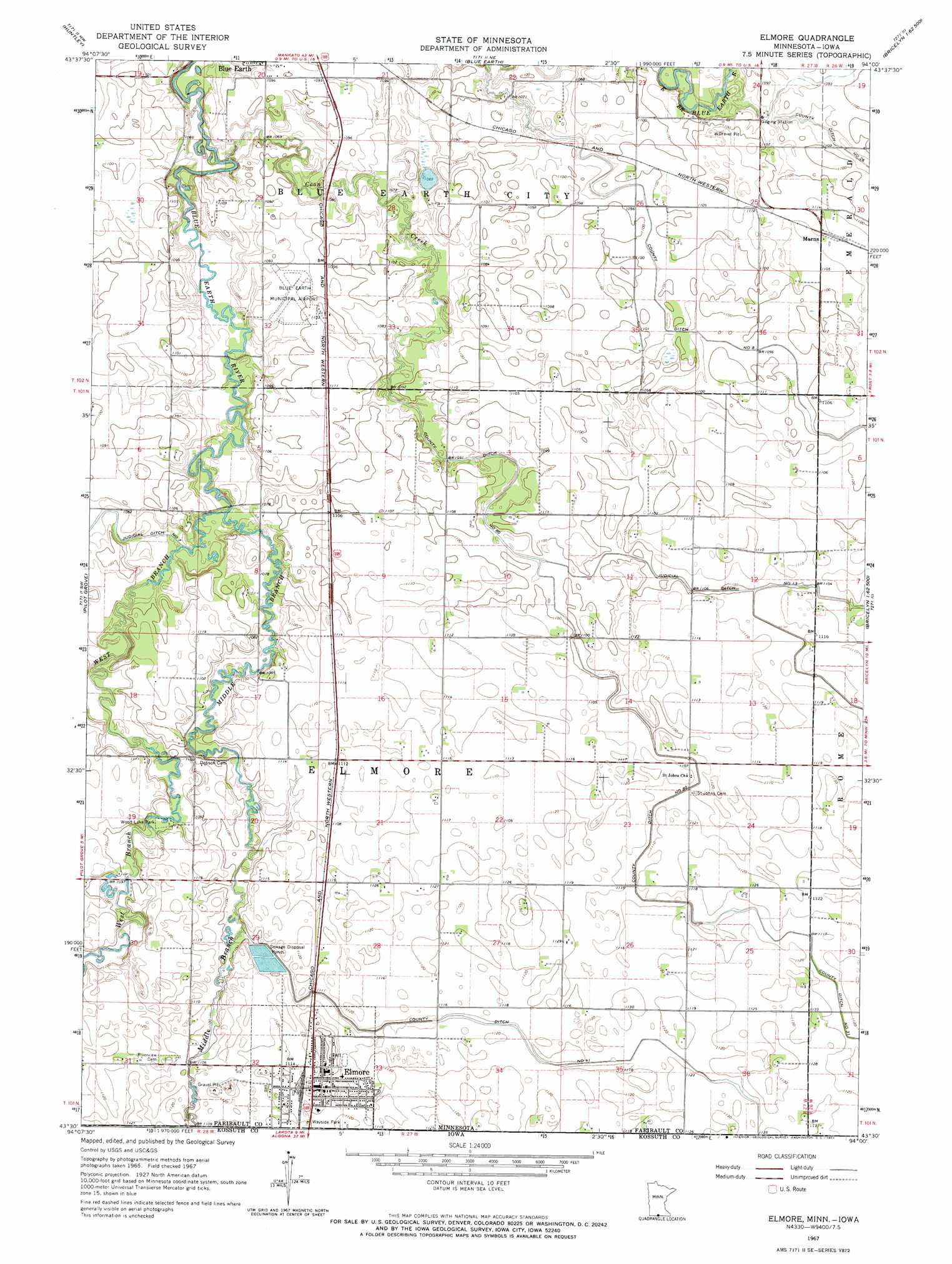
USGS Topo Quad 43094e1 - 1:24,000 scale
| Topo Map Name: | Elmore |
| USGS Topo Quad ID: | 43094e1 |
| Print Size: | ca. 21 1/4" wide x 27" high |
| Southeast Coordinates: | 43.5° N latitude / 94° W longitude |
| Map Center Coordinates: | 43.5625° N latitude / 94.0625° W longitude |
| U.S. States: | MN, IA |
| Filename: | o43094e1.jpg |
| Download Map JPG Image: | Elmore topo map 1:24,000 scale |
| Map Type: | Topographic |
| Topo Series: | 7.5´ |
| Map Scale: | 1:24,000 |
| Source of Map Images: | United States Geological Survey (USGS) |
| Alternate Map Versions: |
Elmore MN 1967, updated 1968 Download PDF Buy paper map Elmore MN 2010 Download PDF Buy paper map Elmore MN 2013 Download PDF Buy paper map Elmore MN 2016 Download PDF Buy paper map |
1:24,000 Topo Quads surrounding Elmore
Truman Se |
Winnebago |
Delavan |
Easton |
Minnesota Lake |
Granada |
Huntley |
Blue Earth |
Oza Tanka Lakebed |
Brush Creek |
East Chain |
Pilot Grove |
Elmore |
Frost |
Bricelyn |
Swea City |
Ledyard |
Lakota |
Buffalo Center |
Buffalo Center Ne |
Armstrong Se |
Bancroft |
German Valley |
Buffalo Center Sw |
Thompson |
> Back to 43094e1 at 1:100,000 scale
> Back to 43094a1 at 1:250,000 scale
> Back to U.S. Topo Maps home
Elmore topo map: Gazetteer
Elmore: Airports
Blue Earth Municipal Airport elevation 334m 1095′Elmore: Canals
County Ditch Number Eight elevation 333m 1092′County Ditch Number Eighty elevation 335m 1099′
County Ditch Number Fortyone elevation 338m 1108′
County Ditch Number Twentysix elevation 329m 1079′
Judicial Ditch Number Thirteen elevation 335m 1099′
Elmore: Lakes
Browns Lake elevation 320m 1049′Elmore: Parks
Moses Sailor First Settler Commemorative Monument elevation 329m 1079′State Line Wayside Park elevation 341m 1118′
Wood Lake Park elevation 333m 1092′
Elmore: Populated Places
Elmore elevation 345m 1131′Marna elevation 338m 1108′
Elmore: Post Offices
Elmore Post Office elevation 342m 1122′Marna Post Office (historical) elevation 338m 1108′
Elmore: Streams
Coon Creek elevation 319m 1046′Middle Branch Blue Earth River elevation 326m 1069′
West Branch Blue Earth River elevation 326m 1069′
Elmore digital topo map on disk
Buy this Elmore topo map showing relief, roads, GPS coordinates and other geographical features, as a high-resolution digital map file on DVD: