Ceylon Topo Map Minnesota
To zoom in, hover over the map of Ceylon
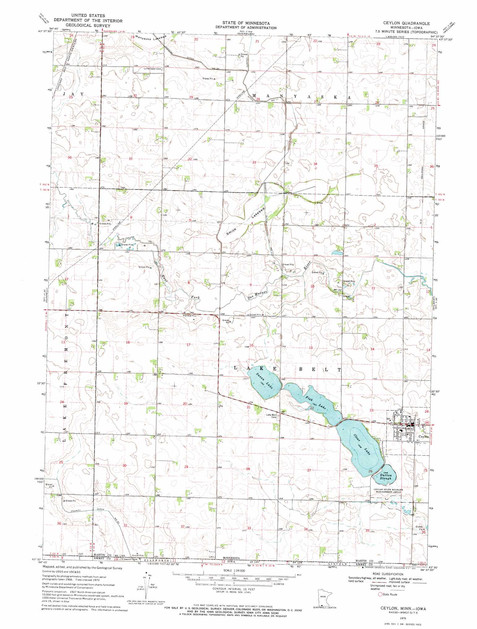
USGS Topo Quad 43094e6 - 1:24,000 scale
| Topo Map Name: | Ceylon |
| USGS Topo Quad ID: | 43094e6 |
| Print Size: | ca. 21 1/4" wide x 27" high |
| Southeast Coordinates: | 43.5° N latitude / 94.625° W longitude |
| Map Center Coordinates: | 43.5625° N latitude / 94.6875° W longitude |
| U.S. States: | MN, IA |
| Filename: | o43094e6.jpg |
| Download Map JPG Image: | Ceylon topo map 1:24,000 scale |
| Map Type: | Topographic |
| Topo Series: | 7.5´ |
| Map Scale: | 1:24,000 |
| Source of Map Images: | United States Geological Survey (USGS) |
| Alternate Map Versions: |
Ceylon MN 1970, updated 1972 Download PDF Buy paper map Ceylon MN 2010 Download PDF Buy paper map Ceylon MN 2013 Download PDF Buy paper map Ceylon MN 2016 Download PDF Buy paper map |
1:24,000 Topo Quads surrounding Ceylon
Bergen |
Mountain Lake Se |
Trimont |
Saint James Se |
Truman |
Jackson Nw |
Alpha |
Sherburn |
Welcome |
Fairmont |
Jackson |
Dunnell |
Ceylon |
Wilbert |
Wilmert Lake |
Superior |
Estherville |
Gruver |
Dolliver |
Armstrong |
Terril |
Wallingford |
Ingham Lake |
Ringsted |
Seneca |
> Back to 43094e1 at 1:100,000 scale
> Back to 43094a1 at 1:250,000 scale
> Back to U.S. Topo Maps home
Ceylon topo map: Gazetteer
Ceylon: Canals
County Ditch Number Eleven elevation 377m 1236′Judicial Ditch Number Fifty elevation 381m 1250′
Ceylon: Flats
Smith Lakebed elevation 378m 1240′Ceylon: Guts
Dutton Slough elevation 378m 1240′Ceylon: Lakes
Clear Lake elevation 378m 1240′Fish Lake elevation 378m 1240′
Susan Lake elevation 378m 1240′
Ceylon: Parks
Ceylon State Wildlife Management Areas elevation 373m 1223′Ceylon: Populated Places
Ceylon elevation 384m 1259′Ceylon: Post Offices
Ceylon Post Office elevation 384m 1259′Ceylon digital topo map on disk
Buy this Ceylon topo map showing relief, roads, GPS coordinates and other geographical features, as a high-resolution digital map file on DVD: